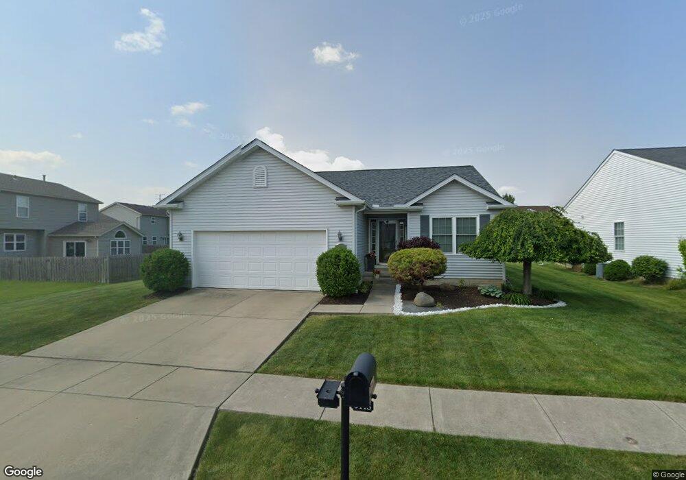
5448 Coopers Ln Lorain, OH 44053
Estimated Value: $227,076 - $309,000
2
Beds
2
Baths
1,444
Sq Ft
$186/Sq Ft
Est. Value
About This Home
This home is located at 5448 Coopers Ln, Lorain, OH 44053 and is currently estimated at $268,019, approximately $185 per square foot. 5448 Coopers Ln is a home located in Lorain County with nearby schools including Powers Elementary School, Walter G. Nord Middle School, and Amherst Junior High School.
Ownership History
Date
Name
Owned For
Owner Type
Purchase Details
Closed on
Mar 28, 2006
Sold by
R L R Construction Inc
Bought by
Steward Gerald A and Steward Betty C
Current Estimated Value
Home Financials for this Owner
Home Financials are based on the most recent Mortgage that was taken out on this home.
Original Mortgage
$97,653
Outstanding Balance
$56,021
Interest Rate
6.33%
Mortgage Type
Purchase Money Mortgage
Estimated Equity
$211,998
Create a Home Valuation Report for This Property
The Home Valuation Report is an in-depth analysis detailing your home's value as well as a comparison with similar homes in the area
Home Values in the Area
Average Home Value in this Area
Purchase History
| Date | Buyer | Sale Price | Title Company |
|---|---|---|---|
| Steward Gerald A | $162,800 | Lorain County Title Co Inc |
Source: Public Records
Mortgage History
| Date | Status | Borrower | Loan Amount |
|---|---|---|---|
| Open | Steward Gerald A | $97,653 |
Source: Public Records
Tax History
| Year | Tax Paid | Tax Assessment Tax Assessment Total Assessment is a certain percentage of the fair market value that is determined by local assessors to be the total taxable value of land and additions on the property. | Land | Improvement |
|---|---|---|---|---|
| 2024 | $678 | $15,925 | $15,925 | -- |
| 2023 | $697 | $13,808 | $13,808 | $0 |
| 2022 | $670 | $13,808 | $13,808 | $0 |
| 2021 | $671 | $13,808 | $13,808 | $0 |
| 2020 | $672 | $12,250 | $12,250 | $0 |
| 2019 | $660 | $12,250 | $12,250 | $0 |
| 2018 | $3,189 | $55,330 | $12,250 | $43,080 |
| 2017 | $3,384 | $59,230 | $14,350 | $44,880 |
| 2016 | $3,360 | $59,230 | $14,350 | $44,880 |
| 2015 | $3,253 | $59,230 | $14,350 | $44,880 |
| 2014 | $3,264 | $59,230 | $14,350 | $44,880 |
| 2013 | $3,273 | $59,230 | $14,350 | $44,880 |
Source: Public Records
Map
Nearby Homes
- 1260 Meadowview Ln
- 239 Habant Dr
- 4872 Leavitt Rd
- 423 Quarry Creek Dr
- 110 Habant Dr
- 1011 N Main St
- 0 Leavitt Rd Unit 5169364
- 3932 Courtyard Dr
- 4497 Bellow Dr
- 120 Springvale Dr
- 4459 Bellow Dr
- 4513 Vineyard Dr
- 1900 Narragansett Blvd
- 4195 Jenee Dr
- 1215 Spruce Tree Ln
- 5611 Independence Dr
- 4518 Santina Way
- 4253 Santina Way
- 3794 Freedom Place
- 4048 Kenyon Ave
- 5440 Coopers Ln
- 5540 Boxwood Dr
- 5560 Boxwood Dr
- 3488 Bellflower Dr
- 5432 Coopers Ln
- 3486 Bellflower Dr
- 5447 Coopers Ln
- 5441 Coopers Ln
- 5453 Coopers Ln
- 5580 Boxwood Dr
- 5429 Coopers Ln
- 5424 Coopers Ln
- 5459 Coopers Ln
- 3484 Bellflower Dr
- 3485 Coopers Trail
- 5416 Coopers Ln
- 5467 Coopers Ln
- 3371 Coopers Trail
- 3361 Coopers Trail
- 3381 Coopers Trail
Your Personal Tour Guide
Ask me questions while you tour the home.