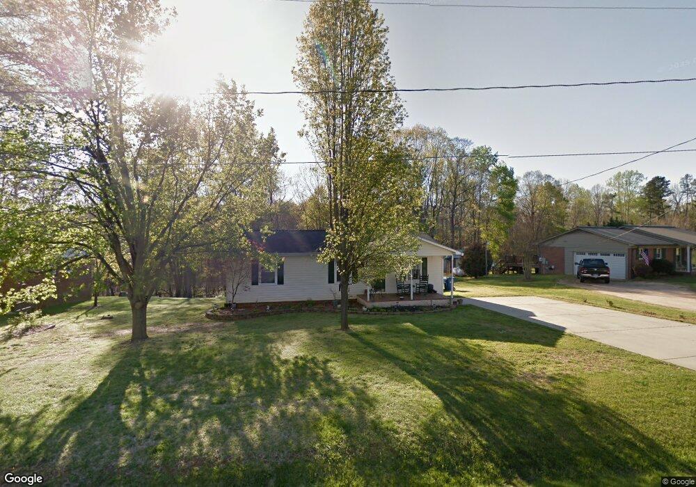
5449 Whiting Ave Kannapolis, NC 28083
Estimated Value: $141,000 - $272,000
2
Beds
1
Bath
1,050
Sq Ft
$216/Sq Ft
Est. Value
About This Home
This home is located at 5449 Whiting Ave, Kannapolis, NC 28083 and is currently estimated at $227,180, approximately $216 per square foot. 5449 Whiting Ave is a home located in Cabarrus County with nearby schools including Royal Oaks Elementary School, Concord Middle School, and Concord High School.
Ownership History
Date
Name
Owned For
Owner Type
Purchase Details
Closed on
Oct 4, 2024
Sold by
Johnson Judy B and Ferguson Judy Carol
Bought by
Null Angela and Bowlin Rita
Current Estimated Value
Home Financials for this Owner
Home Financials are based on the most recent Mortgage that was taken out on this home.
Original Mortgage
$134,995
Outstanding Balance
$133,576
Interest Rate
6.35%
Mortgage Type
New Conventional
Estimated Equity
$93,604
Purchase Details
Closed on
Feb 1, 1982
Create a Home Valuation Report for This Property
The Home Valuation Report is an in-depth analysis detailing your home's value as well as a comparison with similar homes in the area
Home Values in the Area
Average Home Value in this Area
Purchase History
| Date | Buyer | Sale Price | Title Company |
|---|---|---|---|
| Null Angela | $143,500 | None Listed On Document | |
| Null Angela | $143,500 | None Listed On Document | |
| -- | $38,500 | -- |
Source: Public Records
Mortgage History
| Date | Status | Borrower | Loan Amount |
|---|---|---|---|
| Open | Null Angela | $134,995 | |
| Closed | Null Angela | $134,995 |
Source: Public Records
Tax History Compared to Growth
Tax History
| Year | Tax Paid | Tax Assessment Tax Assessment Total Assessment is a certain percentage of the fair market value that is determined by local assessors to be the total taxable value of land and additions on the property. | Land | Improvement |
|---|---|---|---|---|
| 2025 | $1,686 | $249,460 | $58,000 | $191,460 |
| 2024 | $843 | $249,460 | $58,000 | $191,460 |
| 2023 | $1,105 | $137,330 | $31,000 | $106,330 |
| 2022 | $1,105 | $134,350 | $31,000 | $103,350 |
| 2021 | $1,105 | $134,350 | $31,000 | $103,350 |
| 2020 | $1,105 | $134,350 | $31,000 | $103,350 |
| 2019 | $725 | $88,100 | $18,000 | $70,100 |
| 2018 | $707 | $88,100 | $18,000 | $70,100 |
| 2017 | $689 | $88,100 | $18,000 | $70,100 |
| 2016 | $689 | $93,010 | $20,000 | $73,010 |
| 2015 | $728 | $93,010 | $20,000 | $73,010 |
| 2014 | $728 | $93,010 | $20,000 | $73,010 |
Source: Public Records
Map
Nearby Homes
- 2018 Osborne Rd
- 3075 Simmons St
- 3397 Camp Julia Rd
- 5391 Sapp Rd
- 5875 Irish Potato Rd
- 5316 Teakwood Dr
- 5100 Patterson Rd
- 4825 Samuel Richard St
- 4849 Samuel Richard St
- 2707 Ireton Place
- 3820 Old Salisbury-Concord Rd
- 6475 Goldfish Rd
- 4033 Hilton Lake Rd
- 3007 Centergrove Rd
- 4630 Irish Potato Rd
- 3535 Old Salisbury Concord Rd
- 3524 New Potato Dr
- 145 Wellington Estates Dr
- 2551 Glenwood St
- 165 Wellington Estates Dr
- 5455 Whiting Ave
- 5445 Whiting Ave
- 5459 Whiting Ave
- 5441 Whiting Ave
- 2006 Blair St
- 5446 Whiting Ave
- 5437 Whiting Ave
- 2010 Blair St
- 5466 Whiting Ave
- 5431 Whiting Ave
- 2007 Blair St
- 2007 Blair St Unit 14
- 2011 Blair St
- 5473 Whiting Ave
- 2015 Blair St
- 2006 Osborne Rd
- 2010 Osborne Rd
- 5477 Whiting Ave
- 2014 Osborne Rd
- 2018 Osborne St