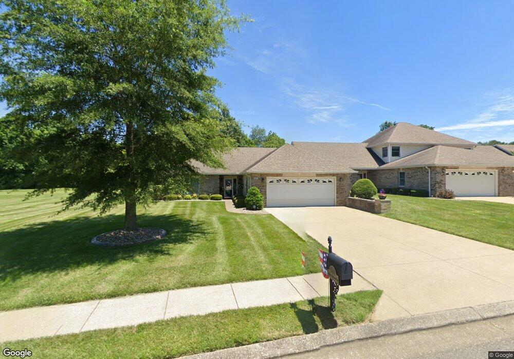
545-1 Saint Andrews Dr Vine Grove, KY 40175
Estimated Value: $256,083 - $324,000
2
Beds
2
Baths
1,558
Sq Ft
$180/Sq Ft
Est. Value
About This Home
This home is located at 545-1 Saint Andrews Dr, Vine Grove, KY 40175 and is currently estimated at $281,021, approximately $180 per square foot. 545-1 Saint Andrews Dr is a home located in Hardin County with nearby schools including Vine Grove Elementary School, James T. Alton Middle School, and North Hardin High School.
Ownership History
Date
Name
Owned For
Owner Type
Purchase Details
Closed on
Sep 19, 2018
Sold by
Mains Matilda B Est
Bought by
Proffitt Barbara J
Current Estimated Value
Home Financials for this Owner
Home Financials are based on the most recent Mortgage that was taken out on this home.
Original Mortgage
$124,000
Outstanding Balance
$107,913
Interest Rate
4.5%
Mortgage Type
Unknown
Estimated Equity
$173,108
Purchase Details
Closed on
Mar 28, 2005
Sold by
Mans William H and Mans Matilda B
Bought by
Mains Matilda B
Create a Home Valuation Report for This Property
The Home Valuation Report is an in-depth analysis detailing your home's value as well as a comparison with similar homes in the area
Home Values in the Area
Average Home Value in this Area
Purchase History
| Date | Buyer | Sale Price | Title Company |
|---|---|---|---|
| Proffitt Barbara J | $155,000 | -- | |
| Mains Matilda B | -- | None Available |
Source: Public Records
Mortgage History
| Date | Status | Borrower | Loan Amount |
|---|---|---|---|
| Open | Proffitt Barbara J | $124,000 |
Source: Public Records
Tax History Compared to Growth
Tax History
| Year | Tax Paid | Tax Assessment Tax Assessment Total Assessment is a certain percentage of the fair market value that is determined by local assessors to be the total taxable value of land and additions on the property. | Land | Improvement |
|---|---|---|---|---|
| 2024 | $1,151 | $166,800 | $21,700 | $145,100 |
| 2023 | $1,306 | $166,800 | $21,700 | $145,100 |
| 2022 | $1,214 | $166,800 | $21,700 | $145,100 |
| 2021 | $1,265 | $155,000 | $21,700 | $133,300 |
| 2020 | $1,289 | $155,000 | $21,700 | $133,300 |
| 2019 | $0 | $155,000 | $0 | $0 |
| 2018 | $1,099 | $101,100 | $0 | $0 |
| 2017 | $984 | $90,900 | $0 | $0 |
| 2016 | $0 | $91,600 | $0 | $0 |
| 2015 | $808 | $91,600 | $0 | $0 |
| 2012 | -- | $128,500 | $0 | $0 |
Source: Public Records
Map
Nearby Homes
- Lot 83 Pebble Beach Ct
- Lot 82 Pebble Beach Ct
- Lot 84 Pebble Beach Ct
- 586 Pinehurst Dr
- 584 Pinehurst Dr
- 578 Pinehurst Dr
- 580 Pinehurst Dr
- 589 Pinehurst Dr
- 587 Pinehurst Dr
- 585 Pinehurst Dr
- 155 Sawgrass Ave
- 405 Turnberry Ct
- 561 Pinehurst Dr
- 557 Pinehurst Dr
- 576 Pinehurst Dr
- 575 Pinehurst Dr
- KINGSTON Plan at The Landings
- DUPONT Plan at The Landings
- ESSEX Plan at The Landings
- ABERNATHY Plan at The Landings
- 545-2 Saint Andrews Dr
- 547-1 Saint Andrews Dr
- 547-2 Saint Andrews Dr
- 546-1 Saint Andrews Dr
- 549 Saint Andrews Dr
- 546-2 Saint Andrews Dr
- 548 Saint Andrews Dr Unit 1
- 548-1 St Andrews Dr
- 548-1 Saint Andrews Dr
- 548-2 Saint Andrews Dr
- 551 Saint Andrews Dr
- 553 Saint Andrews Dr
- 555 St Andrews
- 555 St Andrews Unit St. Andrews Dr.
- 555 Saint Andrews Dr
- 554 Saint Andrews Dr
- 1098 Otter Creek Rd
- 557 St Andrews
- 702 Augusta Dr
- 557 Saint Andrews Dr