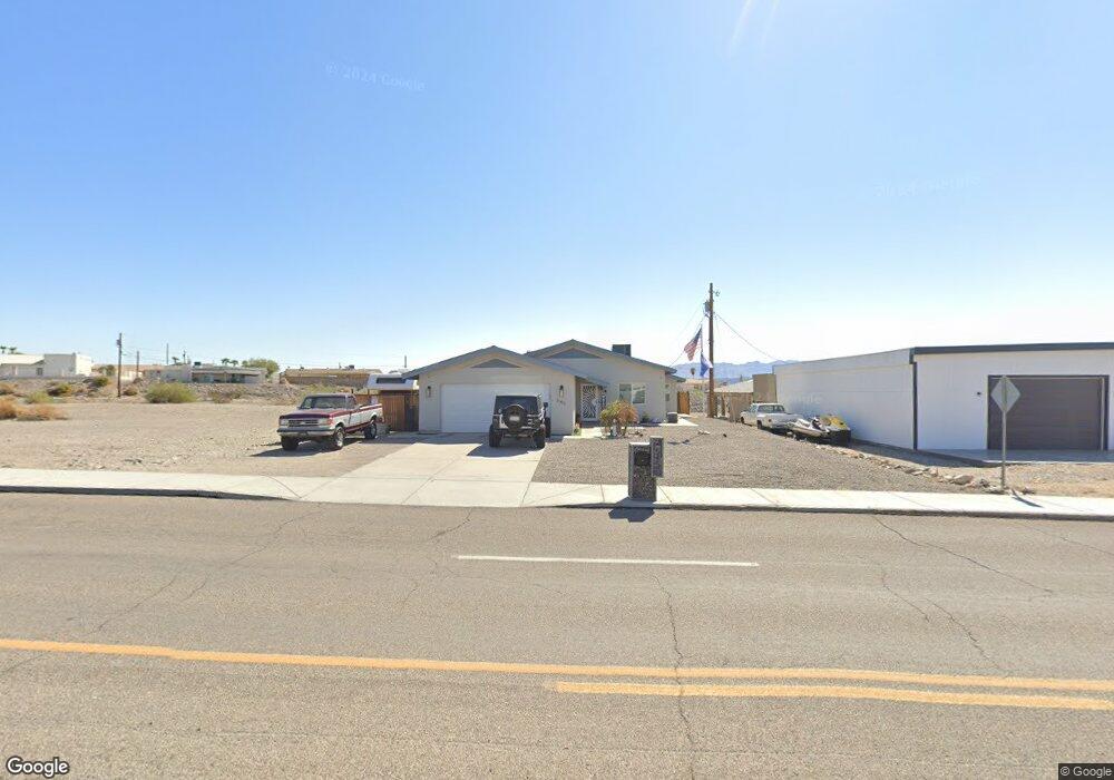
545 Acoma Blvd N Lake Havasu City, AZ 86403
Estimated Value: $354,000 - $474,000
--
Bed
1
Bath
1,514
Sq Ft
$289/Sq Ft
Est. Value
About This Home
This home is located at 545 Acoma Blvd N, Lake Havasu City, AZ 86403 and is currently estimated at $438,045, approximately $289 per square foot. 545 Acoma Blvd N is a home located in Mohave County with nearby schools including Smoketree Elementary School, Thunderbolt Middle School, and Lake Havasu High School.
Ownership History
Date
Name
Owned For
Owner Type
Purchase Details
Closed on
Feb 28, 2019
Sold by
Talley George and Talley Sharon
Bought by
Burton Shandie
Current Estimated Value
Home Financials for this Owner
Home Financials are based on the most recent Mortgage that was taken out on this home.
Original Mortgage
$175,000
Outstanding Balance
$153,855
Interest Rate
4.4%
Mortgage Type
Seller Take Back
Estimated Equity
$284,190
Purchase Details
Closed on
Nov 3, 2003
Sold by
Talley George and Talley Sharon
Bought by
Talley Family Trust
Create a Home Valuation Report for This Property
The Home Valuation Report is an in-depth analysis detailing your home's value as well as a comparison with similar homes in the area
Home Values in the Area
Average Home Value in this Area
Purchase History
| Date | Buyer | Sale Price | Title Company |
|---|---|---|---|
| Burton Shandie | $175,000 | Chicago Title Agency Inc | |
| Talley Family Trust | -- | -- |
Source: Public Records
Mortgage History
| Date | Status | Borrower | Loan Amount |
|---|---|---|---|
| Open | Burton Shandie | $175,000 |
Source: Public Records
Tax History Compared to Growth
Tax History
| Year | Tax Paid | Tax Assessment Tax Assessment Total Assessment is a certain percentage of the fair market value that is determined by local assessors to be the total taxable value of land and additions on the property. | Land | Improvement |
|---|---|---|---|---|
| 2026 | -- | -- | -- | -- |
| 2025 | $1,449 | $39,859 | $0 | $0 |
| 2024 | $1,449 | $43,853 | $0 | $0 |
| 2023 | $1,449 | $38,386 | $0 | $0 |
| 2022 | $1,395 | $28,520 | $0 | $0 |
| 2021 | $1,350 | $22,711 | $0 | $0 |
| 2019 | $1,285 | $18,613 | $0 | $0 |
| 2018 | $1,466 | $17,351 | $0 | $0 |
| 2017 | $1,452 | $16,564 | $0 | $0 |
| 2016 | $1,317 | $15,067 | $0 | $0 |
| 2015 | $1,263 | $12,734 | $0 | $0 |
Source: Public Records
Map
Nearby Homes
- 532 Acoma Blvd N
- 583 Robin Ln
- 1790 Rainbow Ave S
- 640 Acoma Blvd N
- 2200 Clarke Dr
- 2270 Constellation Dr
- 2311 Rainbow Ave N
- 675 Knobhill Ln
- 2295 Cosnina Dr
- 2305 Cosnina Dr
- 2301 Sahara Dr
- 1986 Bahama Ave
- 2349 Clarke Dr
- 2294 Pheasant Ln
- 1960 Pirate Ln
- 2075 Palo Verde Blvd S
- 2067 Palo Verde Blvd S
- 2021 Industrial
- 320 Chipeta Ln
- 660 Wayside Dr
- 553 Gem Ln
- 549 Gem Ln
- 557 Gem Ln
- 550 Acoma Blvd N
- 544 Acoma Blvd N
- 561 Gem Ln
- 569 Acoma Blvd N
- 556 Acoma Blvd N
- 565 Gem Ln
- 1718 Rainbow Ave S
- 1724 Rainbow Ave S
- 562 Acoma Blvd N
- 1714 Rainbow Ave S
- 1728 Rainbow Ave S
- 2212 Hopi Ln
- 568 Acoma Blvd N
- 2204 Hopi Ln
- 1704 Rainbow Ave S
- 1732 Rainbow Ave S
- 575 Robin Ln