Estimated Value: $76,000 - $169,000
--
Bed
--
Bath
392
Sq Ft
$354/Sq Ft
Est. Value
About This Home
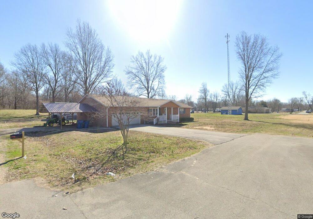
This home is located at 545 Dale St, Fisk, MO 63940 and is currently estimated at $138,747, approximately $353 per square foot. 545 Dale St is a home with nearby schools including Twin Rivers High School.
Ownership History
Date
Name
Owned For
Owner Type
Purchase Details
Closed on
Oct 27, 2025
Sold by
Mckuin Michael and Mckuin Mike
Bought by
Fisk Family Estates Llc
Current Estimated Value
Purchase Details
Closed on
Dec 10, 2019
Sold by
Mckuin Michael K
Bought by
Wilkerson Nathan and Wilkerson Kristi
Home Financials for this Owner
Home Financials are based on the most recent Mortgage that was taken out on this home.
Original Mortgage
$135,471
Interest Rate
3.7%
Mortgage Type
Future Advance Clause Open End Mortgage
Purchase Details
Closed on
Aug 27, 2015
Sold by
Magruder Dana F and Magruder Kimberly A
Bought by
21St Mortgage Corp
Purchase Details
Closed on
Sep 27, 2007
Sold by
Mosier Darrel and Mosier Lisa
Bought by
Magruder Dana F and Magruder Kimberly A
Home Financials for this Owner
Home Financials are based on the most recent Mortgage that was taken out on this home.
Original Mortgage
$78,229
Interest Rate
6.66%
Mortgage Type
New Conventional
Create a Home Valuation Report for This Property
The Home Valuation Report is an in-depth analysis detailing your home's value as well as a comparison with similar homes in the area
Home Values in the Area
Average Home Value in this Area
Purchase History
| Date | Buyer | Sale Price | Title Company |
|---|---|---|---|
| Fisk Family Estates Llc | -- | None Listed On Document | |
| Wilkerson Nathan | -- | Heritage Title Company | |
| 21St Mortgage Corp | $55,500 | None Available | |
| Magruder Dana F | -- | -- |
Source: Public Records
Mortgage History
| Date | Status | Borrower | Loan Amount |
|---|---|---|---|
| Previous Owner | Wilkerson Nathan | $135,471 | |
| Previous Owner | Magruder Dana F | $78,229 |
Source: Public Records
Tax History Compared to Growth
Tax History
| Year | Tax Paid | Tax Assessment Tax Assessment Total Assessment is a certain percentage of the fair market value that is determined by local assessors to be the total taxable value of land and additions on the property. | Land | Improvement |
|---|---|---|---|---|
| 2024 | $1,395 | $30,050 | $0 | $0 |
| 2023 | $1,395 | $30,050 | $0 | $0 |
| 2022 | $1,345 | $29,020 | $0 | $0 |
| 2021 | $1,362 | $29,020 | $0 | $0 |
| 2020 | $1,332 | $27,650 | $0 | $0 |
| 2019 | $523 | $27,650 | $0 | $0 |
| 2018 | $523 | $540 | $0 | $0 |
| 2017 | -- | $540 | $0 | $0 |
| 2016 | -- | $17,380 | $0 | $0 |
| 2015 | -- | $17,380 | $0 | $0 |
| 2014 | -- | $14,960 | $0 | $0 |
| 2012 | $593 | $14,520 | $0 | $0 |
Source: Public Records
Map
Nearby Homes
- 401 3rd St
- Off Hwy Dd
- Off Hwy Dd
- 1706 County Road 622
- 2458 County Road 622
- 1329 Cr 581
- 1329 County Road 581
- 00 County Road 628
- 5040 County Road 628
- 251 Highway Z
- 2816 County Road 628
- 6771 Highway 51
- 14007 State Highway Ww
- 36 County Road 629
- 1181 U S 60
- 6928 State Highway Ff
- 620 County Rd
- 2826 Highway T
- 54 County Road 560
- 18384 County Road 487