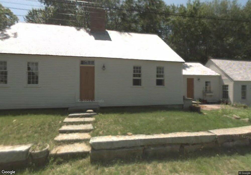
545 Ferry Rd Saco, ME 04072
Ferry Beach NeighborhoodEstimated Value: $618,769 - $801,000
3
Beds
2
Baths
2,874
Sq Ft
$252/Sq Ft
Est. Value
About This Home
This home is located at 545 Ferry Rd, Saco, ME 04072 and is currently estimated at $723,942, approximately $251 per square foot. 545 Ferry Rd is a home located in York County with nearby schools including C K Burns School, Saco Middle School, and Florence Lombard Christian School.
Ownership History
Date
Name
Owned For
Owner Type
Purchase Details
Closed on
Mar 29, 2006
Sold by
Pierson Scott and Pierson Dale C
Bought by
Decker Kelly E and Irons Michel S
Current Estimated Value
Home Financials for this Owner
Home Financials are based on the most recent Mortgage that was taken out on this home.
Original Mortgage
$237,000
Outstanding Balance
$135,881
Interest Rate
6.32%
Mortgage Type
Unknown
Estimated Equity
$588,061
Create a Home Valuation Report for This Property
The Home Valuation Report is an in-depth analysis detailing your home's value as well as a comparison with similar homes in the area
Home Values in the Area
Average Home Value in this Area
Purchase History
| Date | Buyer | Sale Price | Title Company |
|---|---|---|---|
| Decker Kelly E | -- | -- |
Source: Public Records
Mortgage History
| Date | Status | Borrower | Loan Amount |
|---|---|---|---|
| Open | Decker Kelly E | $237,000 |
Source: Public Records
Tax History
| Year | Tax Paid | Tax Assessment Tax Assessment Total Assessment is a certain percentage of the fair market value that is determined by local assessors to be the total taxable value of land and additions on the property. | Land | Improvement |
|---|---|---|---|---|
| 2024 | $5,274 | $375,400 | $149,100 | $226,300 |
| 2023 | $5,537 | $375,400 | $149,100 | $226,300 |
| 2022 | $5,017 | $273,700 | $113,300 | $160,400 |
| 2021 | $4,845 | $256,600 | $102,800 | $153,800 |
| 2020 | $4,577 | $232,700 | $92,000 | $140,700 |
| 2019 | $4,510 | $232,700 | $92,000 | $140,700 |
| 2018 | $4,446 | $229,400 | $88,700 | $140,700 |
| 2017 | $4,215 | $217,500 | $80,600 | $136,900 |
| 2016 | $4,898 | $252,200 | $77,200 | $175,000 |
| 2015 | $4,807 | $250,100 | $77,200 | $172,900 |
| 2014 | $4,657 | $250,100 | $77,200 | $172,900 |
| 2013 | $5,936 | $319,500 | $77,200 | $242,300 |
Source: Public Records
Map
Nearby Homes
- 46 Ferry Ln
- 10 Lower Beach Rd
- 650 Pool St
- 625 Pool St
- 1 Main Ave
- 9 Riverside Ave
- 3 Walker Dr Unit 101
- 4 Walker Dr Unit 101
- 3 Walker Dr Unit 101
- TBD 530 Ferry Rd
- 295 Ferry Rd
- 30 Vines Rd
- 280 Seaside Ave
- 378 Pool St
- 74 Guinea Rd
- 353 Pool St
- 9 Windward Ridge
- 343 Pool St
- 125 Hills Beach Rd
- 8 Days Landing
- 559 Ferry Rd
- 547 Ferry Rd
- 543 Ferry Rd Unit 3
- 550 Ferry Rd
- 546 Ferry Rd
- 552 Ferry Rd
- 560 Ferry Rd
- 561 Ferry Rd
- 537 Ferry Rd Unit 9
- 537 Ferry Rd Unit 8
- 537 Ferry Rd Unit 7
- 537 Ferry Rd Unit 6
- 537 Ferry Rd Unit 5
- 537 Ferry Rd Unit 4
- 537 Ferry Rd Unit 3
- 537 Ferry Rd Unit 2
- 537 Ferry Rd Unit 1
- 537 Ferry Rd
- 537 Ferry Rd Unit 537
- 540 Ferry Rd
Your Personal Tour Guide
Ask me questions while you tour the home.