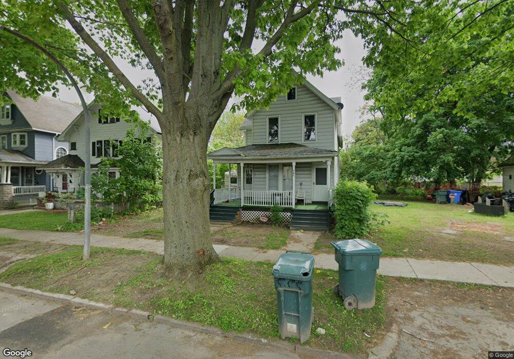
545 Flint St Unit 547 Rochester, NY 14611
Genesee-Jefferson NeighborhoodEstimated Value: $120,000 - $143,245
4
Beds
2
Baths
2,016
Sq Ft
$64/Sq Ft
Est. Value
About This Home
This home is located at 545 Flint St Unit 547, Rochester, NY 14611 and is currently estimated at $129,561, approximately $64 per square foot. 545 Flint St Unit 547 is a home located in Monroe County with nearby schools including Adlai E. Stevenson School 29, George Mather Forbes School No. 4, and School 19 Dr Charles T Lunsford.
Ownership History
Date
Name
Owned For
Owner Type
Purchase Details
Closed on
Jun 29, 2020
Sold by
Ruth Bar Iian Kessar Llc
Bought by
Mej Rochester Llc and E Global Llc
Current Estimated Value
Purchase Details
Closed on
Jun 10, 2015
Sold by
Collins Vaughn
Bought by
Ruth Bar Ilan Kessar Llc
Purchase Details
Closed on
Sep 15, 2005
Sold by
Collins Eva Mae and Collins Vaughn
Bought by
Collins Vaughn
Purchase Details
Closed on
Jun 24, 2003
Sold by
Mae Collins Eva
Bought by
Mae Collins Eva
Purchase Details
Closed on
Feb 13, 2002
Create a Home Valuation Report for This Property
The Home Valuation Report is an in-depth analysis detailing your home's value as well as a comparison with similar homes in the area
Home Values in the Area
Average Home Value in this Area
Purchase History
| Date | Buyer | Sale Price | Title Company |
|---|---|---|---|
| Mej Rochester Llc | $69,000 | None Available | |
| Ruth Bar Ilan Kessar Llc | $17,000 | None Available | |
| Collins Vaughn | -- | -- | |
| Mae Collins Eva | -- | -- | |
| -- | -- | -- |
Source: Public Records
Tax History Compared to Growth
Tax History
| Year | Tax Paid | Tax Assessment Tax Assessment Total Assessment is a certain percentage of the fair market value that is determined by local assessors to be the total taxable value of land and additions on the property. | Land | Improvement |
|---|---|---|---|---|
| 2024 | $1,200 | $111,200 | $7,700 | $103,500 |
| 2023 | $791 | $52,100 | $3,100 | $49,000 |
| 2022 | $808 | $52,100 | $3,100 | $49,000 |
| 2021 | $788 | $52,100 | $3,100 | $49,000 |
| 2020 | $695 | $52,100 | $3,100 | $49,000 |
| 2019 | $617 | $42,000 | $3,100 | $38,900 |
| 2018 | $2,609 | $42,000 | $3,100 | $38,900 |
| 2017 | $2,609 | $42,000 | $3,100 | $38,900 |
| 2016 | $617 | $42,000 | $3,100 | $38,900 |
| 2015 | -- | $42,000 | $3,100 | $38,900 |
| 2014 | -- | $42,000 | $3,100 | $38,900 |
Source: Public Records
Map
Nearby Homes
- 21 Arnett Blvd Unit 25
- 68 Arnett Blvd
- 687 Genesee St
- 16 Shelter St
- 399 Cottage St
- 137 Aldine St
- 51 W High Terrace
- 672 Jefferson Ave
- 33 Sawyer St
- 116 W High Terrace
- 359 Wellington Ave
- 790 Genesee St
- 190 Roslyn St
- 572-574 Seward St
- 244 Kenwood Ave
- 246 Columbia Ave
- 170 Epworth St
- 187 Elmdorf Ave Unit 189
- 1143-1145 S Plymouth Ave
- 70 Barton St
- 541 Flint St
- 555 Flint St
- 2 Walter Park
- 4 Walter Park
- 559 Flint St
- 531 Flint St
- 6 Walter Park
- 196 Shelter St Unit 198
- 192 Shelter St
- 525 Flint St
- 569 Flint St
- 186 Shelter St Unit 188
- 186-188 Shelter St
- 200 Shelter St
- 206 Shelter St
- 180 Shelter St
- 573 Flint St
- 519 Flint St
- 210 Shelter St
- 548 Flint St