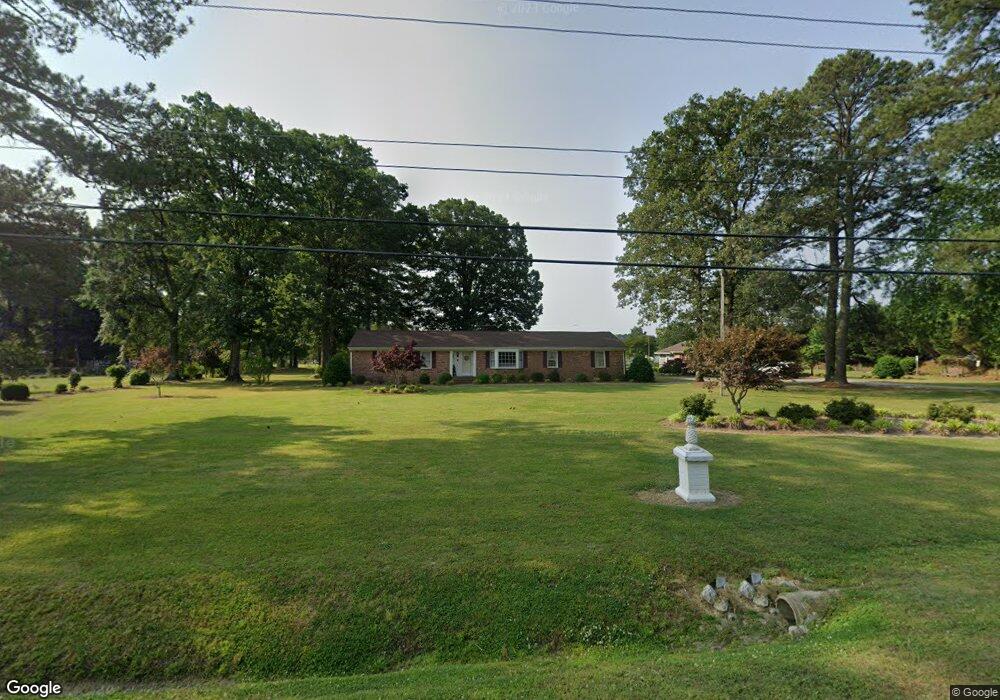
545 Kings Fork Rd Suffolk, VA 23434
Chuckatuck NeighborhoodEstimated Value: $486,000 - $534,000
3
Beds
2
Baths
2,081
Sq Ft
$243/Sq Ft
Est. Value
About This Home
This home is located at 545 Kings Fork Rd, Suffolk, VA 23434 and is currently estimated at $505,223, approximately $242 per square foot. 545 Kings Fork Rd is a home located in Suffolk City with nearby schools including Elephant's Fork Elementary School, King's Fork Middle School, and King's Fork High School.
Ownership History
Date
Name
Owned For
Owner Type
Purchase Details
Closed on
Nov 3, 2021
Sold by
Riddick Chester K and Riddick Peggy S
Bought by
Bray Allison L and Bray Michael A
Current Estimated Value
Home Financials for this Owner
Home Financials are based on the most recent Mortgage that was taken out on this home.
Original Mortgage
$140,000
Outstanding Balance
$127,265
Interest Rate
2.88%
Mortgage Type
New Conventional
Estimated Equity
$377,958
Create a Home Valuation Report for This Property
The Home Valuation Report is an in-depth analysis detailing your home's value as well as a comparison with similar homes in the area
Home Values in the Area
Average Home Value in this Area
Purchase History
| Date | Buyer | Sale Price | Title Company |
|---|---|---|---|
| Bray Allison L | $440,000 | Va Home Title & Settlements |
Source: Public Records
Mortgage History
| Date | Status | Borrower | Loan Amount |
|---|---|---|---|
| Open | Bray Allison L | $140,000 |
Source: Public Records
Tax History Compared to Growth
Tax History
| Year | Tax Paid | Tax Assessment Tax Assessment Total Assessment is a certain percentage of the fair market value that is determined by local assessors to be the total taxable value of land and additions on the property. | Land | Improvement |
|---|---|---|---|---|
| 2025 | $5,215 | $445,300 | $94,700 | $350,600 |
| 2024 | $5,215 | $418,700 | $86,000 | $332,700 |
| 2023 | $4,873 | $412,400 | $86,000 | $326,400 |
| 2022 | $3,999 | $366,900 | $86,000 | $280,900 |
| 2021 | $3,397 | $306,000 | $86,000 | $220,000 |
| 2020 | $3,609 | $325,100 | $86,000 | $239,100 |
| 2019 | $3,393 | $305,700 | $86,000 | $219,700 |
| 2018 | $1,263 | $306,700 | $86,000 | $220,700 |
| 2017 | $3,490 | $326,200 | $86,000 | $240,200 |
| 2016 | $3,490 | $326,200 | $86,000 | $240,200 |
| 2015 | $136 | $326,200 | $86,000 | $240,200 |
| 2014 | $136 | $326,200 | $86,000 | $240,200 |
Source: Public Records
Map
Nearby Homes
- 1051 Boundary Dr
- 121 Blessing Cir
- 5073 Kings Grant Cir
- 5061 Kings Grant Cir
- 102 Chalmers Dr
- 147 Squire Reach
- 201 Station Dr
- 253 Mccormick Dr
- 286 Mccormick Dr
- 265 Mccormick Dr
- 269 Mccormick Dr
- 151 Berkshire Blvd
- 134 Wexford Dr E
- 114 Ashford Dr
- The Tuscany Plan at The Vineyards at Hallstead Reserve
- The Veneto Plan at The Vineyards at Hallstead Reserve
- The Lombardy Plan at The Vineyards at Hallstead Reserve
- 307 Shore Dr
- 2000 Venture Way
- 2000 Venture Way Unit B
- 543 Kings Fork Rd
- 1000 Quarter Horse Ln
- 1002 Quarter Horse Ln
- 1004 Quarter Horse Ln
- 525 Kings Fork Rd
- 1006 Quarter Horse Ln
- 104 Tassell Crescent
- 106 Tassell Crescent
- 252 Mccormick Dr
- 5006 Westfalen Ct
- 5008 Westfalen Ct
- 1008 Quarter Horse Ln
- 5004 Westfalen Ct
- 5010 Westfalen Ct
- 5000 Westfalen Ct
- 5012 Westfalen Ct
- 554 Kings Fork Rd
- 552 Kings Fork Rd
- 5014 Westfalen Ct
- 1010 Quarter Horse Ln