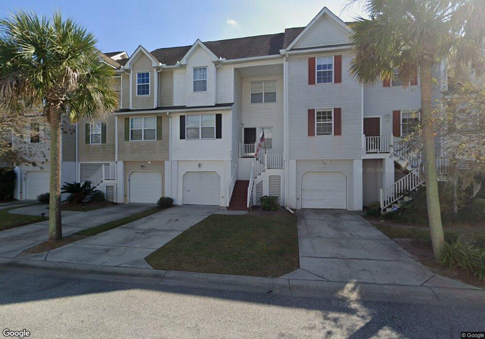
545 McLernon Trace Johns Island, SC 29455
Estimated Value: $344,771 - $372,000
3
Beds
3
Baths
1,520
Sq Ft
$235/Sq Ft
Est. Value
About This Home
This home is located at 545 McLernon Trace, Johns Island, SC 29455 and is currently estimated at $356,443, approximately $234 per square foot. 545 McLernon Trace is a home located in Charleston County with nearby schools including Oakland Elementary School, West Ashley High School, and Evangel Christian School.
Ownership History
Date
Name
Owned For
Owner Type
Purchase Details
Closed on
Apr 29, 2011
Sold by
Hunter Quinn Properties Llc
Bought by
Rickabaugh Rodney
Current Estimated Value
Home Financials for this Owner
Home Financials are based on the most recent Mortgage that was taken out on this home.
Original Mortgage
$90,000
Outstanding Balance
$62,402
Interest Rate
4.83%
Mortgage Type
New Conventional
Estimated Equity
$294,041
Purchase Details
Closed on
Dec 28, 2010
Sold by
Sa Group Properties Inc
Bought by
Hunter Quinn Properties Llc
Purchase Details
Closed on
Aug 20, 2009
Sold by
Portrait Homes Marsh View Commons Llc
Bought by
Sa Group Properties Inc
Home Financials for this Owner
Home Financials are based on the most recent Mortgage that was taken out on this home.
Original Mortgage
$9,975,658
Interest Rate
5.05%
Mortgage Type
Assumption
Create a Home Valuation Report for This Property
The Home Valuation Report is an in-depth analysis detailing your home's value as well as a comparison with similar homes in the area
Home Values in the Area
Average Home Value in this Area
Purchase History
| Date | Buyer | Sale Price | Title Company |
|---|---|---|---|
| Rickabaugh Rodney | $106,990 | -- | |
| Hunter Quinn Properties Llc | $1,000,000 | -- | |
| Sa Group Properties Inc | -- | -- |
Source: Public Records
Mortgage History
| Date | Status | Borrower | Loan Amount |
|---|---|---|---|
| Open | Rickabaugh Rodney | $90,000 | |
| Previous Owner | Sa Group Properties Inc | $9,975,658 |
Source: Public Records
Tax History Compared to Growth
Tax History
| Year | Tax Paid | Tax Assessment Tax Assessment Total Assessment is a certain percentage of the fair market value that is determined by local assessors to be the total taxable value of land and additions on the property. | Land | Improvement |
|---|---|---|---|---|
| 2024 | $894 | $6,030 | $0 | $0 |
| 2023 | $894 | $6,030 | $0 | $0 |
| 2022 | $805 | $6,030 | $0 | $0 |
| 2021 | $842 | $6,030 | $0 | $0 |
| 2020 | $870 | $6,030 | $0 | $0 |
| 2019 | $783 | $5,250 | $0 | $0 |
| 2017 | $758 | $5,250 | $0 | $0 |
| 2016 | $729 | $5,250 | $0 | $0 |
| 2015 | $751 | $5,250 | $0 | $0 |
| 2014 | $651 | $0 | $0 | $0 |
| 2011 | -- | $0 | $0 | $0 |
Source: Public Records
Map
Nearby Homes
- 582 McLernon Trace
- 305 Lanyard St
- 574 McLernon Trace
- 534 McLernon Trace
- 313 Lanyard St
- 210 Winding River Dr
- 681 McLernon Trace
- 136 Winding River Dr
- 139 Winding River Dr
- 185 Winding River Dr
- 3666 Morse Ave
- 3622 Hilton Dr
- 3646 Hilton Dr
- 3670 Hilton Dr
- 1 Marshfield Rd
- 677 & 679 Bear Swamp Rd
- 1821 Mead Ln
- 3591 Bayou Rd
- 3872 James Bay Rd
- 1195 Quick Rabbit Loop
- 547 McLernon Trace
- 541 McLernon Trace
- 549 McLernon Trace
- 539 McLernon Trace
- 542 McLernon Trace
- 544 McLernon Trace
- 303 Lanyard St
- 546 McLernon Trace
- 301 Lanyard St
- 538 McLernon Trace
- 548 McLernon Trace
- 536 McLernon Trace
- 311 Lanyard St
- 550 McLernon Trace
- 532 McLernon Trace
- 610 McLernon Trace
- 530 McLernon Trace
- 315 Lanyard St
- 552 McLernon Trace
- 612 McLernon Trace