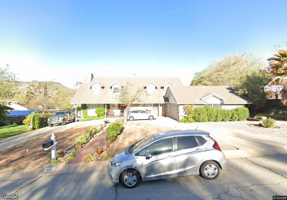
545 N 260 West Cir Saint George, UT 84770
Estimated Value: $748,212 - $999,000
7
Beds
5
Baths
3,706
Sq Ft
$226/Sq Ft
Est. Value
About This Home
This home is located at 545 N 260 West Cir, Saint George, UT 84770 and is currently estimated at $837,553, approximately $225 per square foot. 545 N 260 West Cir is a home located in Washington County with nearby schools including Heritage School, Dixie Middle School, and Dixie Intermediate School.
Ownership History
Date
Name
Owned For
Owner Type
Purchase Details
Closed on
Sep 1, 2011
Sold by
Brooking Suzanne
Bought by
Thompson Ronald W and Michael D Hughes Childrens Trust
Current Estimated Value
Purchase Details
Closed on
Dec 22, 2010
Sold by
Thompson Ronald W
Bought by
Brooking Suzanne D
Purchase Details
Closed on
Jun 17, 2008
Sold by
Hughes Michael Dean
Bought by
Hughes Michael D and Michael D Hughes Childrens Trust
Purchase Details
Closed on
Mar 4, 2008
Sold by
Brooking Suzanne D and Hughes Suzanne D
Bought by
Brooking Suzanne D and Hughes Michael D
Create a Home Valuation Report for This Property
The Home Valuation Report is an in-depth analysis detailing your home's value as well as a comparison with similar homes in the area
Home Values in the Area
Average Home Value in this Area
Purchase History
| Date | Buyer | Sale Price | Title Company |
|---|---|---|---|
| Thompson Ronald W | -- | None Available | |
| Brooking Suzanne D | -- | None Available | |
| Hughes Michael D | $90,000 | None Available | |
| Brooking Suzanne D | -- | None Available |
Source: Public Records
Tax History Compared to Growth
Tax History
| Year | Tax Paid | Tax Assessment Tax Assessment Total Assessment is a certain percentage of the fair market value that is determined by local assessors to be the total taxable value of land and additions on the property. | Land | Improvement |
|---|---|---|---|---|
| 2025 | $3,078 | $451,110 | $89,375 | $361,735 |
| 2023 | $3,026 | $452,045 | $89,375 | $362,670 |
| 2022 | $3,219 | $452,320 | $89,375 | $362,945 |
| 2021 | $2,653 | $556,000 | $104,000 | $452,000 |
| 2020 | $2,345 | $462,700 | $75,000 | $387,700 |
| 2019 | $2,458 | $473,800 | $70,000 | $403,800 |
| 2018 | $2,114 | $204,325 | $0 | $0 |
| 2017 | $2,097 | $202,620 | $0 | $0 |
| 2016 | $1,984 | $177,320 | $0 | $0 |
| 2015 | $2,043 | $175,230 | $0 | $0 |
| 2014 | $1,871 | $161,480 | $0 | $0 |
Source: Public Records
Map
Nearby Homes
- 485 N 400 W
- 485 W Diagonal Unit 11
- 454 W 400 N
- 485 Diagonal St Unit 11
- 550 W 600 N Unit 9
- 578 S Cecita Way
- 590 S Cecita Way
- 311 N Donlee Dr
- 301 N Donlee Dr
- 468 Ridgeview Dr
- 453 Northridge Ave
- 567 Ridgeview Dr
- 571 W 15 Cir N
- 250 S Donlee Dr Unit J
- 250 S Donlee Dr
- 135 S 100 St W
- 663 W 65 S
- 568 N 950 W
- 588 N 950 W
- 358 W 200 S
- 525 N 260 West Cir
- 291 W 550 North Cir Unit 22
- 291 Sandstone Cir
- 286 W 500 N
- 303 Sandstone Cir
- 300 W 500 N
- 544 N 260 Cir W
- 544 N 260 West Cir
- 234 W 500 N
- 246 W 500 N
- 286 Sandstone Cir
- 309 Sandstone Cir
- 556 N 260 West Cir
- 220 W 500 N
- 316 W 500 N
- 277 W 500 N
- 295 W 500 N
- 267 W 500 N
- 303 W 500 N
- 324 Sandstone Cir