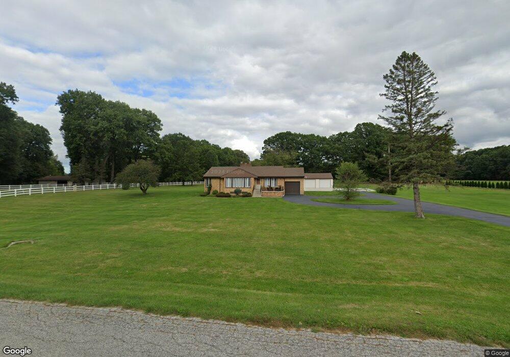
545 N 750 W Hobart, IN 46342
Estimated Value: $312,000 - $362,625
3
Beds
2
Baths
1,296
Sq Ft
$261/Sq Ft
Est. Value
About This Home
This home is located at 545 N 750 W, Hobart, IN 46342 and is currently estimated at $338,656, approximately $261 per square foot. 545 N 750 W is a home located in Porter County with nearby schools including Union Township Middle School, Wheeler High School, and Trinity Lutheran School.
Ownership History
Date
Name
Owned For
Owner Type
Purchase Details
Closed on
Jun 24, 2024
Sold by
Giba Kris A
Bought by
Rouch Lucas Paul
Current Estimated Value
Purchase Details
Closed on
Dec 18, 2008
Sold by
Roper J Timothy and Roper Linda C
Bought by
Giba Kris A
Home Financials for this Owner
Home Financials are based on the most recent Mortgage that was taken out on this home.
Original Mortgage
$120,000
Interest Rate
6.19%
Mortgage Type
Purchase Money Mortgage
Purchase Details
Closed on
Jan 22, 2007
Sold by
Watson Cheryl Ann and Sophie M Ulozas Living Trust
Bought by
Ulozas Ronald J
Create a Home Valuation Report for This Property
The Home Valuation Report is an in-depth analysis detailing your home's value as well as a comparison with similar homes in the area
Home Values in the Area
Average Home Value in this Area
Purchase History
| Date | Buyer | Sale Price | Title Company |
|---|---|---|---|
| Rouch Lucas Paul | $365,000 | None Listed On Document | |
| Giba Kris A | -- | Meridian Title Corp | |
| Ulozas Ronald J | -- | None Available |
Source: Public Records
Mortgage History
| Date | Status | Borrower | Loan Amount |
|---|---|---|---|
| Previous Owner | Giba Kris A | $120,000 |
Source: Public Records
Tax History Compared to Growth
Tax History
| Year | Tax Paid | Tax Assessment Tax Assessment Total Assessment is a certain percentage of the fair market value that is determined by local assessors to be the total taxable value of land and additions on the property. | Land | Improvement |
|---|---|---|---|---|
| 2024 | $1,919 | $264,000 | $56,500 | $207,500 |
| 2023 | $1,779 | $235,000 | $49,200 | $185,800 |
| 2022 | $1,674 | $217,900 | $49,200 | $168,700 |
| 2021 | $1,658 | $194,400 | $49,200 | $145,200 |
| 2020 | $1,630 | $187,400 | $43,200 | $144,200 |
| 2019 | $1,481 | $171,000 | $43,200 | $127,800 |
| 2018 | $1,541 | $164,900 | $43,200 | $121,700 |
| 2017 | $1,387 | $162,700 | $43,200 | $119,500 |
| 2016 | $1,344 | $159,400 | $44,100 | $115,300 |
| 2014 | $1,197 | $147,800 | $41,200 | $106,600 |
| 2013 | -- | $154,400 | $45,600 | $108,800 |
Source: Public Records
Map
Nearby Homes
- 736 Cinnamon Teal Ct
- 606 Merganser Dr
- N/a County Line Sr 130
- 745 Pintail Ln
- 6490 County Line Rd
- 2411 E 10th St
- 633 W 600 N
- 4539 Us Hwy 30
- 679 N 700 W
- 4175 Viceroy St
- 4164 Viceroy St
- 4163 Viceroy St
- 4146 Viceroy St
- 6235 Randolph St
- 7922 Bracken Pkwy
- 4118 Viceroy St
- BELLAMY Plan at Bauer Farm
- HENLEY Plan at Bauer Farm
- HARMONY Plan at Bauer Farm
- 2925 Mcafee Dr