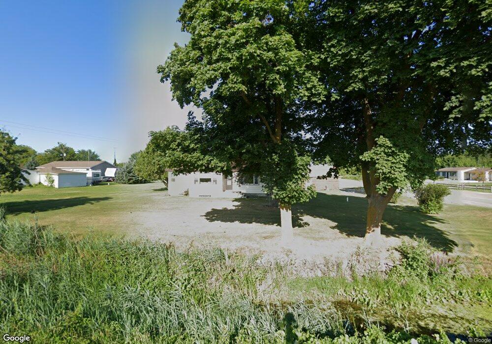
545 N Garfield Rd Linwood, MI 48634
Estimated Value: $66,533 - $166,000
--
Bed
1
Bath
1,174
Sq Ft
$107/Sq Ft
Est. Value
About This Home
This home is located at 545 N Garfield Rd, Linwood, MI 48634 and is currently estimated at $125,633, approximately $107 per square foot. 545 N Garfield Rd is a home located in Bay County with nearby schools including Linwood Elementary School, Pinconning Central Elementary School, and Pinconning Middle School.
Ownership History
Date
Name
Owned For
Owner Type
Purchase Details
Closed on
Apr 26, 2010
Sold by
Hess Gail Marie
Bought by
Call Kevin and Call Tracie
Current Estimated Value
Home Financials for this Owner
Home Financials are based on the most recent Mortgage that was taken out on this home.
Original Mortgage
$34,000
Outstanding Balance
$24,846
Interest Rate
7%
Mortgage Type
Seller Take Back
Estimated Equity
$100,787
Purchase Details
Closed on
Sep 24, 2009
Sold by
Cruthers Roger Erwin and Cruthers June A
Bought by
Hess Gail Marie
Purchase Details
Closed on
Oct 24, 1986
Sold by
Cruthers Inez H and Cruthers Erwin C
Bought by
Cruthers Inez H and Cruthers Erwin C
Create a Home Valuation Report for This Property
The Home Valuation Report is an in-depth analysis detailing your home's value as well as a comparison with similar homes in the area
Home Values in the Area
Average Home Value in this Area
Purchase History
| Date | Buyer | Sale Price | Title Company |
|---|---|---|---|
| Call Kevin | $40,000 | None Available | |
| Hess Gail Marie | $11,000 | None Available | |
| Cruthers Inez H | -- | None Available | |
| Cruthers Inez H Roger E | -- | -- |
Source: Public Records
Mortgage History
| Date | Status | Borrower | Loan Amount |
|---|---|---|---|
| Open | Call Kevin | $34,000 |
Source: Public Records
Tax History Compared to Growth
Tax History
| Year | Tax Paid | Tax Assessment Tax Assessment Total Assessment is a certain percentage of the fair market value that is determined by local assessors to be the total taxable value of land and additions on the property. | Land | Improvement |
|---|---|---|---|---|
| 2025 | $1,218 | $25,650 | $0 | $0 |
| 2024 | $1,149 | $23,000 | $0 | $0 |
| 2023 | $190 | $18,350 | $0 | $0 |
| 2022 | $1,031 | $17,550 | $0 | $0 |
| 2021 | $929 | $17,450 | $2,650 | $14,800 |
| 2020 | $915 | $17,000 | $2,650 | $14,350 |
| 2019 | $875 | $16,600 | $0 | $0 |
| 2018 | $847 | $15,200 | $0 | $0 |
| 2017 | $821 | $14,950 | $0 | $0 |
| 2016 | $820 | $14,600 | $1,300 | $13,300 |
| 2015 | -- | $13,550 | $1,300 | $12,250 |
| 2014 | -- | $13,450 | $2,200 | $11,250 |
Source: Public Records
Map
Nearby Homes
- 2218 S Nine Mile Rd
- 1255 S Nine Mile Rd
- 1560 N 8 Mile Rd
- 0 S 11 Mile Rd
- 4949 S Garfield Rd
- 2730 W Anderson Rd
- 2192 S Garfield Rd
- 2515 S 11 Mile Rd
- Vacant Land N Garfield Rd
- Vacant Land N Garfield Rd Unit V/L Parcel B Garfiel
- 1992 N 7 Mile Rd
- 0 E Prevo Rd
- 1428 S 8 Mile Rd
- 2671 N 8 Mile Rd
- V/L N Ehlers Rd
- 5096 N Waldo Rd
- 50 Schmidt Rd
- 1826 8 Mile Rd
- 2010 Eleven Mile
- 2041 S Carter Rd
- 529 N Garfield Rd
- 530 Crump St
- 1022 Crump St
- 526 N Garfield Rd
- 528 Crump St
- 528 Crump St
- 1034 W Anderson Rd
- 1014 W Anderson Rd
- 1024 W Anderson Rd
- 1030 W Anderson Rd
- 506 N Garfield Rd
- 493 N Garfield Rd
- 984 W Anderson Rd
- 1031 W Anderson Rd
- 1060 Crump St
- 1070 W Anderson Rd
- 964 W Anderson Rd
- 1041 W Anderson Rd
- 1051 W Anderson Rd
- 1088 W Anderson Rd