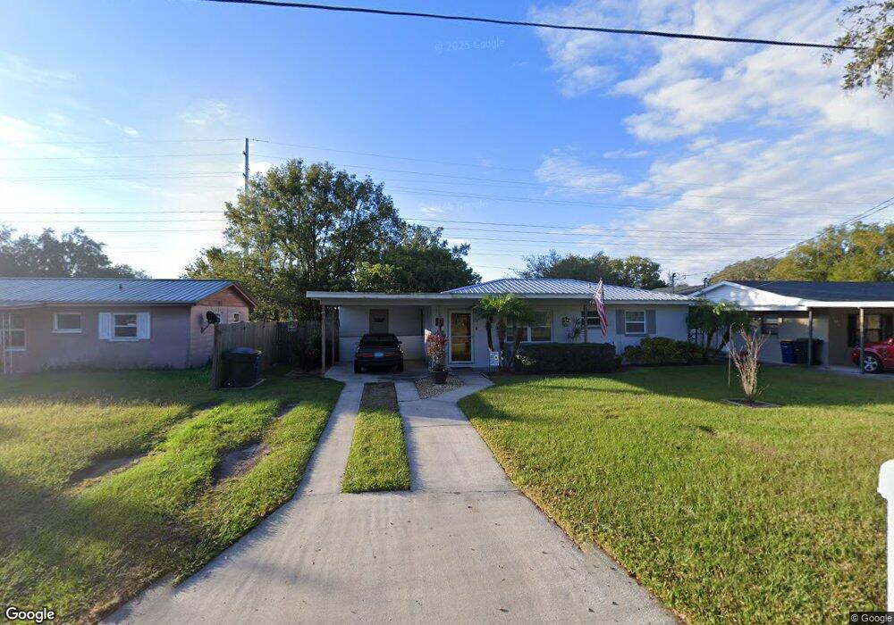
545 Ralph St Bartow, FL 33830
Estimated Value: $165,000 - $198,000
2
Beds
1
Bath
876
Sq Ft
$209/Sq Ft
Est. Value
About This Home
This home is located at 545 Ralph St, Bartow, FL 33830 and is currently estimated at $183,023, approximately $208 per square foot. 545 Ralph St is a home located in Polk County with nearby schools including Spessard L Holland Elementary School, Bartow Elementary Academy, and Bartow Middle School.
Ownership History
Date
Name
Owned For
Owner Type
Purchase Details
Closed on
Jun 20, 2003
Sold by
Shanks George Arthur and Shanks Lareita Y
Bought by
Whistin Jimmie D
Current Estimated Value
Home Financials for this Owner
Home Financials are based on the most recent Mortgage that was taken out on this home.
Original Mortgage
$61,458
Outstanding Balance
$26,237
Interest Rate
5.43%
Mortgage Type
FHA
Estimated Equity
$156,786
Purchase Details
Closed on
Dec 19, 2002
Sold by
Sheppard Noreen
Bought by
Shanks George A and Shanks Lareita Y
Create a Home Valuation Report for This Property
The Home Valuation Report is an in-depth analysis detailing your home's value as well as a comparison with similar homes in the area
Home Values in the Area
Average Home Value in this Area
Purchase History
| Date | Buyer | Sale Price | Title Company |
|---|---|---|---|
| Whistin Jimmie D | $62,000 | -- | |
| Shanks George A | $42,000 | -- |
Source: Public Records
Mortgage History
| Date | Status | Borrower | Loan Amount |
|---|---|---|---|
| Open | Whistin Jimmie D | $61,458 |
Source: Public Records
Tax History
| Year | Tax Paid | Tax Assessment Tax Assessment Total Assessment is a certain percentage of the fair market value that is determined by local assessors to be the total taxable value of land and additions on the property. | Land | Improvement |
|---|---|---|---|---|
| 2025 | $857 | $54,708 | -- | -- |
| 2024 | $765 | $53,166 | -- | -- |
| 2023 | $765 | $51,617 | $0 | $0 |
| 2022 | $629 | $50,114 | $0 | $0 |
| 2021 | $551 | $48,654 | $0 | $0 |
| 2020 | $479 | $47,982 | $0 | $0 |
| 2018 | $459 | $46,028 | $0 | $0 |
| 2017 | $442 | $45,081 | $0 | $0 |
| 2016 | $432 | $44,154 | $0 | $0 |
Source: Public Records
Map
Nearby Homes
- 435 Lucille St
- 475 W Ethelene St
- 1650 N Tate Ave
- 1655 N Floral Ave
- 650 Shady Ln
- 610 Lyle Pkwy
- 830 Shady Ln
- 1880 N Virginia Ave
- 930 Pinecrest Dr
- 0 N Maple Ave
- 1040 Austin St
- 1060 Austin St
- 845 N Gordon Ave
- 0 Polk St W
- 533 Waldon Ave
- 929 Polk St
- 2606 Olive Ln
- 810 N Maple Ave
- 2814 Virginia Pine Dr
- 2822 Virginia Pine Dr
Your Personal Tour Guide
Ask me questions while you tour the home.