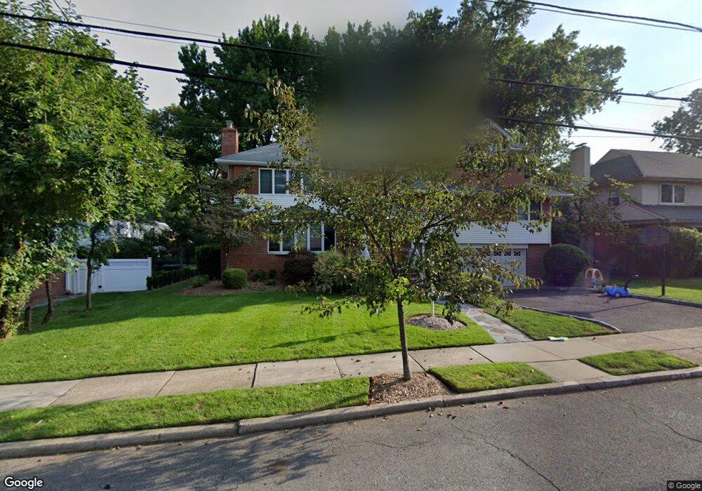
545 Rutland Ave Teaneck, NJ 07666
Estimated Value: $1,625,637 - $1,981,000
--
Bed
--
Bath
1,680
Sq Ft
$1,074/Sq Ft
Est. Value
About This Home
This home is located at 545 Rutland Ave, Teaneck, NJ 07666 and is currently estimated at $1,804,546, approximately $1,074 per square foot. 545 Rutland Ave is a home located in Bergen County with nearby schools including Teaneck Senior High School, Grace Lutheran School, and Yeshivat He'atid.
Ownership History
Date
Name
Owned For
Owner Type
Purchase Details
Closed on
Jul 20, 2022
Sold by
Barmash and Ida
Bought by
Barmash Family Trust
Current Estimated Value
Purchase Details
Closed on
Aug 9, 2002
Purchase Details
Closed on
Mar 1, 1998
Sold by
Carmody Liam
Bought by
Cherniak Alexander and Rudshteyn Elizabeth
Home Financials for this Owner
Home Financials are based on the most recent Mortgage that was taken out on this home.
Original Mortgage
$130,000
Interest Rate
6.55%
Create a Home Valuation Report for This Property
The Home Valuation Report is an in-depth analysis detailing your home's value as well as a comparison with similar homes in the area
Home Values in the Area
Average Home Value in this Area
Purchase History
| Date | Buyer | Sale Price | Title Company |
|---|---|---|---|
| Barmash Family Trust | -- | Beress & Zalkind Pllc | |
| -- | $298,000 | -- | |
| Cherniak Alexander | $206,000 | -- |
Source: Public Records
Mortgage History
| Date | Status | Borrower | Loan Amount |
|---|---|---|---|
| Previous Owner | Cherniak Alexander | $130,000 |
Source: Public Records
Tax History Compared to Growth
Tax History
| Year | Tax Paid | Tax Assessment Tax Assessment Total Assessment is a certain percentage of the fair market value that is determined by local assessors to be the total taxable value of land and additions on the property. | Land | Improvement |
|---|---|---|---|---|
| 2025 | $29,875 | $1,367,900 | $590,400 | $777,500 |
| 2024 | $32,138 | $1,367,900 | $590,400 | $777,500 |
| 2023 | $12,072 | $349,600 | $198,800 | $150,800 |
| 2022 | $12,072 | $349,600 | $198,800 | $150,800 |
| 2021 | $12,082 | $349,600 | $198,800 | $150,800 |
| 2020 | $11,700 | $341,100 | $198,800 | $142,300 |
| 2019 | $11,495 | $341,100 | $198,800 | $142,300 |
| 2018 | $11,284 | $341,100 | $198,800 | $142,300 |
| 2017 | $11,004 | $341,100 | $198,800 | $142,300 |
| 2016 | $10,700 | $341,100 | $198,800 | $142,300 |
| 2015 | $10,499 | $341,100 | $198,800 | $142,300 |
| 2014 | $10,322 | $341,100 | $198,800 | $142,300 |
Source: Public Records
Map
Nearby Homes
- 526 Rutland Ave
- 591 Warwick Ave
- 532 Winthrop Rd
- 364 Rutland Ave
- 21 Briarcliffe Rd
- 1329 Dickerson Rd
- 711 Camperdown Rd
- 565 N Forest Dr
- 506 Sunderland Rd
- 1328 Taft Rd
- 273 W Englewood Ave
- 48 Sussex Rd
- 325 New Bridge Rd
- 665 Northumberland Rd
- 98 John Place
- 64 Glenwood Dr S
- 1106 Bromley Ave
- 55 Maiden Ln
- 1105 Belle Ave
- 1093 Sheridan St
- 537 Rutland Ave
- 1445 Hudson Rd
- 1453 Hudson Rd
- 534 Maitland Ave
- 528 Maitland Ave
- 529 Rutland Ave
- 1435 Hudson Rd
- 1461 Hudson Rd
- 544 Rutland Ave
- 522 Maitland Ave
- 538 Rutland Ave
- 532 Rutland Ave
- 521 Rutland Ave
- 1429 Hudson Rd
- 514 Maitland Ave
- 565 Rutland Ave
- 1454 Hudson Rd
- 1425 Hudson Rd
- 564 Rutland Ave
- 529 Maitland Ave