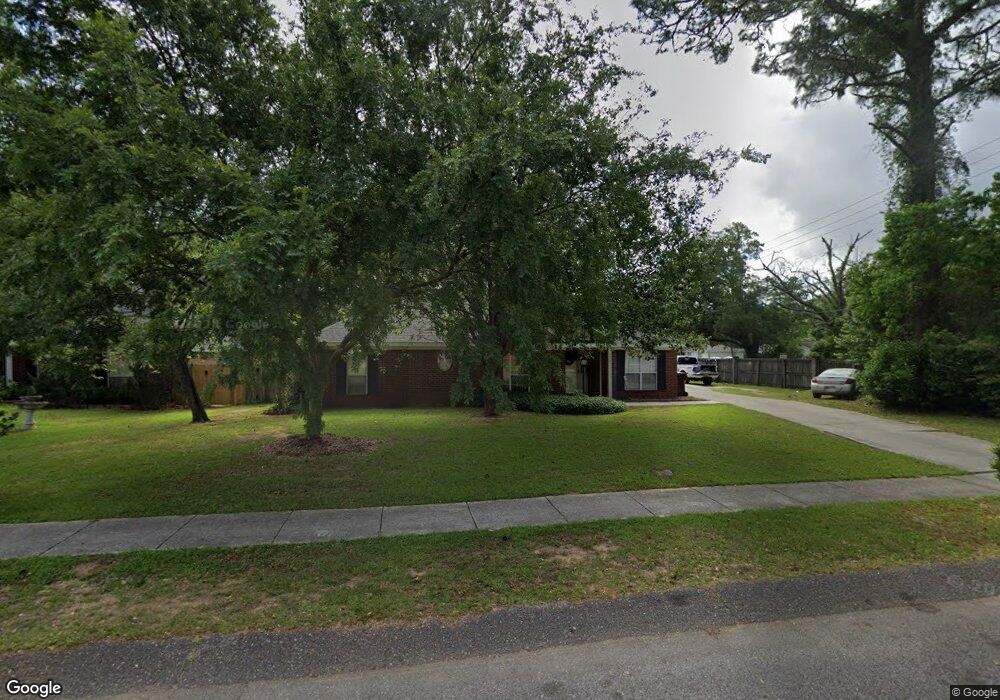
5450 Colony Trace Ct Unit 2 Satsuma, AL 36572
Estimated Value: $247,805 - $288,000
3
Beds
2
Baths
1,626
Sq Ft
$163/Sq Ft
Est. Value
About This Home
This home is located at 5450 Colony Trace Ct Unit 2, Satsuma, AL 36572 and is currently estimated at $265,201, approximately $163 per square foot. 5450 Colony Trace Ct Unit 2 is a home located in Mobile County with nearby schools including Robert E. Lee Elementary School, Satsuma High School, and Satsuma Christian School.
Ownership History
Date
Name
Owned For
Owner Type
Purchase Details
Closed on
Aug 15, 2024
Sold by
Crownover Phillip R and Crownover Holly H
Bought by
Langley Lyndon Rane and Langley Willie Joe
Current Estimated Value
Home Financials for this Owner
Home Financials are based on the most recent Mortgage that was taken out on this home.
Original Mortgage
$244,200
Outstanding Balance
$241,479
Interest Rate
6.95%
Mortgage Type
FHA
Estimated Equity
$23,722
Purchase Details
Closed on
May 18, 2001
Sold by
The Mitchell Company Inc
Bought by
Crownover Phillip R and Crownover Holly H
Home Financials for this Owner
Home Financials are based on the most recent Mortgage that was taken out on this home.
Original Mortgage
$60,000
Interest Rate
7.02%
Create a Home Valuation Report for This Property
The Home Valuation Report is an in-depth analysis detailing your home's value as well as a comparison with similar homes in the area
Home Values in the Area
Average Home Value in this Area
Purchase History
| Date | Buyer | Sale Price | Title Company |
|---|---|---|---|
| Langley Lyndon Rane | $260,000 | None Listed On Document | |
| Crownover Phillip R | $115,500 | Surety Land Title Inc |
Source: Public Records
Mortgage History
| Date | Status | Borrower | Loan Amount |
|---|---|---|---|
| Open | Langley Lyndon Rane | $244,200 | |
| Previous Owner | Crownover Phillip R | $60,000 |
Source: Public Records
Tax History Compared to Growth
Tax History
| Year | Tax Paid | Tax Assessment Tax Assessment Total Assessment is a certain percentage of the fair market value that is determined by local assessors to be the total taxable value of land and additions on the property. | Land | Improvement |
|---|---|---|---|---|
| 2024 | $954 | $16,720 | $2,500 | $14,220 |
| 2023 | $946 | $16,600 | $3,500 | $13,100 |
| 2022 | $868 | $15,320 | $3,360 | $11,960 |
| 2021 | $719 | $12,880 | $2,800 | $10,080 |
| 2020 | $727 | $13,020 | $2,800 | $10,220 |
| 2019 | $709 | $12,720 | $0 | $0 |
| 2018 | $716 | $12,840 | $0 | $0 |
| 2017 | $738 | $13,200 | $0 | $0 |
| 2016 | $746 | $13,320 | $0 | $0 |
| 2013 | $700 | $12,360 | $0 | $0 |
Source: Public Records
Map
Nearby Homes
- 5454 Colony Trace Ct
- 336 Avondale Ct
- 0 Travellers Ct Unit 34 0653435
- 5366 Scanlan Way E
- 5463 Barbara Dr
- 315 Thunderbird Dr
- 334 Avondale Ave
- 100 Baker Rd
- 0 Orchard St
- 5640 Orchard St
- 5718 Apache Dr
- 5503 Darring St
- 5509 Darring St
- 5719 Warrior Dr
- 5726 Apache Dr
- 5303 U S 43
- 612 Saraland Ave
- 615 Saraland Ave
- 39 Brice Ave
- 0 Kalifield Blvd Unit 25 384900
- 5458 Colony Trace Ct
- 5462 Colony Trace Ct
- 5451 Colony Trace Ct
- 5455 Colony Trace Ct
- 5466 Colony Trace Ct
- 5459 Colony Trace Ct
- 307 Baker Rd
- 5463 Colony Trace Ct
- 5470 Colony Trace Ct
- 355 Baker Rd
- 358 Baker Rd
- 5467 Colony Trace Ct
- 5415 Hartley Rd
- 5474 Colony Trace Ct
- 5471 Colony Trace Ct
- 359 Baker Rd
- 5419 Hartley Rd
- 306 Avondale Ct
- 5478 Colony Trace Ct
- 5475 Colony Trace Ct