Estimated Value: $289,648 - $487,000
4
Beds
2
Baths
3,035
Sq Ft
$133/Sq Ft
Est. Value
About This Home
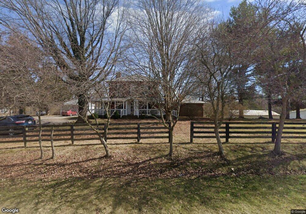
This home is located at 5450 N Dixie Hwy, Lima, OH 45807 and is currently estimated at $403,912, approximately $133 per square foot. 5450 N Dixie Hwy is a home located in Allen County with nearby schools including Allen East Elementary School, Allen East Middle School, and Allen East High School.
Ownership History
Date
Name
Owned For
Owner Type
Purchase Details
Closed on
Sep 19, 2006
Sold by
Runk Wesley T and Runk Mary Beth
Bought by
Pellegrini Dante Louis and Pellegrini Dovie Colleen
Current Estimated Value
Purchase Details
Closed on
May 1, 1998
Sold by
Winkelman Harold
Bought by
Runk Wesely
Home Financials for this Owner
Home Financials are based on the most recent Mortgage that was taken out on this home.
Original Mortgage
$120,800
Interest Rate
7.18%
Mortgage Type
New Conventional
Purchase Details
Closed on
Dec 5, 1985
Bought by
Runk Wesley Thomas
Create a Home Valuation Report for This Property
The Home Valuation Report is an in-depth analysis detailing your home's value as well as a comparison with similar homes in the area
Home Values in the Area
Average Home Value in this Area
Purchase History
| Date | Buyer | Sale Price | Title Company |
|---|---|---|---|
| Pellegrini Dante Louis | $85,000 | None Available | |
| Runk Wesely | $115,209 | -- | |
| Runk Wesley Thomas | -- | -- |
Source: Public Records
Mortgage History
| Date | Status | Borrower | Loan Amount |
|---|---|---|---|
| Previous Owner | Runk Wesely | $120,800 |
Source: Public Records
Tax History Compared to Growth
Tax History
| Year | Tax Paid | Tax Assessment Tax Assessment Total Assessment is a certain percentage of the fair market value that is determined by local assessors to be the total taxable value of land and additions on the property. | Land | Improvement |
|---|---|---|---|---|
| 2024 | $3,059 | $87,260 | $10,990 | $76,270 |
| 2023 | $2,573 | $66,610 | $8,400 | $58,210 |
| 2022 | $2,593 | $66,610 | $8,400 | $58,210 |
| 2021 | $2,593 | $66,610 | $8,400 | $58,210 |
| 2020 | $2,434 | $60,870 | $7,810 | $53,060 |
| 2019 | $2,434 | $60,870 | $7,810 | $53,060 |
| 2018 | $2,432 | $60,870 | $7,810 | $53,060 |
| 2017 | $2,222 | $53,940 | $7,810 | $46,130 |
| 2016 | $2,213 | $53,940 | $7,810 | $46,130 |
| 2015 | $2,109 | $53,940 | $7,810 | $46,130 |
| 2014 | $2,109 | $49,740 | $7,420 | $42,320 |
| 2013 | $2,054 | $49,740 | $7,420 | $42,320 |
Source: Public Records
Map
Nearby Homes
- 5025 N Cool Rd
- 6476 Mickelson Ln
- 000 Napoleon Rd
- 207 W Prospect St
- 108 E Main St
- 4619 N Thayer Rd
- 6601 N Napoleon Rd
- 4700 Herr Rd
- 0 N Dixie Hwy Unit 308796
- 0 N Dixie Hwy Unit 300253
- 5496 Sandusky Rd
- 000 Lincoln Hwy
- 108 Highland Lakes Dr
- 9290 Lincoln Hwy
- 0 Lincoln Hwy
- 7957 Hillville Rd
- 00000 Ohio 696
- 000 Ohio 696
- 0000 Ohio 696
- 8305 Hillville Rd