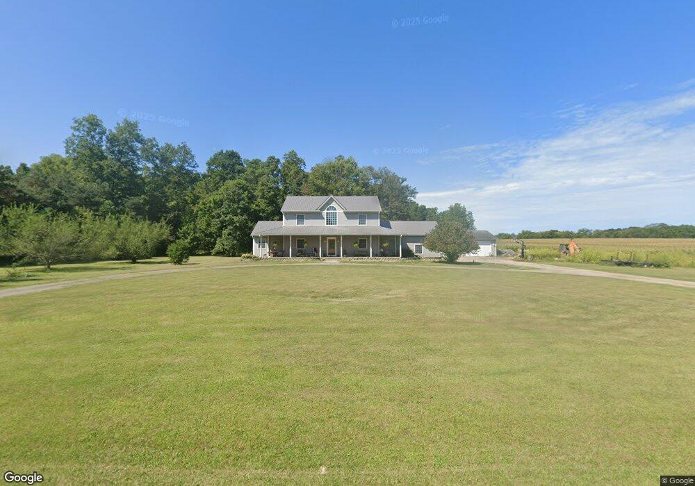
5450 Smoky Row Rd Greens Fork, IN 47345
Estimated Value: $306,000 - $521,206
3
Beds
4
Baths
2,832
Sq Ft
$161/Sq Ft
Est. Value
About This Home
This home is located at 5450 Smoky Row Rd, Greens Fork, IN 47345 and is currently estimated at $455,302, approximately $160 per square foot. 5450 Smoky Row Rd is a home located in Wayne County with nearby schools including Hagerstown Elementary School and Hagerstown Junior/Senior High School.
Ownership History
Date
Name
Owned For
Owner Type
Purchase Details
Closed on
Aug 22, 2016
Sold by
Hernly Emily C
Bought by
Hernly Jeffrey E
Current Estimated Value
Purchase Details
Closed on
Jan 22, 2007
Sold by
Chaney John E and Chaney Jeana J
Bought by
Hernly Jeffrey E and Hernly Emily C
Home Financials for this Owner
Home Financials are based on the most recent Mortgage that was taken out on this home.
Original Mortgage
$224,000
Interest Rate
6.19%
Mortgage Type
New Conventional
Create a Home Valuation Report for This Property
The Home Valuation Report is an in-depth analysis detailing your home's value as well as a comparison with similar homes in the area
Home Values in the Area
Average Home Value in this Area
Purchase History
| Date | Buyer | Sale Price | Title Company |
|---|---|---|---|
| Hernly Jeffrey E | -- | -- | |
| Hernly Jeffrey E | -- | -- |
Source: Public Records
Mortgage History
| Date | Status | Borrower | Loan Amount |
|---|---|---|---|
| Previous Owner | Hernly Jeffrey E | $224,000 |
Source: Public Records
Tax History Compared to Growth
Tax History
| Year | Tax Paid | Tax Assessment Tax Assessment Total Assessment is a certain percentage of the fair market value that is determined by local assessors to be the total taxable value of land and additions on the property. | Land | Improvement |
|---|---|---|---|---|
| 2024 | $2,603 | $252,700 | $24,200 | $228,500 |
| 2023 | $2,662 | $231,800 | $21,500 | $210,300 |
| 2022 | $2,868 | $239,600 | $20,100 | $219,500 |
| 2021 | $2,646 | $217,900 | $19,300 | $198,600 |
| 2020 | $2,734 | $222,900 | $19,100 | $203,800 |
| 2019 | $2,662 | $220,400 | $20,100 | $200,300 |
| 2018 | $2,627 | $220,600 | $20,300 | $200,300 |
| 2017 | $2,598 | $224,900 | $21,100 | $203,800 |
| 2016 | $2,455 | $219,200 | $21,000 | $198,200 |
| 2014 | $2,075 | $202,400 | $21,400 | $181,000 |
| 2013 | $2,075 | $195,100 | $20,300 | $174,800 |
Source: Public Records
Map
Nearby Homes
- 314 S Main St
- 6855 N Centerville Rd
- 5159 State Road 38
- 8292 Main St
- 0 Walnut St
- 6049 U S 35
- 8171 George Early Rd
- 2336 W New Garden Rd
- 207 College Corner Rd
- 1003 N Morton Ave
- 210 Sunset Ave
- 2507 Flatley Rd
- 2603 NW 16th St
- 5586 U S 27
- 2518 NW 15th St
- 0 Round Barn Rd
- 1414 Holsapple Rd
- 502 N 1st St
- 2700 Williamsburg Pike
- 701 W Cherry St
- 5378 Smoky Row Rd
- 5322 Smoky Row Rd
- 5270 Smoky Row Rd
- 7372 Webster Rd
- 0 Webster Rd
- 7384 Smokey Row Rd
- 7485 Palmer Rd
- 7006 Webster Rd
- 7624 Smoky Row Rd
- 7627 Webster Rd
- 7751 Smoky Row Rd
- 7308 Smoky Row Rd
- 7458 Palmer Rd
- 7015 Webster Rd
- 0 Smoky Row
- 7394 Palmer Rd
- 6726 Webster Rd
- 7941 Webster Rd
- 7251 Palmer Rd
- 7334 Palmer Rd