Estimated Value: $120,000
--
Bed
--
Bath
--
Sq Ft
0.45
Acres
About This Home
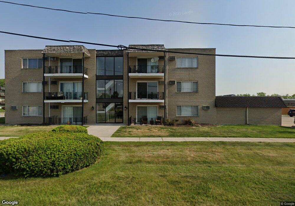
This home is located at 5450 W 127th St Unit P8, Alsip, IL 60803 and is currently estimated at $120,000. 5450 W 127th St Unit P8 is a home located in Cook County with nearby schools including Hazelgreen Elementary School, Prairie Jr High School, and A B Shepard High School.
Ownership History
Date
Name
Owned For
Owner Type
Purchase Details
Closed on
Mar 21, 2022
Sold by
Perez Jose C and Perez Maria E
Bought by
First Midwest Bank
Current Estimated Value
Purchase Details
Closed on
Mar 15, 2022
Sold by
Perez Jose C and Perez Maria E
Bought by
First Midwest Bank
Purchase Details
Closed on
Nov 12, 2021
Sold by
Fagan Cynthia M and Fagan Cynthia M
Bought by
Perez Jose C and Perez Maria E
Purchase Details
Closed on
Jun 17, 2016
Sold by
Fagan Cynthia A
Bought by
Livi Fagan Cynthia M and Cynthia M Fagan Revocable Living Trust
Purchase Details
Closed on
Dec 8, 2010
Sold by
Bresnahan Michael
Bought by
Fagan Cynthia M
Purchase Details
Closed on
Mar 15, 2007
Sold by
Alpine Crest Condominiums
Bought by
Bresnahan Michael
Purchase Details
Closed on
Dec 14, 2006
Sold by
Alpine Crest Llc
Bought by
Alpine Crest Condominiums
Create a Home Valuation Report for This Property
The Home Valuation Report is an in-depth analysis detailing your home's value as well as a comparison with similar homes in the area
Home Values in the Area
Average Home Value in this Area
Purchase History
| Date | Buyer | Sale Price | Title Company |
|---|---|---|---|
| First Midwest Bank | -- | -- | |
| First Midwest Bank | -- | -- | |
| Perez Jose C | $86,000 | Chicago Title Insurance Co | |
| Livi Fagan Cynthia M | -- | None Available | |
| Fagan Cynthia M | -- | None Available | |
| Bresnahan Michael | -- | None Available | |
| Alpine Crest Condominiums | -- | Chicago Title Insurance Co |
Source: Public Records
Tax History Compared to Growth
Tax History
| Year | Tax Paid | Tax Assessment Tax Assessment Total Assessment is a certain percentage of the fair market value that is determined by local assessors to be the total taxable value of land and additions on the property. | Land | Improvement |
|---|---|---|---|---|
| 2024 | $77 | $202 | $27 | $175 |
| 2023 | $66 | $232 | $27 | $205 |
| 2022 | $66 | $166 | $28 | $138 |
| 2021 | $63 | $165 | $28 | $137 |
| 2020 | $62 | $165 | $28 | $137 |
| 2019 | $40 | $101 | $25 | $76 |
| 2018 | $38 | $101 | $25 | $76 |
| 2017 | $38 | $101 | $25 | $76 |
| 2016 | $58 | $149 | $21 | $128 |
| 2015 | $57 | $149 | $21 | $128 |
| 2014 | $55 | $149 | $21 | $128 |
| 2013 | $59 | $171 | $21 | $150 |
Source: Public Records
Map
Nearby Homes
- 12620 S Alpine Dr Unit 6
- 12620 S Alpine Dr Unit 4
- 12620 S Alpine Dr Unit 8
- 12649 S Parkside Ave
- 5544 W Cal Sag Rd
- 12720 Carriage Ln Unit B2
- 12613 S Parkside Ave
- 12750 Carriage Ln Unit F2
- 5715 Park Place Unit J2
- 5715 Park Place Unit K1
- 5704 W 128th St Unit 1C
- 5712 128th St Unit 1A
- 12828 Terrace Ln
- 5821 W 127th St
- 5723 129th St Unit 7E
- 9208 S Monitor Ave
- 12557 S Mason Ave
- 5844 W 124th St
- 12732 S Austin Ave
- 5942 W 124th St
- 5450 W 127th St Unit G2
- 5450 W 127th St Unit P19
- 5450 W 127th St Unit P18
- 5450 W 127th St Unit P17
- 5450 W 127th St Unit 302
- 5450 W 127th St Unit P2
- 5450 W 127th St Unit G5
- 5450 W 127th St Unit P15
- 5450 W 127th St Unit P14
- 5450 W 127th St Unit P7
- 5450 W 127th St Unit P5
- 5450 W 127th St Unit P4
- 5450 W 127th St Unit P3
- 5450 W 127th St Unit P1
- 5450 W 127th St Unit 304
- 5450 W 127th St Unit 303
- 5450 W 127th St Unit 202
- 5450 W 127th St Unit 201
- 5450 W 127th St Unit 103
- 5450 W 127th St Unit 102