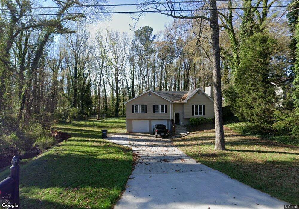
5451 Ledford Dr Unit 4 Austell, GA 30106
Estimated Value: $273,000 - $322,000
3
Beds
2
Baths
1,567
Sq Ft
$190/Sq Ft
Est. Value
About This Home
This home is located at 5451 Ledford Dr Unit 4, Austell, GA 30106 and is currently estimated at $298,512, approximately $190 per square foot. 5451 Ledford Dr Unit 4 is a home located in Cobb County with nearby schools including Deerwood Elementary School, Austell Elementary School, and Garrett Middle School.
Ownership History
Date
Name
Owned For
Owner Type
Purchase Details
Closed on
Nov 3, 2016
Sold by
Tarbert Llc
Bought by
Csh 2016 2 Borrower Llc
Current Estimated Value
Purchase Details
Closed on
Jan 31, 2014
Sold by
Srp Sub Llc
Bought by
Tarbert Llc and C O Waypoint Homes
Purchase Details
Closed on
Jun 1, 2004
Sold by
Crosley Orman S
Bought by
Crosley Orman S and Crosley Lisa
Home Financials for this Owner
Home Financials are based on the most recent Mortgage that was taken out on this home.
Original Mortgage
$20,000
Interest Rate
6.25%
Mortgage Type
New Conventional
Purchase Details
Closed on
Sep 3, 1997
Sold by
Duke Barry G and Duke Lisa D
Bought by
Crosley Orman S and Crosley Lisa P
Home Financials for this Owner
Home Financials are based on the most recent Mortgage that was taken out on this home.
Original Mortgage
$79,652
Interest Rate
7.39%
Mortgage Type
FHA
Create a Home Valuation Report for This Property
The Home Valuation Report is an in-depth analysis detailing your home's value as well as a comparison with similar homes in the area
Home Values in the Area
Average Home Value in this Area
Purchase History
| Date | Buyer | Sale Price | Title Company |
|---|---|---|---|
| Csh 2016 2 Borrower Llc | -- | -- | |
| Tarbert Llc | -- | -- | |
| Crosley Orman S | -- | -- | |
| Crosley Orman S | $80,300 | -- |
Source: Public Records
Mortgage History
| Date | Status | Borrower | Loan Amount |
|---|---|---|---|
| Previous Owner | Crosley Orman S | $20,000 | |
| Previous Owner | Crosley Orman S | $79,652 |
Source: Public Records
Tax History Compared to Growth
Tax History
| Year | Tax Paid | Tax Assessment Tax Assessment Total Assessment is a certain percentage of the fair market value that is determined by local assessors to be the total taxable value of land and additions on the property. | Land | Improvement |
|---|---|---|---|---|
| 2025 | $3,431 | $113,872 | $30,000 | $83,872 |
| 2024 | $3,433 | $113,872 | $30,000 | $83,872 |
| 2023 | $3,499 | $116,068 | $20,000 | $96,068 |
| 2022 | $2,916 | $96,084 | $10,000 | $86,084 |
| 2021 | $1,937 | $63,824 | $10,000 | $53,824 |
| 2020 | $1,937 | $63,824 | $10,000 | $53,824 |
| 2019 | $1,497 | $49,328 | $6,000 | $43,328 |
| 2018 | $1,497 | $49,328 | $6,000 | $43,328 |
| 2017 | $1,418 | $49,328 | $6,000 | $43,328 |
| 2016 | $1,042 | $36,232 | $6,000 | $30,232 |
| 2015 | $1,067 | $36,232 | $6,000 | $30,232 |
| 2014 | $640 | $21,552 | $0 | $0 |
Source: Public Records
Map
Nearby Homes
- 1803 Gherry Dr
- 1971 Annette Ln
- 1841 Mobley St
- 5025 Bishops Row SW
- 1943 Arnold Dr
- 0 Harris St Unit 7661273
- 5466 Davis Dr
- 2060 Sanders Dr
- 1 Perkerson Mill Rd SW
- 2136 Perkerson Mill Rd SW
- 5425 Davis Dr
- 0 Dogwood Cir Unit 7671035
- 0 Dogwood Cir Unit 10630776
- 2335 Ravencliff Dr
- 2335 Ravencliff Dr Unit 91
- 5410 Beth Dr
- 2425 Ravencliff Dr Unit 88
- 2425 Ravencliff Dr
- 5320 Beth Dr
- 2145 Venesa Cir
- 5451 Ledford Dr
- 5461 Ledford Dr
- 0 Ledford Dr Unit 7405803
- 0 Ledford Dr Unit 7577375
- 0 Ledford Dr
- 5421 Ledford Dr
- 5471 Ledford Dr
- 5440 Ledford Dr
- 5460 Ledford Dr
- 5450 Ledford Dr
- 5430 Ledford Dr
- 5481 Ledford Dr
- 5470 Ledford Dr
- 2091 Gherry Dr
- 5420 Ledford Dr
- 2093 Gherry Dr
- 5480 Ledford Dr
- 5480 Ledford Dr
- 2029 Gherry Dr
- 2017 Gherry Dr