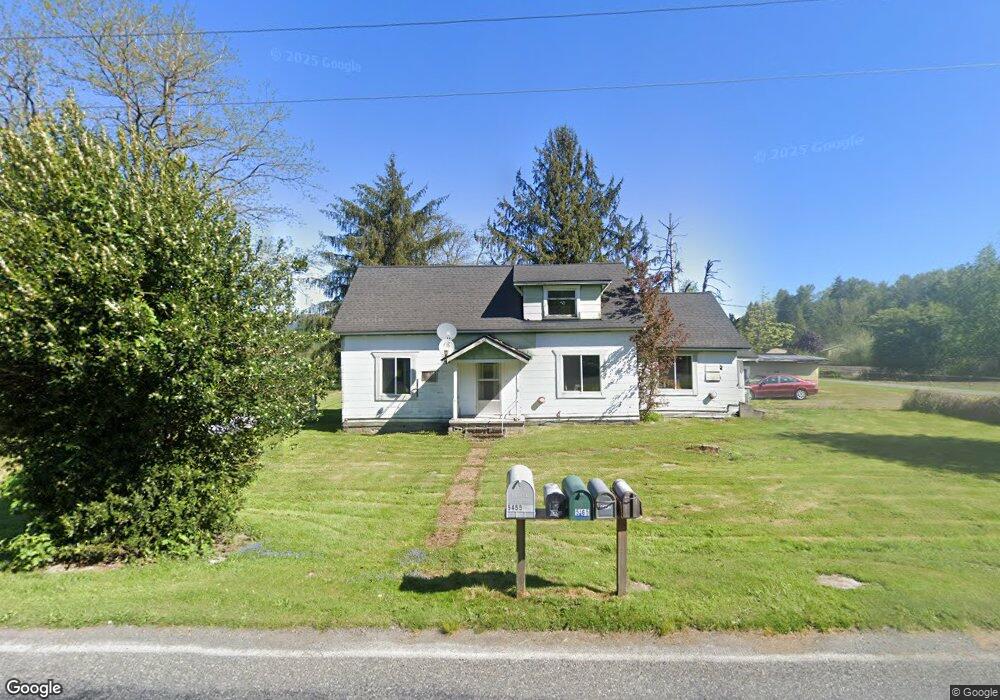
5454 Potter Rd Deming, WA 98244
Estimated Value: $249,000 - $490,000
4
Beds
1
Bath
1,384
Sq Ft
$250/Sq Ft
Est. Value
About This Home
This home is located at 5454 Potter Rd, Deming, WA 98244 and is currently estimated at $345,598, approximately $249 per square foot. 5454 Potter Rd is a home located in Whatcom County with nearby schools including Mount Baker Senior High School.
Ownership History
Date
Name
Owned For
Owner Type
Purchase Details
Closed on
Dec 9, 2014
Sold by
Lindell Kelly and Lindell Kay
Bought by
Dekriek Kristoffer and Dekriek Kelly
Current Estimated Value
Purchase Details
Closed on
Sep 26, 2007
Sold by
Lindell Sandra
Bought by
Lindell Robert
Purchase Details
Closed on
Mar 17, 1998
Sold by
Jones Thomas J and Jones Marla H
Bought by
Lindell Robert and Lindell Sandra
Home Financials for this Owner
Home Financials are based on the most recent Mortgage that was taken out on this home.
Original Mortgage
$75,000
Interest Rate
6.73%
Mortgage Type
Seller Take Back
Create a Home Valuation Report for This Property
The Home Valuation Report is an in-depth analysis detailing your home's value as well as a comparison with similar homes in the area
Home Values in the Area
Average Home Value in this Area
Purchase History
| Date | Buyer | Sale Price | Title Company |
|---|---|---|---|
| Dekriek Kristoffer | $105,000 | Whatcom Land Title | |
| Lindell Robert | $32,883 | None Available | |
| Lindell Robert | -- | -- |
Source: Public Records
Mortgage History
| Date | Status | Borrower | Loan Amount |
|---|---|---|---|
| Previous Owner | Lindell Robert | $75,000 |
Source: Public Records
Tax History Compared to Growth
Tax History
| Year | Tax Paid | Tax Assessment Tax Assessment Total Assessment is a certain percentage of the fair market value that is determined by local assessors to be the total taxable value of land and additions on the property. | Land | Improvement |
|---|---|---|---|---|
| 2024 | $1,402 | $199,621 | $120,328 | $79,293 |
| 2023 | $1,402 | $187,306 | $112,905 | $74,401 |
| 2022 | $1,289 | $165,761 | $99,918 | $65,843 |
| 2021 | $1,122 | $131,556 | $79,300 | $52,256 |
| 2020 | $1,172 | $107,833 | $65,000 | $42,833 |
| 2019 | $903 | $107,833 | $65,000 | $42,833 |
| 2018 | $1,061 | $90,211 | $62,800 | $27,411 |
| 2017 | $879 | $83,316 | $58,000 | $25,316 |
| 2016 | $875 | $76,119 | $53,000 | $23,119 |
| 2015 | $851 | $73,836 | $51,750 | $22,086 |
| 2014 | -- | $69,289 | $48,500 | $20,789 |
| 2013 | -- | $71,976 | $50,000 | $21,976 |
Source: Public Records
Map
Nearby Homes
- 4086 Valley Hwy
- 4120 Valley Hwy
- 5718 Schornbush Rd
- 4126 Caron Rd
- 5070 Deming Rd
- 0 Mt Baker Hwy Unit NWM2371192
- 0 Mt Baker Hwy Unit NWM2230071
- 5510 Mt Baker Hwy
- 8290 Mount Baker Hwy
- 5458 Mount Baker Hwy
- 7019 Mount Baker Hwy
- 0 N Fork Rd
- 5463 Mosquito Lake Rd
- 4290 Mt Baker Hwy
- 5860 Bell Creek Logging Rd
- 3999 Deming Rd
- 5888 Mount Baker Hwy
- 3505 E Smith Rd
- 3557 Cedarville Rd Unit 13
- 5753 Lawrence Rd
- 5465 Potter Rd
- 4097 Valley Hwy
- 5440 Potter Rd
- 34 Valley Hwy
- 5455 Potter Rd
- 4095 Valley Hwy
- 4102 Valley Hwy
- 4096 Valley Hwy
- 5503 Potter Rd
- 5501 Potter Rd
- 4185 Valley Hwy
- 4020 Valley Hwy
- 5554 Potter Rd
- 4015 Valley Hwy
- 0 Schornbush Rd
- 4188 Valley Hwy
- 3996 Valley Hwy
- 4202 Valley Hwy
- 4039 Nelson Rd
- 4223 Valley Hwy