Estimated Value: $516,029 - $552,000
3
Beds
3
Baths
1,200
Sq Ft
$445/Sq Ft
Est. Value
About This Home
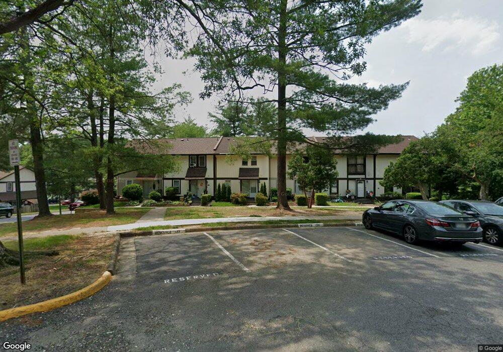
This home is located at 5456 Crossrail Dr, Burke, VA 22015 and is currently estimated at $533,757, approximately $444 per square foot. 5456 Crossrail Dr is a home located in Fairfax County with nearby schools including Kings Park Elementary School, Kings Glen Elementary School, and Lake Braddock Secondary School.
Ownership History
Date
Name
Owned For
Owner Type
Purchase Details
Closed on
Jul 8, 2008
Sold by
Kim Kyung
Bought by
Diaz Hector M and Jaimes,Maria L
Current Estimated Value
Home Financials for this Owner
Home Financials are based on the most recent Mortgage that was taken out on this home.
Original Mortgage
$294,380
Outstanding Balance
$190,490
Interest Rate
6.13%
Mortgage Type
FHA
Estimated Equity
$343,267
Purchase Details
Closed on
May 8, 2003
Sold by
Zhou Shuntai
Bought by
Kim Hee
Home Financials for this Owner
Home Financials are based on the most recent Mortgage that was taken out on this home.
Original Mortgage
$184,000
Interest Rate
5.93%
Mortgage Type
New Conventional
Purchase Details
Closed on
May 26, 2000
Sold by
Haider M Wali
Bought by
Zhou Shantai
Home Financials for this Owner
Home Financials are based on the most recent Mortgage that was taken out on this home.
Original Mortgage
$101,600
Interest Rate
8.1%
Create a Home Valuation Report for This Property
The Home Valuation Report is an in-depth analysis detailing your home's value as well as a comparison with similar homes in the area
Home Values in the Area
Average Home Value in this Area
Purchase History
| Date | Buyer | Sale Price | Title Company |
|---|---|---|---|
| Diaz Hector M | $299,000 | -- | |
| Kim Hee | $204,000 | -- | |
| Zhou Shantai | $127,000 | -- |
Source: Public Records
Mortgage History
| Date | Status | Borrower | Loan Amount |
|---|---|---|---|
| Open | Diaz Hector M | $294,380 | |
| Previous Owner | Kim Hee | $184,000 | |
| Previous Owner | Zhou Shantai | $101,600 |
Source: Public Records
Tax History Compared to Growth
Tax History
| Year | Tax Paid | Tax Assessment Tax Assessment Total Assessment is a certain percentage of the fair market value that is determined by local assessors to be the total taxable value of land and additions on the property. | Land | Improvement |
|---|---|---|---|---|
| 2025 | $5,229 | $512,530 | $200,000 | $312,530 |
| 2024 | $5,229 | $451,330 | $170,000 | $281,330 |
| 2023 | $4,904 | $434,590 | $170,000 | $264,590 |
| 2022 | $4,663 | $407,760 | $150,000 | $257,760 |
| 2021 | $4,590 | $391,180 | $140,000 | $251,180 |
| 2020 | $4,321 | $365,120 | $138,000 | $227,120 |
| 2019 | $3,897 | $329,260 | $115,000 | $214,260 |
| 2018 | $3,786 | $329,260 | $115,000 | $214,260 |
| 2017 | $3,686 | $317,490 | $105,000 | $212,490 |
| 2016 | $3,514 | $303,290 | $95,000 | $208,290 |
| 2015 | $3,321 | $297,610 | $95,000 | $202,610 |
| 2014 | $3,314 | $297,610 | $95,000 | $202,610 |
Source: Public Records
Map
Nearby Homes
- 9710 Ashbourn Dr
- 9769 High Water Ct
- 5307 Richardson Dr
- 5711 Crownleigh Ct
- 9662 Westport Ln
- 9513 Burdett Rd
- 9909 Lakepointe Dr
- 5658 Sutherland Ct
- 5714 Mason Bluff Dr
- 9438 Wallingford Dr
- 5137 Richardson Dr
- 5361 Gainsborough Dr
- 5502 Saddlebrook Ct
- 5432 Brixham Ct
- 5313 Stonington Dr
- 9717 Commonwealth Blvd
- 5838 High Bluff Ct
- 5504 Winford Ct
- 5431 Crows Nest Ct
- 5608 Doolittle St
- 5454 Crossrail Dr
- 5458 Crossrail Dr
- 5452 Crossrail Dr
- 5460 Crossrail Dr
- 5450 Crossrail Dr
- 5448 Crossrail Dr
- 5533 Peppercorn Dr
- 5446 Crossrail Dr
- 5444 Crossrail Dr
- 5535 Peppercorn Dr
- 5442 Crossrail Dr
- 5537 Peppercorn Dr
- 5520 Peppercorn Dr
- 5518 Peppercorn Dr
- 5522 Peppercorn Dr
- 5524 Peppercorn Dr
- 5516 Peppercorn Dr
- 5514 Peppercorn Dr
- 5526 Peppercorn Dr
- 5512 Peppercorn Dr