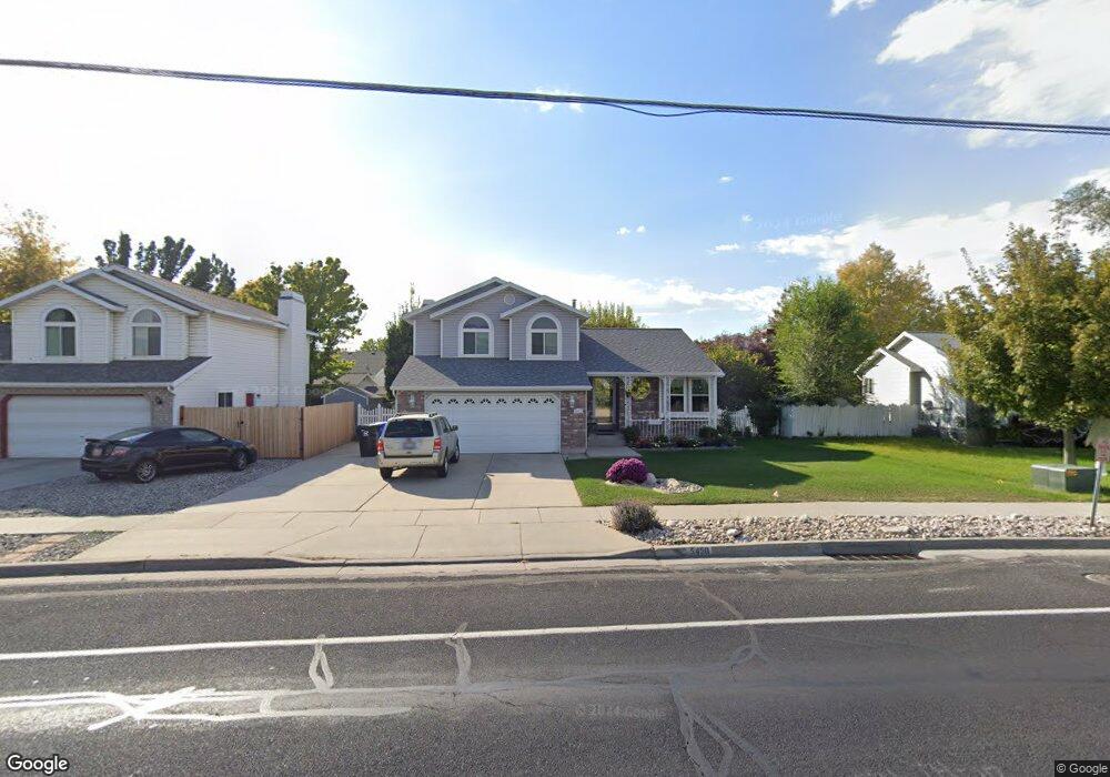
5458 S 1300 W Salt Lake City, UT 84123
Estimated Value: $535,000 - $592,000
4
Beds
4
Baths
1,549
Sq Ft
$359/Sq Ft
Est. Value
About This Home
This home is located at 5458 S 1300 W, Salt Lake City, UT 84123 and is currently estimated at $555,805, approximately $358 per square foot. 5458 S 1300 W is a home located in Salt Lake County with nearby schools including Plymouth Elementary School, Eisenhower Jr High School, and Taylorsville High School.
Ownership History
Date
Name
Owned For
Owner Type
Purchase Details
Closed on
Sep 11, 2002
Sold by
Spiker Chere Lynn
Bought by
Spiker Chere Lyn and Chere Lynne Spiker Living Trust
Current Estimated Value
Home Financials for this Owner
Home Financials are based on the most recent Mortgage that was taken out on this home.
Original Mortgage
$60,900
Interest Rate
5.78%
Mortgage Type
Purchase Money Mortgage
Purchase Details
Closed on
Mar 9, 1998
Sold by
Spiker Chere Lynne
Bought by
Spiker Chere Lynne
Create a Home Valuation Report for This Property
The Home Valuation Report is an in-depth analysis detailing your home's value as well as a comparison with similar homes in the area
Home Values in the Area
Average Home Value in this Area
Purchase History
| Date | Buyer | Sale Price | Title Company |
|---|---|---|---|
| Spiker Chere Lyn | -- | First American Title | |
| Spiker Chere Lynn | -- | First American Title | |
| Spiker Chere Lynne | -- | -- |
Source: Public Records
Mortgage History
| Date | Status | Borrower | Loan Amount |
|---|---|---|---|
| Closed | Spiker Chere Lynn | $60,900 |
Source: Public Records
Tax History Compared to Growth
Tax History
| Year | Tax Paid | Tax Assessment Tax Assessment Total Assessment is a certain percentage of the fair market value that is determined by local assessors to be the total taxable value of land and additions on the property. | Land | Improvement |
|---|---|---|---|---|
| 2025 | $252 | $508,000 | $130,700 | $377,300 |
| 2024 | $252 | $501,600 | $133,200 | $368,400 |
| 2023 | $371 | $451,900 | $124,500 | $327,400 |
| 2022 | $371 | $460,300 | $122,100 | $338,200 |
| 2021 | $192 | $349,600 | $93,900 | $255,700 |
| 2020 | $2,290 | $306,300 | $86,400 | $219,900 |
| 2019 | $148 | $301,400 | $86,400 | $215,000 |
| 2018 | $247 | $272,400 | $83,600 | $188,800 |
| 2017 | $161 | $254,800 | $83,600 | $171,200 |
| 2016 | $197 | $234,400 | $83,600 | $150,800 |
| 2015 | $179 | $216,800 | $85,200 | $131,600 |
| 2014 | -- | $203,900 | $81,200 | $122,700 |
Source: Public Records
Map
Nearby Homes
- 1334 Portside Way Unit 165
- 1273 W Brister Dr
- 5435 S Break Water Dr
- 1380 W Ocean Ct
- 1443 W Spinnaker Row Unit 96
- 5449 S Coastal Ct
- 1381 Beacon Hill Dr
- 1401 Beacon Hill Dr Unit 118
- 5920 S 1300 W
- 903 W Bullion St
- 913 W Bullion St Unit 10
- 5020 S 1250 W
- Sargent Plan at The Gallery at Bullion - Single Family Homes
- Gomez Plan at The Gallery at Bullion - Single Family Homes
- Dexter Plan at The Gallery at Bullion - Single Family Homes
- Hirst 2 Plan at The Gallery at Bullion - Townhomes
- Caro 2 Plan at The Gallery at Bullion - Townhomes
- 944 W Bellshill Dr
- 937 Coalburn Way Unit 102
- 931 Coalburn Way Unit 102
- 5466 S 1300 W
- 5466 S Canal St
- 5466 S Canal St
- 5448 S Canal St
- 5448 S 1300 W
- 5461 S Crossbow Cir
- 5455 Crossbow Cir
- 5461 Crossbow Cir
- 5475 S Crossbow Cir
- 5475 Crossbow Cir
- 5476 S 1300 W
- 5476 S Canal St
- 5436 S 1300 W
- 5447 Crossbow Cir
- 5479 Crossbow Cir
- 1338 W 5550 S
- 5428 S 1300 W
- 1326 W 5550 S
- 5446 S Crossbow Cir
- 5446 Crossbow Cir