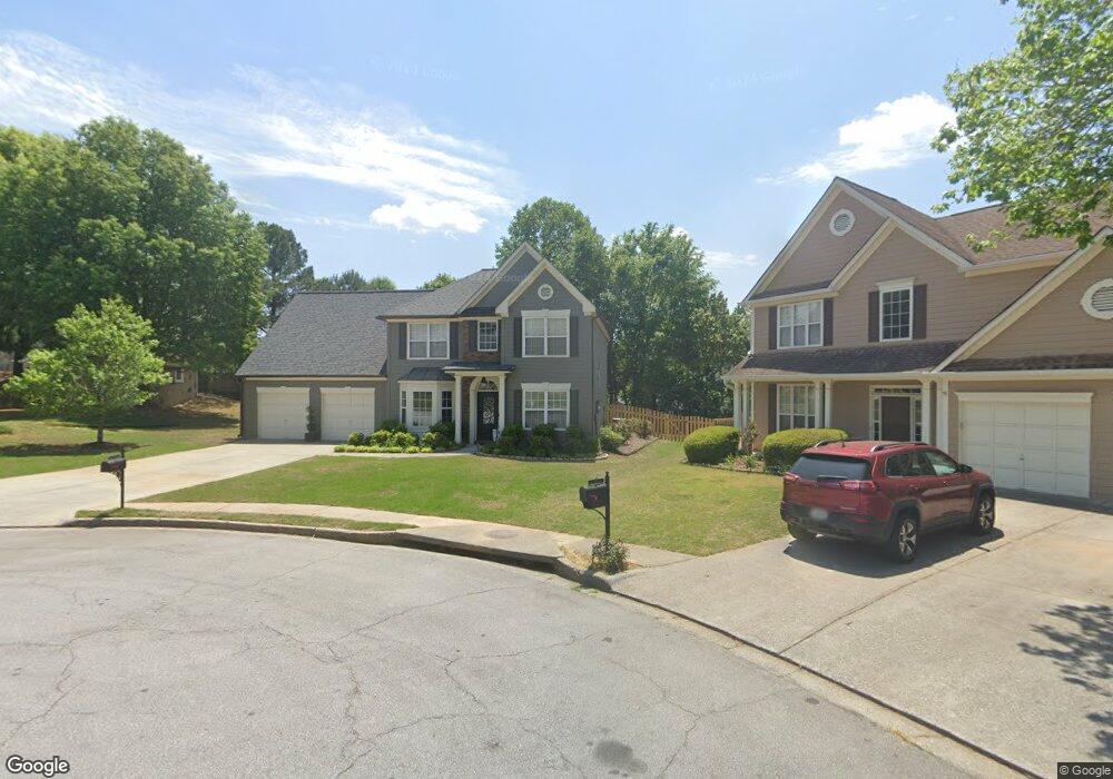
546 Broad Head Point Unit 3 Suwanee, GA 30024
Estimated Value: $472,000 - $524,000
3
Beds
3
Baths
2,243
Sq Ft
$219/Sq Ft
Est. Value
About This Home
This home is located at 546 Broad Head Point Unit 3, Suwanee, GA 30024 and is currently estimated at $491,502, approximately $219 per square foot. 546 Broad Head Point Unit 3 is a home located in Gwinnett County with nearby schools including Riverside Elementary School, North Gwinnett Middle School, and North Gwinnett High School.
Ownership History
Date
Name
Owned For
Owner Type
Purchase Details
Closed on
May 30, 2001
Sold by
Hart Michael S and Hart Paula E
Bought by
Wiggins Jeffrey B and Wiggins Whitney L
Current Estimated Value
Home Financials for this Owner
Home Financials are based on the most recent Mortgage that was taken out on this home.
Original Mortgage
$156,817
Outstanding Balance
$58,325
Interest Rate
7.14%
Mortgage Type
FHA
Estimated Equity
$433,177
Purchase Details
Closed on
Aug 16, 1996
Sold by
Torrey S G Atlanta Ltd
Bought by
Hart Michael S Paula E
Create a Home Valuation Report for This Property
The Home Valuation Report is an in-depth analysis detailing your home's value as well as a comparison with similar homes in the area
Home Values in the Area
Average Home Value in this Area
Purchase History
| Date | Buyer | Sale Price | Title Company |
|---|---|---|---|
| Wiggins Jeffrey B | $164,500 | -- | |
| Hart Michael S Paula E | $140,000 | -- |
Source: Public Records
Mortgage History
| Date | Status | Borrower | Loan Amount |
|---|---|---|---|
| Open | Wiggins Jeffrey B | $156,817 | |
| Closed | Hart Michael S Paula E | $0 |
Source: Public Records
Map
Nearby Homes
- 542 Staghorn Ln
- 570 White Stag Ct
- 412 Antler Ln
- 5395 Harbury Ln
- 972 Harvest Park Ln
- 510 Running Fawn Dr
- 585 Settles Brook Ct
- 535 Running Fawn Dr
- 5295 Antler Ct Unit 1
- 5428 Glencastle Way
- 3681 Trevi Ln
- 5232 Tormeall Trace
- 5013 Briar Rose Ct
- 811 Woodvale Point
- 600 Grimsby Ct
- 5135 Amberden Hall Dr
- 243 Wedmore Ct
- 751 Woodvale Point
- 5224 Brendlynn Dr
- 262 Sandhurst Ct
- 556 Broad Head Point
- 536 Broad Head Point
- 536 Broad Head Point Unit 311
- 555 White Stag Ct
- 555 White Stag Ct
- 545 White Stag Ct Unit 3
- 575 White Stag Ct Unit 3
- 595 White Stag Ct
- 605 White Stag Ct
- 553 Broad Head Point Unit 3
- 535 White Stag Ct
- 526 Broad Head Point
- 523 Broad Head Point
- 543 Broad Head Point
- 525 White Stag Ct
- 615 White Stag Ct
- 562 Staghorn Ln
- 540 White Stag Ct Unit 3
- 550 White Stag Ct
- 552 Staghorn Ln
Your Personal Tour Guide
Ask me questions while you tour the home.