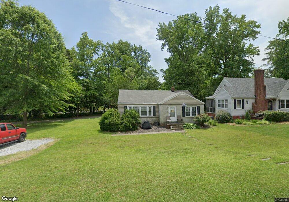
546 E Farriss Ave High Point, NC 27262
Greater High Point NeighborhoodEstimated Value: $150,000 - $194,000
3
Beds
1
Bath
1,368
Sq Ft
$125/Sq Ft
Est. Value
About This Home
This home is located at 546 E Farriss Ave, High Point, NC 27262 and is currently estimated at $171,553, approximately $125 per square foot. 546 E Farriss Ave is a home located in Guilford County with nearby schools including Kirkman Park Elementary School, Penn-Griffin School for the Arts, and T.W. Andrews High School.
Ownership History
Date
Name
Owned For
Owner Type
Purchase Details
Closed on
Jul 8, 2022
Sold by
Dwight Steed Jennings and Dwight Carolyn L
Bought by
Empire Cash Offer Llc
Current Estimated Value
Purchase Details
Closed on
Jul 1, 2022
Sold by
Empire Cash Offer Llc
Bought by
Tran Linda and Nguyen Frank Hung
Purchase Details
Closed on
Jan 19, 2007
Sold by
Steed Jennings Dwight and Steed Carolyn L
Bought by
City Of High Point
Purchase Details
Closed on
Jan 11, 2007
Sold by
City Of High Point
Bought by
High Point University
Purchase Details
Closed on
Sep 13, 2002
Sold by
Cloyd Kathryn R
Bought by
Steed James Dwight and Steed Carolyn L
Home Financials for this Owner
Home Financials are based on the most recent Mortgage that was taken out on this home.
Original Mortgage
$68,400
Interest Rate
5.5%
Create a Home Valuation Report for This Property
The Home Valuation Report is an in-depth analysis detailing your home's value as well as a comparison with similar homes in the area
Home Values in the Area
Average Home Value in this Area
Purchase History
| Date | Buyer | Sale Price | Title Company |
|---|---|---|---|
| Empire Cash Offer Llc | $85,000 | None Listed On Document | |
| Tran Linda | $127,000 | None Listed On Document | |
| City Of High Point | -- | None Available | |
| High Point University | $750 | None Available | |
| High Point University | $2,000 | None Available | |
| Steed James Dwight | $76,000 | -- |
Source: Public Records
Mortgage History
| Date | Status | Borrower | Loan Amount |
|---|---|---|---|
| Previous Owner | Steed James Dwight | $68,400 |
Source: Public Records
Tax History
| Year | Tax Paid | Tax Assessment Tax Assessment Total Assessment is a certain percentage of the fair market value that is determined by local assessors to be the total taxable value of land and additions on the property. | Land | Improvement |
|---|---|---|---|---|
| 2025 | $1,484 | $107,700 | $30,000 | $77,700 |
| 2024 | $1,484 | $101,900 | $30,000 | $71,900 |
| 2023 | $1,484 | $101,900 | $30,000 | $71,900 |
| 2022 | $1,452 | $107,700 | $30,000 | $77,700 |
| 2021 | $1,127 | $81,800 | $22,000 | $59,800 |
| 2020 | $1,127 | $81,800 | $22,000 | $59,800 |
| 2019 | $1,127 | $81,800 | $0 | $0 |
| 2018 | $1,122 | $81,800 | $0 | $0 |
| 2017 | $1,122 | $81,800 | $0 | $0 |
| 2016 | $1,149 | $81,900 | $0 | $0 |
| 2015 | $1,155 | $81,900 | $0 | $0 |
| 2014 | $1,174 | $81,900 | $0 | $0 |
Source: Public Records
Map
Nearby Homes
- 721 Forrest St
- 719 Forrest St
- 702 E Farriss Ave
- 916 Forrest St
- 511 E Farriss Ave
- 304 Louise Ave
- 910 E Dayton Ave
- 1108 Forrest St
- 1310 Madison St
- 1110 Forrest St
- 905 Mint Ave
- 837 Willow Place
- 1428 Futrelle Dr
- 844 Willow Place
- 613 Woodridge Ln
- 1433 Larkin St
- 1507 Larkin St
- 513 Saunders Place Unit A & B
- 1602 Larkin St
- 511 Saunders Place Unit A & B
- 544 E Farriss Ave
- 542 E Farriss Ave
- 727 Forrest St
- 547 E Farriss Ave
- 540 E Farriss Ave
- 723 Forrest St
- 720 Brookside Dr
- 811 Putnam St
- 538 E Farriss Ave
- 545 E Farriss Ave
- 543 E Farriss Ave
- 536 E Farriss Ave
- 541 E Farriss Ave
- 808 Putnam St
- 726 Forrest St
- 728 Forrest St
- 718 Brookside Dr
- 724 Forrest St
- 730 Forrest St
- 810 Putnam St
Your Personal Tour Guide
Ask me questions while you tour the home.