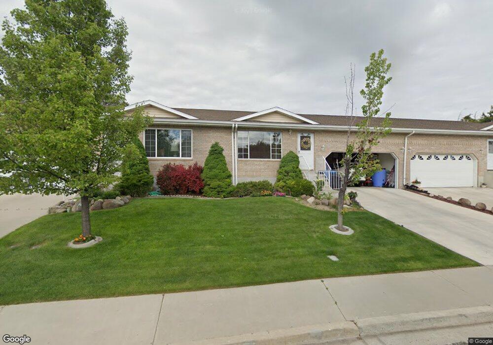
546 Goosenest Dr Unit B Payson, UT 84651
Estimated Value: $327,000 - $518,000
3
Beds
2
Baths
2,320
Sq Ft
$174/Sq Ft
Est. Value
About This Home
This home is located at 546 Goosenest Dr Unit B, Payson, UT 84651 and is currently estimated at $402,641, approximately $173 per square foot. 546 Goosenest Dr Unit B is a home located in Utah County with nearby schools including Mt. Loafer Elementary School, Salem Junior High School, and Valley View Middle School.
Ownership History
Date
Name
Owned For
Owner Type
Purchase Details
Closed on
Jul 29, 2024
Sold by
Taylor Richard A
Bought by
Richard A Taylor Family Trust and Taylor
Current Estimated Value
Purchase Details
Closed on
Nov 15, 2019
Sold by
Phillips Lorna L
Bought by
Taylor Richard A
Home Financials for this Owner
Home Financials are based on the most recent Mortgage that was taken out on this home.
Original Mortgage
$259,350
Interest Rate
3.65%
Mortgage Type
New Conventional
Purchase Details
Closed on
Mar 12, 2013
Sold by
Perkins Ingrid P and The Pohlsander Family Living T
Bought by
Phillips Lorna L
Home Financials for this Owner
Home Financials are based on the most recent Mortgage that was taken out on this home.
Original Mortgage
$70,000
Interest Rate
3.53%
Mortgage Type
New Conventional
Create a Home Valuation Report for This Property
The Home Valuation Report is an in-depth analysis detailing your home's value as well as a comparison with similar homes in the area
Home Values in the Area
Average Home Value in this Area
Purchase History
| Date | Buyer | Sale Price | Title Company |
|---|---|---|---|
| Richard A Taylor Family Trust | -- | None Listed On Document | |
| Taylor Richard A | -- | Gt Title Svcs Spanish Fork | |
| Phillips Lorna L | -- | Absolute Title Agency |
Source: Public Records
Mortgage History
| Date | Status | Borrower | Loan Amount |
|---|---|---|---|
| Previous Owner | Taylor Richard A | $259,350 | |
| Previous Owner | Phillips Lorna L | $70,000 |
Source: Public Records
Tax History Compared to Growth
Tax History
| Year | Tax Paid | Tax Assessment Tax Assessment Total Assessment is a certain percentage of the fair market value that is determined by local assessors to be the total taxable value of land and additions on the property. | Land | Improvement |
|---|---|---|---|---|
| 2025 | $1,954 | $203,995 | $54,500 | $316,400 |
| 2024 | $1,954 | $198,825 | $0 | $0 |
| 2023 | $1,786 | $182,270 | $0 | $0 |
| 2022 | $1,404 | $140,965 | $0 | $0 |
| 2021 | $1,273 | $204,900 | $30,700 | $174,200 |
| 2020 | $1,301 | $204,900 | $30,700 | $174,200 |
| 2019 | $1,189 | $192,000 | $25,000 | $167,000 |
| 2018 | $1,122 | $174,600 | $21,000 | $153,600 |
| 2017 | $997 | $83,490 | $0 | $0 |
| 2016 | $913 | $75,900 | $0 | $0 |
| 2015 | $866 | $71,500 | $0 | $0 |
| 2014 | $778 | $64,680 | $0 | $0 |
Source: Public Records
Map
Nearby Homes
- 660 S Goosenest Dr
- 876 E 400 S
- 430 Ridge Ln
- 753 N Emery Ln Unit 57
- 678 N Mountain View Dr
- 552 E Longview Dr Unit 29
- 350 E Meadow Lark Ln Unit 9
- 1000 S Goosenest Dr W
- 643 E Longview Dr Unit 8
- 942 W Wilcock Cove
- 4100 W 12400 S
- 761 N Birch Ln Unit 64
- 554 E Salem Hills Dr S Unit 2
- 61 S Lighthouse Cir Unit 14
- 627 E Birch N Unit 68
- 1287 S 500 E Unit 134
- 1352 N 1440 E Unit 21
- 526 E Sophie Cir Unit 1
- 700 S Hillside Dr E
- 792 N Mountain Dr
- 546 Goosenest Dr Unit C
- 546 Goosenest Dr
- 546 Goosenest Dr
- 546 S Goosenest Dr Unit A
- 546 S Goosenest Dr
- 1591 N Arrow Park Dr
- 520 Goosenest Dr
- 540 Goosenest Dr
- 520 S Goosenest Dr
- 540 S Goosenest Dr
- 562 S Goosenest Dr
- 562 Goosenest Dr
- 564 S Goosenest Dr
- 564 Goosenest Dr
- 564 Goosenest Dr
- 510 Goosenest Dr
- 566 S Goosenest Dr Unit 7
- 698 Ridge Ln
- 509 Ridge Ln
- 568 Goosenest Dr