Estimated Value: $521,000 - $668,000
6
Beds
4
Baths
3,232
Sq Ft
$187/Sq Ft
Est. Value
About This Home
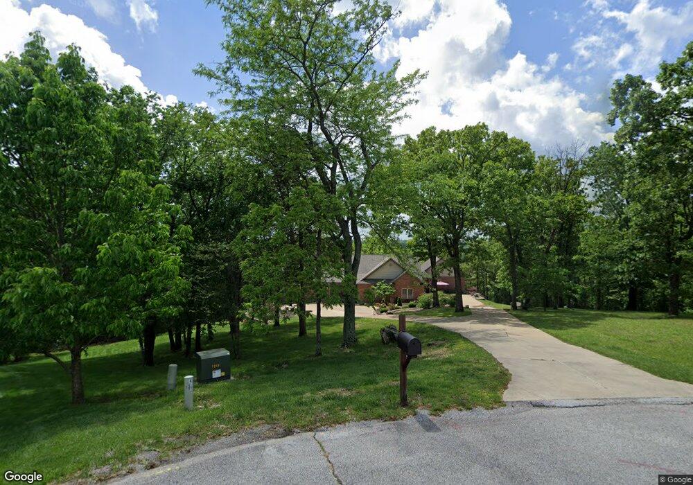
This home is located at 546 Honeysuckle Ln, Union, MO 63084 and is currently estimated at $603,286, approximately $186 per square foot. 546 Honeysuckle Ln is a home located in Franklin County with nearby schools including Union High School and Immaculate Conception School.
Ownership History
Date
Name
Owned For
Owner Type
Purchase Details
Closed on
Oct 24, 2011
Sold by
Federal National Mortgage Association
Bought by
Elliott Robert D and Elliott Lisa J
Current Estimated Value
Home Financials for this Owner
Home Financials are based on the most recent Mortgage that was taken out on this home.
Original Mortgage
$324,425
Outstanding Balance
$30,746
Interest Rate
4.14%
Mortgage Type
New Conventional
Estimated Equity
$572,540
Purchase Details
Closed on
Oct 14, 2010
Sold by
Eckstein Joseph M and Eckstein Julie R
Bought by
Federal National Mortgage Association
Create a Home Valuation Report for This Property
The Home Valuation Report is an in-depth analysis detailing your home's value as well as a comparison with similar homes in the area
Home Values in the Area
Average Home Value in this Area
Purchase History
| Date | Buyer | Sale Price | Title Company |
|---|---|---|---|
| Elliott Robert D | -- | None Available | |
| Federal National Mortgage Association | $338,850 | None Available |
Source: Public Records
Mortgage History
| Date | Status | Borrower | Loan Amount |
|---|---|---|---|
| Open | Elliott Robert D | $324,425 |
Source: Public Records
Tax History Compared to Growth
Tax History
| Year | Tax Paid | Tax Assessment Tax Assessment Total Assessment is a certain percentage of the fair market value that is determined by local assessors to be the total taxable value of land and additions on the property. | Land | Improvement |
|---|---|---|---|---|
| 2024 | $4,216 | $78,990 | $0 | $0 |
| 2023 | $4,216 | $78,990 | $0 | $0 |
| 2022 | $4,825 | $90,187 | $0 | $0 |
| 2021 | $4,834 | $90,187 | $0 | $0 |
| 2020 | $4,429 | $81,440 | $0 | $0 |
| 2019 | $4,416 | $81,440 | $0 | $0 |
| 2018 | $3,808 | $74,436 | $0 | $0 |
| 2017 | $3,823 | $74,436 | $0 | $0 |
| 2016 | $3,684 | $69,901 | $0 | $0 |
| 2015 | $3,619 | $69,901 | $0 | $0 |
| 2014 | $3,666 | $70,501 | $0 | $0 |
Source: Public Records
Map
Nearby Homes
- 7048 Koko Beach Rd
- 0 Koko Beach Rd
- 0 Lot 5 Clearview Dr Unit 19010510
- 0 Lot 4 Clearview Dr Unit 19010507
- 0 Lot 6 Clearview Dr Unit 19010511
- 0 Clearview Unit 19010495
- 2 White Pine Ct
- 402 Gruber Ave
- 408 Macarthur Ave
- 1103 W Main St
- 7 Bertha Ln
- 613 S Jefferson Ave
- 105 Old Farm Estates Rd
- 613 W State St
- 507 S Oak St
- 762 Crider Ln
- 1980 Judith Springs Rd
- 101 Hickory Cir
- 89 Hickory Cir
- 204 Wally Ave
- 540 Honeysuckle Ln
- 535 Honeysuckle Ln
- 528 Honeysuckle Ln
- 524 Honeysuckle Ln
- 511 Honeysuckle Ln
- 496 Honeysuckle Ln
- 22 Ridgepoint Meadows Ct (Lot 10)
- 22 Ridgepoint Meadows Ct
- 7060 Koko Beach Rd
- 920 Clearview Dr
- 7056 Koko Beach Rd
- 18 Ridgepoint Meadows Ct (Lot 11)
- 18 Ridgepoint Meadows Ct
- 14 Ridgepoint Meadows Ct (Lot 12) Ct
- 14 Ridgepoint Meadows Ct
- 14 Ridgepoint Meadows Ct
- 0 Lot 10 Koko Beach Rd Unit 80028069
- 0 Koko Beach Unit 13015776
- 0 Koko Beach Unit 13061507
- 0 Koko Beach Unit 15018518