Estimated Value: $122,000 - $189,000
--
Bed
--
Bath
1,345
Sq Ft
$113/Sq Ft
Est. Value
About This Home
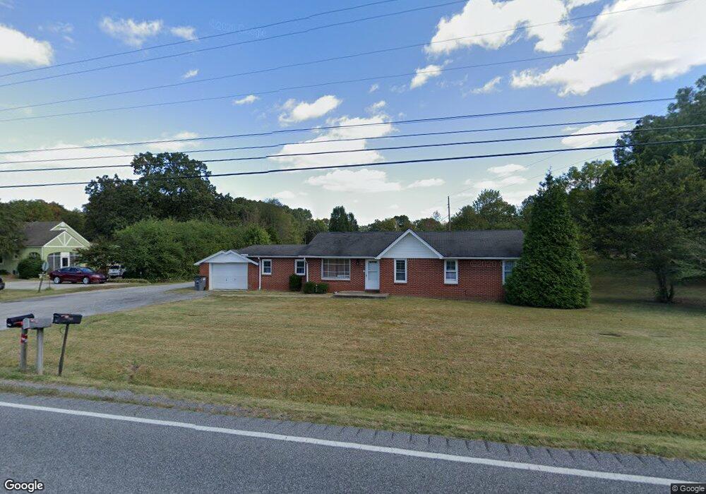
This home is located at 546 Radio Rd, Almo, KY 42020 and is currently estimated at $151,834, approximately $112 per square foot. 546 Radio Rd is a home located in Calloway County with nearby schools including North Calloway Elementary School, Calloway County Middle School, and Calloway County High School.
Ownership History
Date
Name
Owned For
Owner Type
Purchase Details
Closed on
Nov 30, 2023
Sold by
Amberg John B and Amberg Amy E
Bought by
Brady Jerry L and Brady Carolyn M
Current Estimated Value
Purchase Details
Closed on
Mar 24, 2022
Sold by
Rosemary Miller
Bought by
Amberg John B and Amberg Amy E
Purchase Details
Closed on
Dec 13, 2018
Sold by
Miller Rosemary
Bought by
Amberg John B and Amberg Amy E
Home Financials for this Owner
Home Financials are based on the most recent Mortgage that was taken out on this home.
Original Mortgage
$70,550
Interest Rate
4.8%
Mortgage Type
Commercial
Purchase Details
Closed on
Jun 1, 2009
Sold by
Schueler Harry R and Schueler Dona M
Bought by
Miller Tommy
Create a Home Valuation Report for This Property
The Home Valuation Report is an in-depth analysis detailing your home's value as well as a comparison with similar homes in the area
Home Values in the Area
Average Home Value in this Area
Purchase History
| Date | Buyer | Sale Price | Title Company |
|---|---|---|---|
| Brady Jerry L | $28,000 | None Listed On Document | |
| Amberg John B | $20,000 | Hopkins Warren K | |
| Amberg John B | $20,000 | None Listed On Document | |
| Amberg John B | $83,000 | None Available | |
| Miller Tommy | $52,000 | None Available |
Source: Public Records
Mortgage History
| Date | Status | Borrower | Loan Amount |
|---|---|---|---|
| Previous Owner | Amberg John B | $70,550 |
Source: Public Records
Tax History Compared to Growth
Tax History
| Year | Tax Paid | Tax Assessment Tax Assessment Total Assessment is a certain percentage of the fair market value that is determined by local assessors to be the total taxable value of land and additions on the property. | Land | Improvement |
|---|---|---|---|---|
| 2024 | $753 | $83,000 | $0 | $0 |
| 2023 | $775 | $83,000 | $0 | $0 |
| 2022 | $789 | $83,000 | $0 | $0 |
| 2021 | $804 | $83,000 | $0 | $0 |
| 2020 | $792 | $83,000 | $0 | $0 |
| 2019 | $761 | $83,000 | $0 | $0 |
| 2018 | $755 | $85,000 | $0 | $0 |
| 2017 | $734 | $85,000 | $0 | $0 |
| 2016 | $726 | $85,000 | $0 | $0 |
| 2015 | $409 | $52,000 | $0 | $0 |
| 2011 | $409 | $52,000 | $0 | $0 |
Source: Public Records
Map
Nearby Homes
- 1515 Boggess Dr
- 000 North Dr
- 206 Metcalf Ln
- 1783 Radio Rd
- 202 John Purdom Dr
- 1536 Almo Rd
- 0 U S 641 N
- Lot 17 Jordyn Bailey Rd
- 445 John Purdom Dr
- 0000 Brinn Rd
- 2809 W Fork Rd
- 363 Grant Rd
- 000 Spring Rd
- 1087 Poor Farm Rd
- 00 N 16th St
- 00 Streetland Ln
- Lot# 32 Hunters Glen Unit Hunters Pointe
- 0 N State Route 121 Unit 133802
- Lot# 74 Cornwall Dr Unit Hunters Pointe
- Lot 47 Dock Dr