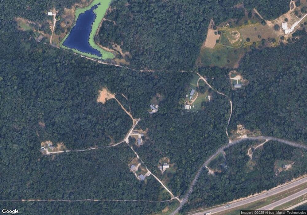
546 Tag A Long Rd Saint Clair, MO 63077
Estimated Value: $131,000 - $273,615
2
Beds
1
Bath
1,404
Sq Ft
$144/Sq Ft
Est. Value
About This Home
This home is located at 546 Tag A Long Rd, Saint Clair, MO 63077 and is currently estimated at $202,308, approximately $144 per square foot. 546 Tag A Long Rd is a home located in Franklin County with nearby schools including St. Clair Elementary School, Edgar Murray Elementary School, and St. Clair Junior High School.
Ownership History
Date
Name
Owned For
Owner Type
Purchase Details
Closed on
Feb 23, 2007
Sold by
Gass Lorraine
Bought by
Powers Kent L
Current Estimated Value
Home Financials for this Owner
Home Financials are based on the most recent Mortgage that was taken out on this home.
Original Mortgage
$137,344
Outstanding Balance
$82,309
Interest Rate
6.17%
Mortgage Type
Purchase Money Mortgage
Estimated Equity
$119,999
Create a Home Valuation Report for This Property
The Home Valuation Report is an in-depth analysis detailing your home's value as well as a comparison with similar homes in the area
Home Values in the Area
Average Home Value in this Area
Purchase History
| Date | Buyer | Sale Price | Title Company |
|---|---|---|---|
| Powers Kent L | -- | None Available |
Source: Public Records
Mortgage History
| Date | Status | Borrower | Loan Amount |
|---|---|---|---|
| Open | Powers Kent L | $137,344 |
Source: Public Records
Tax History Compared to Growth
Tax History
| Year | Tax Paid | Tax Assessment Tax Assessment Total Assessment is a certain percentage of the fair market value that is determined by local assessors to be the total taxable value of land and additions on the property. | Land | Improvement |
|---|---|---|---|---|
| 2024 | $880 | $16,146 | $0 | $0 |
| 2023 | $880 | $16,146 | $0 | $0 |
| 2022 | $775 | $14,162 | $0 | $0 |
| 2021 | $773 | $14,162 | $0 | $0 |
| 2020 | $823 | $14,447 | $0 | $0 |
| 2019 | $815 | $14,447 | $0 | $0 |
| 2018 | $779 | $13,632 | $0 | $0 |
| 2017 | $758 | $13,273 | $0 | $0 |
| 2016 | $749 | $13,098 | $0 | $0 |
| 2015 | $688 | $13,098 | $0 | $0 |
| 2014 | $730 | $13,879 | $0 | $0 |
Source: Public Records
Map
Nearby Homes
- 1615 N Service Rd W
- 0 St Clair Station Ln Unit MIS25068128
- 0 Peacock Rd
- 1921 W Springfield Rd
- 1305 Fox Run Ln
- 887 Hagen Dr
- 1502 Redwood Dr
- 0 Oakwood Dr
- 509 Lake Shore Dr
- 202 Steamboat Springs Rd
- Lot 35,36,37 Countryaire Dr
- 0 Perkins Rd Unit MIS25042480
- 205 Harmony Hills Rd
- 612 Perkins Rd
- 1000 S Lay Ave
- 436 Quiet Valley Ct
- 5 Lots Mosley Ave
- 208 Mosley Ave
- 0 Kingsley Dr
- 000 Westwood Rd
- 554 Tag A Long Rd
- 559 Family Rd
- 584 Tag A Long Rd
- 565 Family Rd
- 577 Tag A Long Rd
- 560 Family Rd
- 1630 N Service Rd W
- 557 Tag A Long Rd
- 1610 N Service Rd W
- 210 Wildwood Estates Ln
- 468 Family Rd
- 1600 N Service Rd W
- 481 Family Rd
- 1750 S Service Rd
- 264 Wildwood Estates Ln
- 0 Wildwood Estates Unit 18005610
- 0 Wildwood Estate Ln Unit 12021754
- 0 Wildwood Estates Unit 17018252
- 0 Wildwood Estates Unit 17026855
- 392 Wildwood Estates Ln
