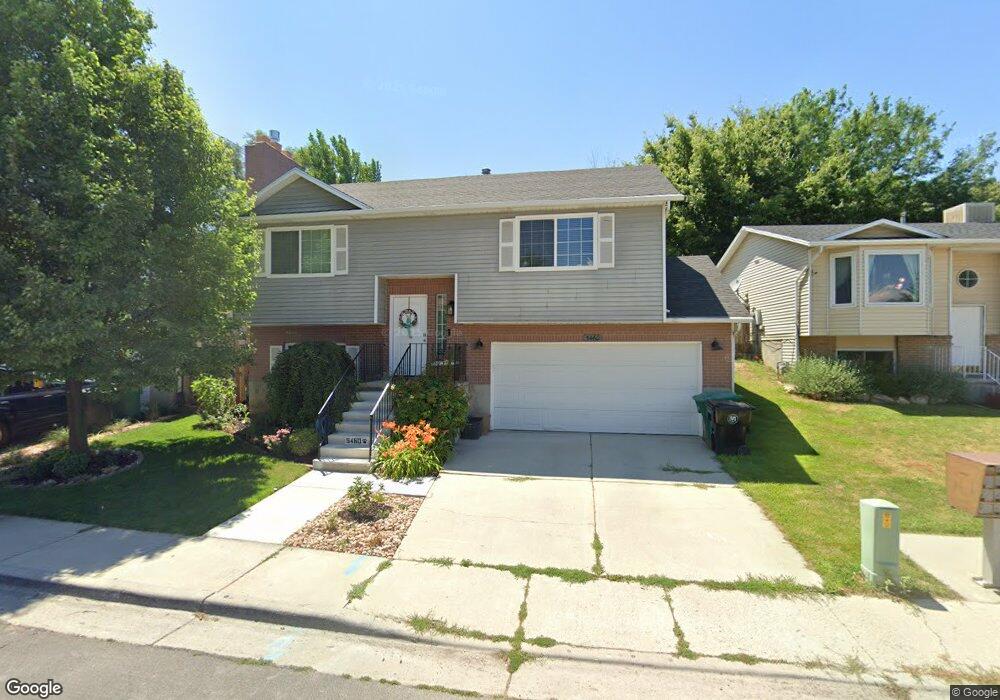
5460 S Brandonwood Dr Salt Lake City, UT 84123
Estimated Value: $466,000 - $518,000
3
Beds
2
Baths
1,506
Sq Ft
$328/Sq Ft
Est. Value
About This Home
This home is located at 5460 S Brandonwood Dr, Salt Lake City, UT 84123 and is currently estimated at $494,225, approximately $328 per square foot. 5460 S Brandonwood Dr is a home located in Salt Lake County with nearby schools including Viewmont Elementary School, Riverview Junior High School, and Murray High School.
Ownership History
Date
Name
Owned For
Owner Type
Purchase Details
Closed on
Aug 18, 2023
Sold by
Schroeder Tobias
Bought by
Hardink Karen and Hardink Diane
Current Estimated Value
Purchase Details
Closed on
Sep 29, 2017
Sold by
Pace Joanna Lee
Bought by
Schroeder Tobias
Home Financials for this Owner
Home Financials are based on the most recent Mortgage that was taken out on this home.
Original Mortgage
$272,964
Interest Rate
3.89%
Mortgage Type
FHA
Purchase Details
Closed on
Jun 25, 2009
Sold by
Smart Robert A and Smart Lynleah C
Bought by
Pace Joanna Lee
Home Financials for this Owner
Home Financials are based on the most recent Mortgage that was taken out on this home.
Original Mortgage
$73,000
Interest Rate
4.87%
Mortgage Type
Purchase Money Mortgage
Purchase Details
Closed on
Mar 19, 2003
Sold by
Citimortgage Inc
Bought by
Hud
Purchase Details
Closed on
Feb 27, 2003
Sold by
Castro Edie Evaristo and Herrera Campos Ana J
Bought by
Citimortgage Inc
Purchase Details
Closed on
Aug 18, 2000
Sold by
Smith Andrew A
Bought by
Castro Edie Evaristo and Herrera Campos Ana J
Home Financials for this Owner
Home Financials are based on the most recent Mortgage that was taken out on this home.
Original Mortgage
$138,340
Interest Rate
8.16%
Mortgage Type
FHA
Purchase Details
Closed on
Jun 29, 1995
Sold by
Wing Carlton and Wing Leigh S
Bought by
Smith Andrew A
Home Financials for this Owner
Home Financials are based on the most recent Mortgage that was taken out on this home.
Original Mortgage
$98,000
Interest Rate
7.88%
Mortgage Type
Purchase Money Mortgage
Purchase Details
Closed on
Nov 15, 1993
Sold by
Rice Jeffery James
Bought by
Wing Carlton and Wing Leigh S
Home Financials for this Owner
Home Financials are based on the most recent Mortgage that was taken out on this home.
Original Mortgage
$95,069
Interest Rate
6.88%
Mortgage Type
FHA
Create a Home Valuation Report for This Property
The Home Valuation Report is an in-depth analysis detailing your home's value as well as a comparison with similar homes in the area
Home Values in the Area
Average Home Value in this Area
Purchase History
| Date | Buyer | Sale Price | Title Company |
|---|---|---|---|
| Hardink Karen | -- | First American Title Insurance | |
| Schroeder Tobias | -- | Title One | |
| Pace Joanna Lee | -- | First American Title | |
| Hud | -- | -- | |
| Citimortgage Inc | $157,456 | -- | |
| Castro Edie Evaristo | -- | Deer Creek Title Insurance I | |
| Smith Andrew A | -- | -- | |
| Wing Carlton | -- | Backman Stewart Title Servic |
Source: Public Records
Mortgage History
| Date | Status | Borrower | Loan Amount |
|---|---|---|---|
| Previous Owner | Schroeder Tobias | $272,964 | |
| Previous Owner | Pace Joanna Lee | $73,000 | |
| Previous Owner | Castro Edie Evaristo | $138,340 | |
| Previous Owner | Smith Andrew A | $98,000 | |
| Previous Owner | Wing Carlton | $95,069 |
Source: Public Records
Tax History Compared to Growth
Tax History
| Year | Tax Paid | Tax Assessment Tax Assessment Total Assessment is a certain percentage of the fair market value that is determined by local assessors to be the total taxable value of land and additions on the property. | Land | Improvement |
|---|---|---|---|---|
| 2025 | $1,066 | $479,500 | $127,400 | $352,100 |
| 2024 | $1,066 | $458,200 | $122,100 | $336,100 |
| 2023 | $1,066 | $438,200 | $119,600 | $318,600 |
| 2022 | $2,215 | $447,400 | $117,300 | $330,100 |
| 2021 | $1,831 | $326,100 | $97,800 | $228,300 |
| 2020 | $1,794 | $302,300 | $66,500 | $235,800 |
| 2019 | $1,791 | $291,700 | $66,500 | $225,200 |
| 2018 | $1,564 | $259,800 | $61,100 | $198,700 |
| 2017 | $1,432 | $239,900 | $61,100 | $178,800 |
| 2016 | $1,300 | $210,300 | $61,100 | $149,200 |
| 2015 | $1,412 | $207,400 | $62,300 | $145,100 |
| 2014 | $1,280 | $186,500 | $56,400 | $130,100 |
Source: Public Records
Map
Nearby Homes
- 1273 W Brister Dr
- 1334 Portside Way Unit 165
- 1332 W Ocean Ct
- 1380 W Ocean Ct
- 1178 W Brandonwood Dr
- 1370 W Telegraph Hill Dr
- 1381 Beacon Hill Dr
- 1401 Beacon Hill Dr Unit 118
- 5449 S Coastal Ct
- Sargent Plan at The Gallery at Bullion - Single Family Homes
- Dexter Plan at The Gallery at Bullion - Single Family Homes
- Gomez Plan at The Gallery at Bullion - Single Family Homes
- Caro 2 Plan at The Gallery at Bullion - Townhomes
- Hirst 2 Plan at The Gallery at Bullion - Townhomes
- 903 W Bullion St
- 913 W Bullion St Unit 10
- 937 Coalburn Way Unit 102
- 931 Coalburn Way Unit 102
- 924 Coalburn Way Unit 8-26
- 923 Coalburn Way Unit 103
- 5460 Brandonwood Dr
- 5470 Brandonwood Dr
- 5470 S Brandonwood Dr
- 5452 S Brandonwood Dr
- 5452 Brandonwood Dr
- 5444 Brandonwood Dr
- 5478 Brandonwood Dr
- 1254 Brister Dr
- 1257 Brandonwood Dr
- 1257 W Brandonwood Dr
- 1249 Brandonwood Dr
- 1248 Brister Dr
- 5438 S Brandonwood Dr
- 5438 Brandonwood Dr
- 1273 Brandonwood Dr
- 1269 Brister Dr
- 1270 Brandonwood Dr
- 1269 W Brister Dr
- 1263 Brister Dr
- 1263 W Brister Dr