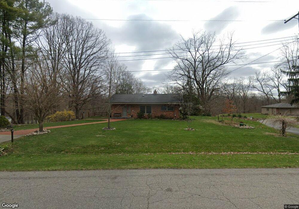
5461 Howe St Shelby Township, MI 48317
Estimated Value: $255,000 - $335,000
--
Bed
2
Baths
902
Sq Ft
$336/Sq Ft
Est. Value
About This Home
This home is located at 5461 Howe St, Shelby Township, MI 48317 and is currently estimated at $303,172, approximately $336 per square foot. 5461 Howe St is a home located in Macomb County with nearby schools including Roberts Elementary School, Eppler Junior High School, and Utica High School.
Ownership History
Date
Name
Owned For
Owner Type
Purchase Details
Closed on
Nov 2, 2020
Sold by
Mcdonald Kathleen M and Macdonald Daniel
Bought by
Macdonald Kathleen M and Macdonald Kathleen M
Current Estimated Value
Purchase Details
Closed on
Apr 4, 2008
Sold by
Macdonald Kathleen M and Macdonald Daniel F
Bought by
Macdonald Daniel F and Macdonald Kathleen M
Home Financials for this Owner
Home Financials are based on the most recent Mortgage that was taken out on this home.
Original Mortgage
$172,000
Interest Rate
6.09%
Mortgage Type
New Conventional
Purchase Details
Closed on
May 16, 2005
Sold by
Minarik Robert C and Payne Timothy R
Bought by
Fleury Kathleen M and Macdonald Daniel F
Purchase Details
Closed on
Aug 28, 2000
Sold by
Josephine M Nedwick
Bought by
Robert C Minarik
Create a Home Valuation Report for This Property
The Home Valuation Report is an in-depth analysis detailing your home's value as well as a comparison with similar homes in the area
Home Values in the Area
Average Home Value in this Area
Purchase History
| Date | Buyer | Sale Price | Title Company |
|---|---|---|---|
| Macdonald Kathleen M | -- | None Available | |
| Macdonald Daniel F | -- | Homeowners Title Agency | |
| Fleury Kathleen M | $210,000 | Multiple | |
| Robert C Minarik | $182,000 | -- |
Source: Public Records
Mortgage History
| Date | Status | Borrower | Loan Amount |
|---|---|---|---|
| Closed | Macdonald Daniel F | $172,000 |
Source: Public Records
Tax History Compared to Growth
Tax History
| Year | Tax Paid | Tax Assessment Tax Assessment Total Assessment is a certain percentage of the fair market value that is determined by local assessors to be the total taxable value of land and additions on the property. | Land | Improvement |
|---|---|---|---|---|
| 2025 | $2,233 | $151,700 | $0 | $0 |
| 2024 | $2,126 | $134,900 | $0 | $0 |
| 2023 | $1,252 | $125,500 | $0 | $0 |
| 2022 | $1,192 | $118,800 | $0 | $0 |
| 2021 | $1,964 | $114,000 | $0 | $0 |
| 2020 | $1,152 | $104,800 | $0 | $0 |
| 2019 | $1,798 | $89,300 | $0 | $0 |
| 2018 | $1,763 | $86,800 | $0 | $0 |
| 2017 | $1,744 | $77,100 | $36,100 | $41,000 |
| 2016 | $1,732 | $77,100 | $0 | $0 |
| 2015 | $1,707 | $67,550 | $0 | $0 |
| 2012 | -- | $0 | $0 | $0 |
Source: Public Records
Map
Nearby Homes
- 47103 Ladd Ave
- 47414 Winthrop St
- 47341 Kennesaw Ridge
- 6525 Little Turkey Run
- 47425 Jeffry
- 46955 Shiloh Way
- 48342 Lake Valley Dr
- 5720 Hearst Rd
- 47760 Shelby Rd
- 6936 Ryburn St
- 47595 Frederick Rd
- 47141 Greenview Rd
- 47840 Greenview Rd
- 45300 Manor Dr
- 48212 Cardinal St
- 4899 Green Ct Unit 22
- 4907 Green Ct
- 45277 Universal Ct
- 7547 Sylvan St
- 3733 Christie Ln