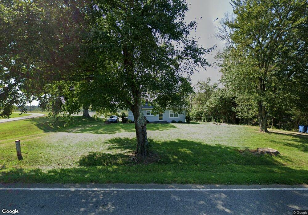
5461 W Nc 10 Hwy Hickory, NC 28602
South Hickory NeighborhoodEstimated Value: $131,000 - $216,000
3
Beds
1
Bath
1,008
Sq Ft
$176/Sq Ft
Est. Value
About This Home
This home is located at 5461 W Nc 10 Hwy, Hickory, NC 28602 and is currently estimated at $177,266, approximately $175 per square foot. 5461 W Nc 10 Hwy is a home located in Catawba County with nearby schools including Fred T. Foard High School, Blackburn Elementary School, and Jacobs Fork Middle School.
Ownership History
Date
Name
Owned For
Owner Type
Purchase Details
Closed on
Jan 9, 2024
Sold by
Harwell John Monroe and Harwell Peggy Cornelius
Bought by
John Monroe Harwell And Peggy Cornelius Harwe and Harwell
Current Estimated Value
Purchase Details
Closed on
Jun 5, 2017
Sold by
Ogle Robert L and Ogle Susan S
Bought by
Harwell John Monroe and Harwell Peggy C
Create a Home Valuation Report for This Property
The Home Valuation Report is an in-depth analysis detailing your home's value as well as a comparison with similar homes in the area
Home Values in the Area
Average Home Value in this Area
Purchase History
| Date | Buyer | Sale Price | Title Company |
|---|---|---|---|
| John Monroe Harwell And Peggy Cornelius Harwe | -- | None Listed On Document | |
| John Monroe Harwell And Peggy Cornelius Harwe | -- | None Listed On Document | |
| Harwell John Monroe | -- | None Available | |
| Harwell John Monroe | $50,000 | None Available |
Source: Public Records
Tax History Compared to Growth
Tax History
| Year | Tax Paid | Tax Assessment Tax Assessment Total Assessment is a certain percentage of the fair market value that is determined by local assessors to be the total taxable value of land and additions on the property. | Land | Improvement |
|---|---|---|---|---|
| 2025 | $636 | $139,000 | $11,500 | $127,500 |
| 2024 | $636 | $139,000 | $11,500 | $127,500 |
| 2023 | $636 | $58,700 | $11,500 | $47,200 |
| 2022 | $383 | $58,700 | $11,500 | $47,200 |
| 2021 | $374 | $58,700 | $11,500 | $47,200 |
| 2020 | $374 | $58,700 | $11,500 | $47,200 |
| 2019 | $374 | $58,700 | $0 | $0 |
| 2018 | $392 | $61,600 | $11,100 | $50,500 |
| 2017 | $392 | $0 | $0 | $0 |
| 2016 | $392 | $0 | $0 | $0 |
| 2015 | $375 | $61,590 | $11,100 | $50,490 |
| 2014 | $375 | $63,400 | $11,100 | $52,300 |
Source: Public Records
Map
Nearby Homes
- 3368 Plateau Rd
- 5780 W Nc 10 Hwy
- 5933 Willowbottom Rd
- 2114 Finger Bridge Rd
- 6161 Willowbottom Rd
- 4149 River Run Cir
- 4175 River Run Cir
- 4176 River Run Cir
- 1160 Mulberry Ln
- 1420 Windemere Ln
- 1438 Windemere Ln
- 6314 Providence Church Rd
- 1 ACRE Jacobs Fork None
- 2423 Lewis Rd
- 6044 Heavner Rd
- 6042 Heavner Rd
- 1301 Shadowfax Wynd None Unit 51
- 3340 Wrenwood Dr
- 3425 Zion Church Rd
- 4146 Old State Rd
- 5435 W Nc 10 Hwy
- 5485 W Nc 10 Hwy
- 5489 W Nc 10 Hwy
- 5509 W Nc 10 Hwy
- 5521 W Nc 10 Hwy
- 5454 W Nc 10 Hwy
- 5535 W Nc 10 Hwy
- 5452 W Nc 10 Hwy
- 5545 W Nc 10 Hwy
- 5398 W Nc 10 Hwy
- 5552 W Nc 10 Hwy
- 5563 W Nc 10 Hwy
- 5693 Whitener Rd
- 5469 W Nc 10 Hwy
- 5648 W Nc 10 Hwy
- 5706 Whitener Rd
- 2303 Ewing Dr
- 0000 W Hwy 10
- 5665 Whitener Rd
- 2284 Ewing Dr