Estimated Value: $329,000 - $344,000
3
Beds
2
Baths
1,727
Sq Ft
$195/Sq Ft
Est. Value
About This Home
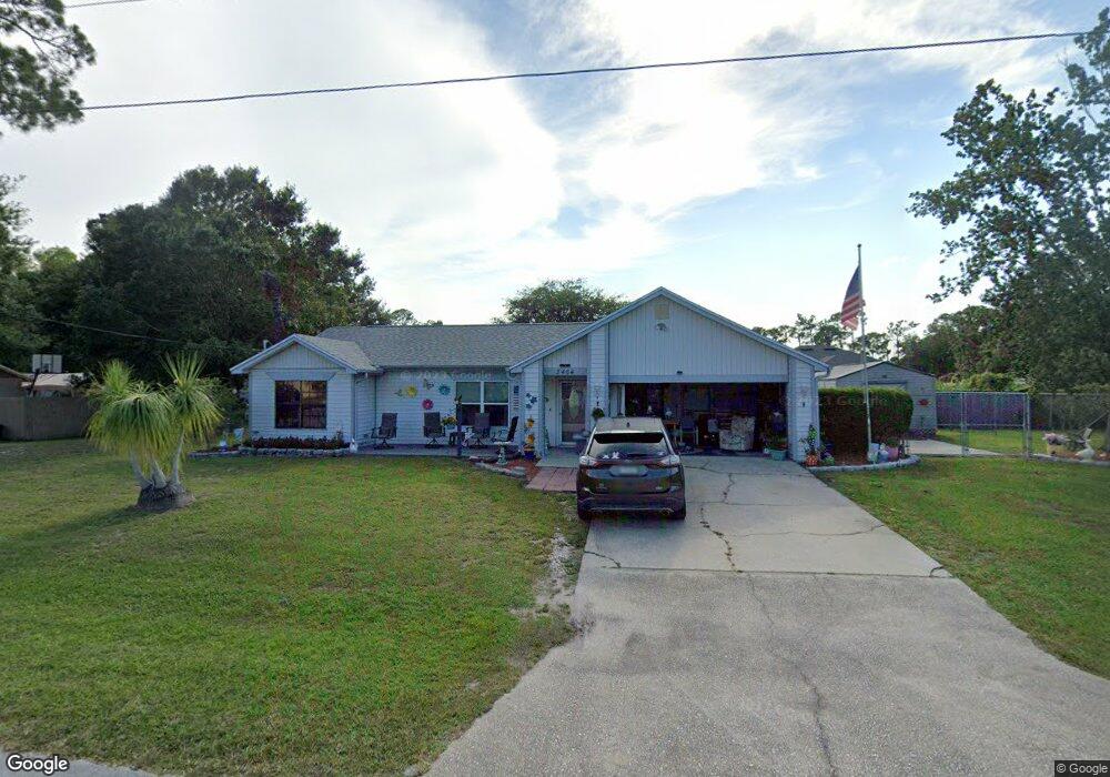
This home is located at 5464 Flint Rd, Cocoa, FL 32927 and is currently estimated at $336,758, approximately $194 per square foot. 5464 Flint Rd is a home located in Brevard County with nearby schools including Enterprise Elementary School, Space Coast Junior/Senior High School, and East Atlantic Prep of Brevard County.
Ownership History
Date
Name
Owned For
Owner Type
Purchase Details
Closed on
May 11, 2018
Sold by
Hatcher Michael K
Bought by
Hatcher Michael K and Adams Carol
Current Estimated Value
Home Financials for this Owner
Home Financials are based on the most recent Mortgage that was taken out on this home.
Original Mortgage
$13,500
Outstanding Balance
$11,624
Interest Rate
4.4%
Estimated Equity
$325,134
Purchase Details
Closed on
Jan 16, 2001
Sold by
Hintz Todd J and Hintz Cynthia F
Bought by
Hatcher Michael K
Home Financials for this Owner
Home Financials are based on the most recent Mortgage that was taken out on this home.
Original Mortgage
$79,800
Interest Rate
7.53%
Mortgage Type
Purchase Money Mortgage
Create a Home Valuation Report for This Property
The Home Valuation Report is an in-depth analysis detailing your home's value as well as a comparison with similar homes in the area
Home Values in the Area
Average Home Value in this Area
Purchase History
| Date | Buyer | Sale Price | Title Company |
|---|---|---|---|
| Hatcher Michael K | $54,000 | Attorney | |
| Hatcher Michael K | $99,800 | -- |
Source: Public Records
Mortgage History
| Date | Status | Borrower | Loan Amount |
|---|---|---|---|
| Open | Hatcher Michael K | $13,500 | |
| Previous Owner | Hatcher Michael K | $79,800 |
Source: Public Records
Tax History
| Year | Tax Paid | Tax Assessment Tax Assessment Total Assessment is a certain percentage of the fair market value that is determined by local assessors to be the total taxable value of land and additions on the property. | Land | Improvement |
|---|---|---|---|---|
| 2025 | $1,480 | $108,380 | -- | -- |
| 2024 | $1,443 | $105,330 | -- | -- |
| 2023 | $1,443 | $102,270 | -- | -- |
| 2022 | $1,345 | $99,300 | $0 | $0 |
| 2021 | $1,344 | $96,410 | $0 | $0 |
| 2020 | $1,281 | $95,080 | $0 | $0 |
| 2019 | $1,217 | $92,950 | $0 | $0 |
| 2018 | $1,089 | $83,030 | $0 | $0 |
| 2017 | $1,079 | $81,330 | $0 | $0 |
| 2016 | $1,077 | $79,660 | $27,000 | $52,660 |
| 2015 | $1,086 | $79,110 | $22,500 | $56,610 |
| 2014 | $1,085 | $78,490 | $16,500 | $61,990 |
Source: Public Records
Map
Nearby Homes
- 6438 Hudson Rd
- 6450 Ember Ave
- 6481 La Brea Ave
- 5601 Banos Ave
- 5680 Banos Ave
- 5220 Holden Rd
- 6615 Dock Ave
- 5215 Holden Rd
- 00 Unknown
- 6581 Bancroft Ave
- 5715 Fairbridge St
- 5221 Carrick Rd
- 6398 Cable Ave
- 5720 Flint Rd
- 6020 Cannon Ave
- 6760 Cairo Rd
- 6375 Cable Ave
- 5946 Deer Ln
- 5945 Coker Ave
- 6094 Cardiff Ave
- 5480 Flint Rd
- 5456 Flint Rd
- 6365 Gillette Ave
- 5473 Flint Rd
- 5481 Flint Rd
- 5488 Flint Rd
- 6395 Gillette Ave
- 5465 Flint Rd
- 5448 Flint Rd
- 5485 Flint Rd
- 5440 Flint Rd
- 6345 Gillette Ave
- 6405 Gillette Ave
- 6382 Fairchild Ave
- 6370 Gillette Ave
- 6380 Gillette Ave
- 5449 Flint Rd
- 6370 Fairchild Ave
- 5489 Flint Rd
- 6360 Gillette Ave
Your Personal Tour Guide
Ask me questions while you tour the home.