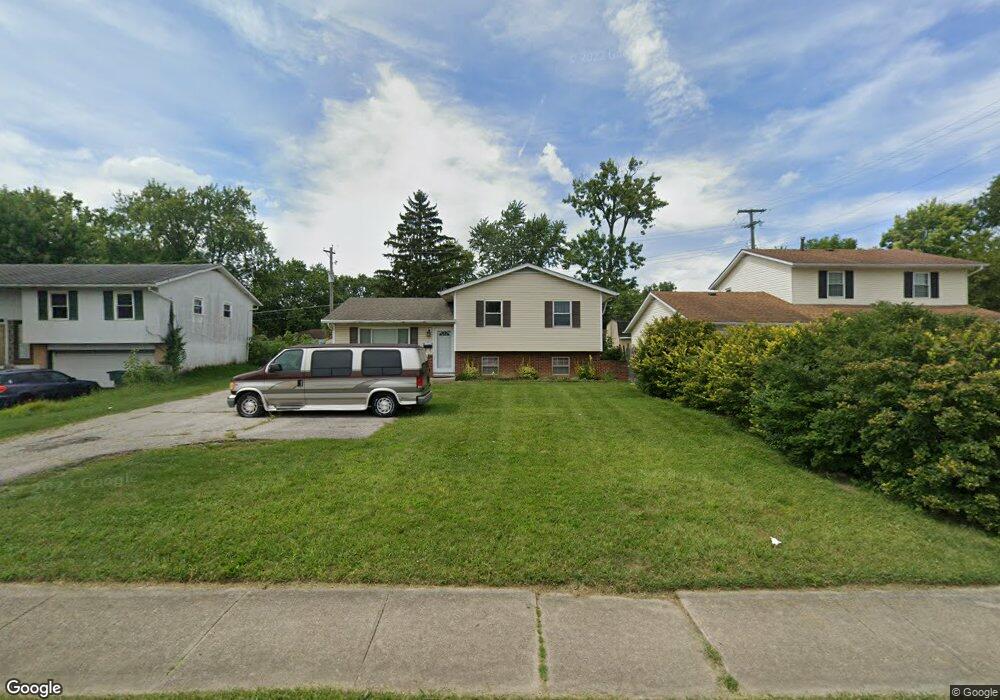
5465 Karl Rd Columbus, OH 43229
Forest Park West NeighborhoodEstimated Value: $257,000 - $285,000
3
Beds
2
Baths
1,504
Sq Ft
$181/Sq Ft
Est. Value
About This Home
This home is located at 5465 Karl Rd, Columbus, OH 43229 and is currently estimated at $271,754, approximately $180 per square foot. 5465 Karl Rd is a home located in Franklin County with nearby schools including Forest Park Elementary School, Woodward Park Middle School, and Northland High School.
Ownership History
Date
Name
Owned For
Owner Type
Purchase Details
Closed on
Nov 16, 2004
Sold by
Born Olma A and Born Donald E
Bought by
Ramirez Carlos L and Rodriguez Marifeli
Current Estimated Value
Home Financials for this Owner
Home Financials are based on the most recent Mortgage that was taken out on this home.
Original Mortgage
$110,000
Outstanding Balance
$54,857
Interest Rate
5.77%
Mortgage Type
Purchase Money Mortgage
Estimated Equity
$216,897
Purchase Details
Closed on
Aug 23, 1999
Sold by
Lehnert Victoria L
Bought by
Lehnert Victoria L and Born Olma A
Purchase Details
Closed on
Sep 29, 1974
Bought by
Lehnert Victoria L
Create a Home Valuation Report for This Property
The Home Valuation Report is an in-depth analysis detailing your home's value as well as a comparison with similar homes in the area
Home Values in the Area
Average Home Value in this Area
Purchase History
| Date | Buyer | Sale Price | Title Company |
|---|---|---|---|
| Ramirez Carlos L | $110,000 | Expedient | |
| Born Olma A | -- | Expedient | |
| Lehnert Victoria L | -- | -- | |
| Lehnert Victoria L | -- | -- |
Source: Public Records
Mortgage History
| Date | Status | Borrower | Loan Amount |
|---|---|---|---|
| Open | Ramirez Carlos L | $110,000 |
Source: Public Records
Tax History Compared to Growth
Tax History
| Year | Tax Paid | Tax Assessment Tax Assessment Total Assessment is a certain percentage of the fair market value that is determined by local assessors to be the total taxable value of land and additions on the property. | Land | Improvement |
|---|---|---|---|---|
| 2024 | $3,348 | $74,590 | $21,180 | $53,410 |
| 2023 | $3,305 | $74,585 | $21,175 | $53,410 |
| 2022 | $2,244 | $43,260 | $11,830 | $31,430 |
| 2021 | $2,248 | $43,260 | $11,830 | $31,430 |
| 2020 | $2,251 | $43,260 | $11,830 | $31,430 |
| 2019 | $2,047 | $33,740 | $9,450 | $24,290 |
| 2018 | $1,992 | $33,740 | $9,450 | $24,290 |
| 2017 | $2,092 | $33,740 | $9,450 | $24,290 |
| 2016 | $2,138 | $32,280 | $7,950 | $24,330 |
| 2015 | $1,941 | $32,280 | $7,950 | $24,330 |
| 2014 | $1,946 | $32,280 | $7,950 | $24,330 |
| 2013 | $1,011 | $33,985 | $8,365 | $25,620 |
Source: Public Records
Map
Nearby Homes
- 5409 Blue Ash Rd
- 1492 Cottonwood Dr
- 1722 Blue Ash Place
- 1687 Brookfield Square S
- 5485 Tamarack Blvd
- 1493 Boxwood Dr
- 1427 Boxwood Dr
- 1752 Pine Tree St S Unit H
- 1918 Torchwood Dr
- 1704 Riverbirch Dr
- 5740 Satinwood Dr
- 1914 Walden Dr
- 5480 Rockwood Ct Unit R1
- 5414 Vinewood Ct
- 1881 Brimfield Rd
- 1855 Northcliff Dr
- 5936 Endicott Rd
- 1390 E Dublin Granville Rd
- 5022 Sienna Ln
- 5462 Roche Dr
- 5473 Karl Rd
- 5457 Karl Rd
- 5449 Karl Rd
- 5481 Karl Rd
- 5472 Hazelwood Rd
- 5464 Hazelwood Rd
- 5480 Hazelwood Rd
- 5456 Hazelwood Rd
- 5488 Hazelwood Rd
- 5441 Karl Rd
- 5487 Karl Rd
- 5448 Hazelwood Rd
- 5496 Hazelwood Rd
- 5433 Karl Rd
- 5495 Karl Rd
- 5438 Hazelwood Rd
- 5504 Hazelwood Rd
- 5475 Hazelwood Rd
- 5425 Karl Rd
- 5467 Hazelwood Rd