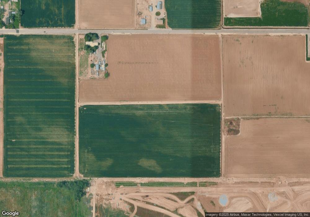
Estimated Value: $609,000 - $732,533
4
Beds
3
Baths
2,148
Sq Ft
$317/Sq Ft
Est. Value
About This Home
This home is located at 5465 Ustick Rd, Nampa, ID 83687 and is currently estimated at $680,883, approximately $316 per square foot. 5465 Ustick Rd is a home located in Canyon County with nearby schools including East Canyon Elementary School, Sage Valley Middle School, and Ridgevue High School.
Ownership History
Date
Name
Owned For
Owner Type
Purchase Details
Closed on
Mar 24, 2025
Sold by
Peterman Nampa Llc and Marietta Thompson Ira
Bought by
City Of Nampa
Current Estimated Value
Purchase Details
Closed on
Dec 22, 2022
Sold by
Jmb3 Charitable Remainder Trust
Bought by
Peterman Nampa Llc and Mountain West Ira Inc
Purchase Details
Closed on
Dec 8, 2022
Sold by
Geneva Mae Gafford Living Trust
Bought by
Peterman Nampa Llc and Mountain West Ira Inc
Purchase Details
Closed on
Sep 28, 2015
Sold by
Gafford Geneva Mae
Bought by
Gafford Geneva Mae and The Geneva Mae Gafford Living Trust
Create a Home Valuation Report for This Property
The Home Valuation Report is an in-depth analysis detailing your home's value as well as a comparison with similar homes in the area
Home Values in the Area
Average Home Value in this Area
Purchase History
| Date | Buyer | Sale Price | Title Company |
|---|---|---|---|
| City Of Nampa | -- | Pioneer Title | |
| Peterman Nampa Llc | -- | First American Title | |
| Peterman Nampa Llc | -- | First American Title | |
| Gafford Geneva Mae | -- | None Available |
Source: Public Records
Tax History Compared to Growth
Tax History
| Year | Tax Paid | Tax Assessment Tax Assessment Total Assessment is a certain percentage of the fair market value that is determined by local assessors to be the total taxable value of land and additions on the property. | Land | Improvement |
|---|---|---|---|---|
| 2025 | $3,295 | $649,610 | $280,510 | $369,100 |
| 2024 | $3,295 | $616,750 | $252,450 | $364,300 |
| 2023 | $3,465 | $619,850 | $252,450 | $367,400 |
| 2022 | $3,056 | $715,550 | $337,750 | $377,800 |
| 2021 | $3,243 | $520,280 | $219,880 | $300,400 |
| 2020 | $3,614 | $462,200 | $199,300 | $262,900 |
| 2019 | $3,882 | $447,190 | $179,990 | $267,200 |
| 2018 | $3,793 | $0 | $0 | $0 |
| 2017 | $3,638 | $0 | $0 | $0 |
| 2016 | $2,826 | $0 | $0 | $0 |
| 2015 | $2,594 | $0 | $0 | $0 |
| 2014 | $2,459 | $267,790 | $103,090 | $164,700 |
Source: Public Records
Map
Nearby Homes
- 5373 E Grizzly St
- 5289 E Grizzly St
- 5528 E Garby St Unit Lot 16 Block 7
- 5371 E Burnte Peak St
- 5357 E Burnte Peak St
- 5343 E Burnte Peak St
- 17759 N Peltzer Ave
- 5598 E Lekeitio Village Dr
- 5622 E Lekeitio Village Dr Unit Lot 4 Block 8
- 17394 N Sendoa Ave Unit Lot 9 Block 9
- 5586 Lekeitio Village Dr Unit Lot 7 Block 8
- 5550 Lekeitio Village Dr Unit Lot 10 Block 8
- 5562 Lekeitio Village Dr Unit Lot 9 Block 8
- 17703 N Peltzer Ave
- 5561 E Lekeitio Village Dr
- 5573 E Lekeitio Village Dr
- Collins Plan at Silver Star - Garden
- Maguire Plan at Silver Star - Woodland
- Lauren Plan at Silver Star - Garden
- Olivia Plan at Silver Star - Garden
- 8600 W Ustick Rd
- 8998 W Ustick Rd
- 5765 Ustick Rd
- 5793 Ustick Rd
- 4751 W Ustick Rd Unit A110
- 4751 W Ustick Rd Unit G114
- 4751 W Ustick Rd Unit G113
- 4751 W Ustick Rd Unit G125
- 4751 W Ustick Rd Unit G122
- 4751 W Ustick Rd Unit G123
- 4751 W Ustick Rd Unit G121
- 4751 W Ustick Rd Unit G124
- 4751 W Ustick Rd Unit G112
- 4751 W Ustick Rd Unit G120
- 4751 W Ustick Rd Unit G118
- 4751 W Ustick Rd Unit G117
- 4751 W Ustick Rd Unit G119
- 4751 W Ustick Rd Unit G110
- 4751 W Ustick Rd Unit G109
- 4751 W Ustick Rd Unit G111
