Estimated Value: $135,000 - $196,000
3
Beds
1
Bath
1,148
Sq Ft
$144/Sq Ft
Est. Value
About This Home
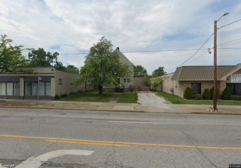
This home is located at 5467 State Rd, Parma, OH 44134 and is currently estimated at $164,785, approximately $143 per square foot. 5467 State Rd is a home located in Cuyahoga County with nearby schools including Thoreau Park Elementary School, Shiloh Middle School, and Normandy High School.
Ownership History
Date
Name
Owned For
Owner Type
Purchase Details
Closed on
Dec 15, 2022
Sold by
New Heights Property Group Llc
Bought by
New Heights Bg Llc
Current Estimated Value
Home Financials for this Owner
Home Financials are based on the most recent Mortgage that was taken out on this home.
Original Mortgage
$68,250
Outstanding Balance
$66,071
Interest Rate
6.61%
Mortgage Type
New Conventional
Estimated Equity
$98,714
Purchase Details
Closed on
Sep 28, 2022
Sold by
Zahler Joseph J and Zahler Joann
Bought by
New Heights Property Group Llc
Purchase Details
Closed on
Mar 25, 2021
Sold by
Stasuk Donald H
Bought by
Zahler Joseph J and Zahler Joann
Purchase Details
Closed on
Jan 1, 1975
Bought by
Stasuk Harry N
Create a Home Valuation Report for This Property
The Home Valuation Report is an in-depth analysis detailing your home's value as well as a comparison with similar homes in the area
Home Values in the Area
Average Home Value in this Area
Purchase History
| Date | Buyer | Sale Price | Title Company |
|---|---|---|---|
| New Heights Bg Llc | -- | Visionland Title Agency | |
| New Heights Property Group Llc | $80,000 | Visionland Title Agency | |
| Zahler Joseph J | $55,000 | City Title Company | |
| Stasuk Harry N | -- | -- |
Source: Public Records
Mortgage History
| Date | Status | Borrower | Loan Amount |
|---|---|---|---|
| Open | New Heights Bg Llc | $68,250 |
Source: Public Records
Tax History Compared to Growth
Tax History
| Year | Tax Paid | Tax Assessment Tax Assessment Total Assessment is a certain percentage of the fair market value that is determined by local assessors to be the total taxable value of land and additions on the property. | Land | Improvement |
|---|---|---|---|---|
| 2024 | $2,935 | $45,605 | $8,960 | $36,645 |
| 2023 | $2,722 | $36,610 | $9,800 | $26,810 |
| 2022 | $2,696 | $36,610 | $9,800 | $26,810 |
| 2021 | $2,714 | $36,610 | $9,800 | $26,810 |
| 2020 | $2,382 | $28,140 | $7,530 | $20,620 |
| 2019 | $2,277 | $80,400 | $21,500 | $58,900 |
| 2018 | $1,145 | $28,140 | $7,530 | $20,620 |
| 2017 | $2,091 | $23,770 | $5,080 | $18,690 |
| 2016 | $2,078 | $23,770 | $5,080 | $18,690 |
| 2015 | $1,962 | $23,770 | $5,080 | $18,690 |
| 2014 | $1,962 | $24,260 | $5,180 | $19,080 |
Source: Public Records
Map
Nearby Homes
- 5432 State Rd
- 3811 Theota Ave
- 3802 Russell Ave
- 3326 Grovewood Ave
- 4007 Tuxedo Ave
- 4000 Pershing Ave
- 4315 Woodway Ave
- 5240 State Rd
- 3018 Russell Ave
- 3910 Wood Ave
- 2922 Grovewood Ave
- 4607 Lincoln Ave
- 2918 North Ave
- 2619 Fortune Ave
- 5279 W 50th St
- 3000 Brookpark Rd Unit S15
- 3000 Brookpark Rd Unit R10
- 4011 Liggett Dr
- 3214 Liggett Dr
- 2503 Brookdale Ave
- 5462 State Rd
- 5476 State Rd
- 3708 Walter Ave
- 5454 State Rd
- 5478 State Rd
- 3712 Walter Ave
- 5486 State Rd
- 3716 Walter Ave
- 3720 Walter Ave
- 3709 Theota Ave
- 3711 Theota Ave
- 5490 State Rd
- 3455 Grovewood Ave
- 3802 Walter Ave
- 3715 Walter Ave
- 3715 Walter Ave
- 3801 Theota Ave
- 5434 State Rd
- 5489 State Rd
- 3443 Grovewood Ave