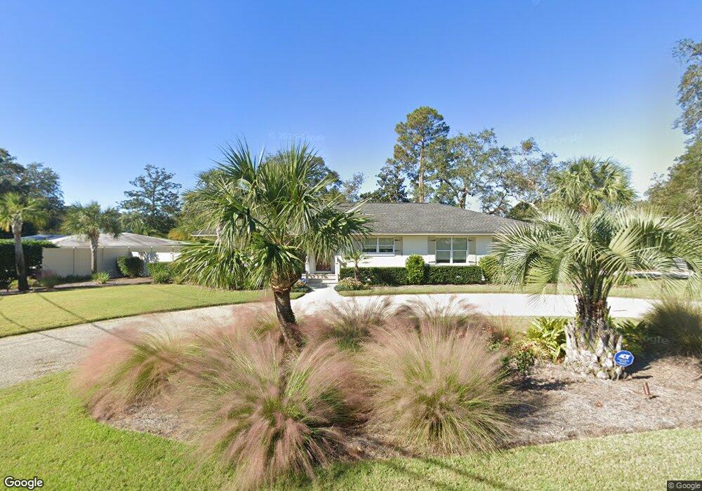
547 Bartow St Saint Simons Island, GA 31522
Estimated Value: $853,000 - $1,186,000
4
Beds
2
Baths
2,199
Sq Ft
$497/Sq Ft
Est. Value
About This Home
This home is located at 547 Bartow St, Saint Simons Island, GA 31522 and is currently estimated at $1,093,472, approximately $497 per square foot. 547 Bartow St is a home located in Glynn County with nearby schools including St. Simons Elementary School, Glynn Middle School, and Glynn Academy.
Ownership History
Date
Name
Owned For
Owner Type
Purchase Details
Closed on
Aug 7, 2017
Sold by
547 Bartow Llc
Bought by
Collins Bradley H
Current Estimated Value
Purchase Details
Closed on
Feb 21, 2017
Sold by
William L Estate
Bought by
547 Bartow Llc
Home Financials for this Owner
Home Financials are based on the most recent Mortgage that was taken out on this home.
Original Mortgage
$250,000
Interest Rate
4.19%
Mortgage Type
New Conventional
Create a Home Valuation Report for This Property
The Home Valuation Report is an in-depth analysis detailing your home's value as well as a comparison with similar homes in the area
Home Values in the Area
Average Home Value in this Area
Purchase History
| Date | Buyer | Sale Price | Title Company |
|---|---|---|---|
| Collins Bradley H | -- | -- | |
| Collins Bradley H | $350,000 | -- | |
| 547 Bartow Llc | -- | -- | |
| 547 Bartow Llc | $250,000 | -- |
Source: Public Records
Mortgage History
| Date | Status | Borrower | Loan Amount |
|---|---|---|---|
| Previous Owner | 547 Bartow Llc | $250,000 |
Source: Public Records
Tax History Compared to Growth
Tax History
| Year | Tax Paid | Tax Assessment Tax Assessment Total Assessment is a certain percentage of the fair market value that is determined by local assessors to be the total taxable value of land and additions on the property. | Land | Improvement |
|---|---|---|---|---|
| 2025 | $8,817 | $351,560 | $173,800 | $177,760 |
| 2024 | $8,814 | $351,440 | $173,800 | $177,640 |
| 2023 | $8,761 | $351,440 | $173,800 | $177,640 |
| 2022 | $7,040 | $275,720 | $131,400 | $144,320 |
| 2021 | $5,653 | $213,760 | $131,400 | $82,360 |
| 2020 | $5,706 | $213,760 | $131,400 | $82,360 |
| 2019 | $5,339 | $199,680 | $117,320 | $82,360 |
| 2018 | $3,780 | $140,000 | $104,000 | $36,000 |
| 2017 | $1,509 | $174,520 | $117,320 | $57,200 |
| 2016 | $1,410 | $123,040 | $53,200 | $69,840 |
| 2015 | $1,410 | $102,200 | $53,200 | $49,000 |
| 2014 | $1,410 | $102,200 | $53,200 | $49,000 |
Source: Public Records
Map
Nearby Homes
- 533 Timmons St
- 536 Delegal St
- 800 Mallery St Unit 52
- 800 Mallery St Unit 90
- 800 Mallery St Unit C-30
- 800 Mallery St Unit J-89
- 805 Mallery St Unit E
- 213 Magnolia Ave
- 30 Admirals Cove
- 125 Tiffany Ln
- 425 Magnolia Ave Unit C
- 413 Ashantilly Ave
- 1044 Village Oaks Ln
- 850 Mallery St Unit 8K
- 850 Mallery St Unit 6A
- 850 Mallery St Unit 4W
- 850 Mallery St Unit S 3
- 850 Mallery St Unit 4O
- 850 Mallery St Unit 13Q
- 850 Mallery St Unit 9W