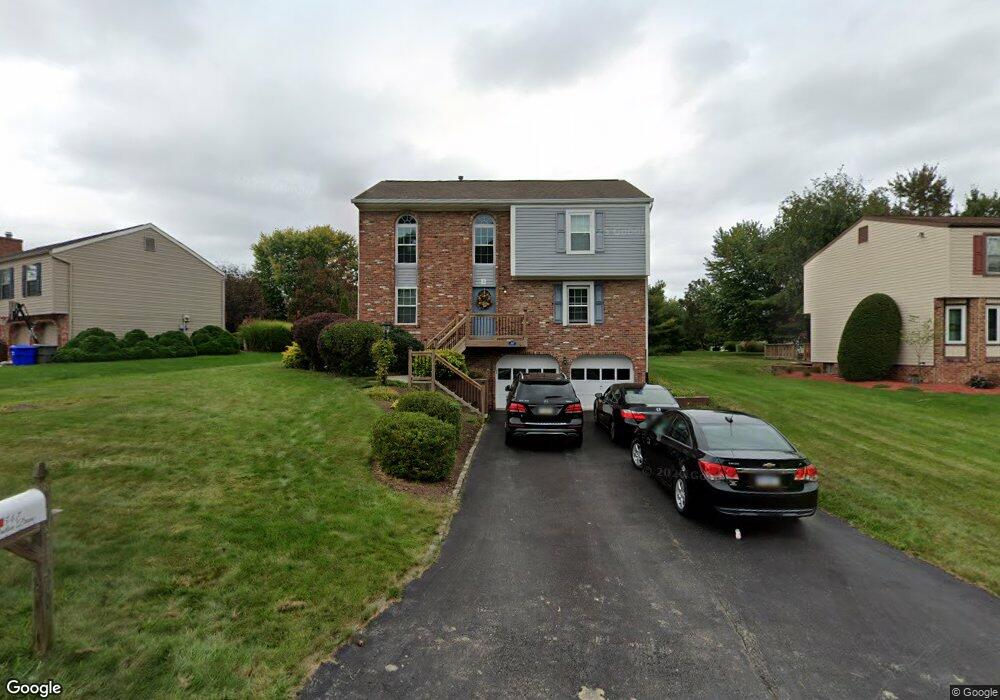
547 Bruton Dr Gibsonia, PA 15044
Estimated Value: $346,225 - $382,000
3
Beds
1
Bath
1,908
Sq Ft
$191/Sq Ft
Est. Value
About This Home
This home is located at 547 Bruton Dr, Gibsonia, PA 15044 and is currently estimated at $364,556, approximately $191 per square foot. 547 Bruton Dr is a home located in Allegheny County with nearby schools including Hance Elementary School, Eden Hall Upper Elementary, and Pine-Richland Middle School.
Ownership History
Date
Name
Owned For
Owner Type
Purchase Details
Closed on
Jun 13, 2005
Sold by
Severin Raymond
Bought by
Wuenschel Laurence
Current Estimated Value
Home Financials for this Owner
Home Financials are based on the most recent Mortgage that was taken out on this home.
Original Mortgage
$129,000
Outstanding Balance
$67,476
Interest Rate
5.79%
Mortgage Type
New Conventional
Estimated Equity
$297,080
Create a Home Valuation Report for This Property
The Home Valuation Report is an in-depth analysis detailing your home's value as well as a comparison with similar homes in the area
Home Values in the Area
Average Home Value in this Area
Purchase History
| Date | Buyer | Sale Price | Title Company |
|---|---|---|---|
| Wuenschel Laurence | $162,000 | -- |
Source: Public Records
Mortgage History
| Date | Status | Borrower | Loan Amount |
|---|---|---|---|
| Open | Wuenschel Laurence | $129,000 |
Source: Public Records
Tax History Compared to Growth
Tax History
| Year | Tax Paid | Tax Assessment Tax Assessment Total Assessment is a certain percentage of the fair market value that is determined by local assessors to be the total taxable value of land and additions on the property. | Land | Improvement |
|---|---|---|---|---|
| 2025 | $3,765 | $139,400 | $49,700 | $89,700 |
| 2024 | $3,765 | $139,400 | $49,700 | $89,700 |
| 2023 | $3,765 | $139,400 | $49,700 | $89,700 |
| 2022 | $3,765 | $139,400 | $49,700 | $89,700 |
| 2021 | $659 | $139,400 | $49,700 | $89,700 |
| 2020 | $3,696 | $139,400 | $49,700 | $89,700 |
| 2019 | $3,696 | $139,400 | $49,700 | $89,700 |
| 2018 | $659 | $139,400 | $49,700 | $89,700 |
| 2017 | $3,644 | $139,400 | $49,700 | $89,700 |
| 2016 | $659 | $139,400 | $49,700 | $89,700 |
| 2015 | $659 | $139,400 | $49,700 | $89,700 |
| 2014 | $3,644 | $139,400 | $49,700 | $89,700 |
Source: Public Records
Map
Nearby Homes
- 3410 E Stag Dr
- 3444 E Stag Dr
- 153 Pintail Rd
- 3255 E Hardies Rd
- 120 Walker Ln
- 213 Lawrence Ct
- 274 Kettering Cir
- 142 Partridge Run Rd
- 136 Raccoon Way
- 3171 Cheltenham Ct
- 2045 Blossom Dr
- 3133 Camberly Dr
- 121 Steeplechase Cir Unit BLDG1
- 113 Steeplechase Cir Unit BLDG1
- 109 Steeplechase Cir Unit BLDG1
- 110 Steeplechase Cir Unit BLDG1
- 5096 Fountainwood Dr
- 5066 Harvest Ln
- 371 Saddlebrook Rd
- 126 Whitby Place
- 553 Bruton Dr
- 541 Bruton Dr
- 557 Bruton Dr
- 542 Yorktown Dr
- 535 Bruton Dr
- 540 Yorktown Dr Unit 221B
- 538 Yorktown Dr Unit 221C
- 548 Bruton Dr
- 536 Yorktown Dr
- 544 Bruton Dr
- 561 Bruton Dr
- 534 Yorktown Dr Unit 221E
- 536 Bruton Dr
- 540 Bruton Dr
- 544 Yorktown Dr Unit 220D
- 552 Bruton Dr
- 529 Bruton Dr
- 532 Yorktown Dr Unit 221F
- 546 Yorktown Dr
- 548 Yorktown Dr Unit 220B