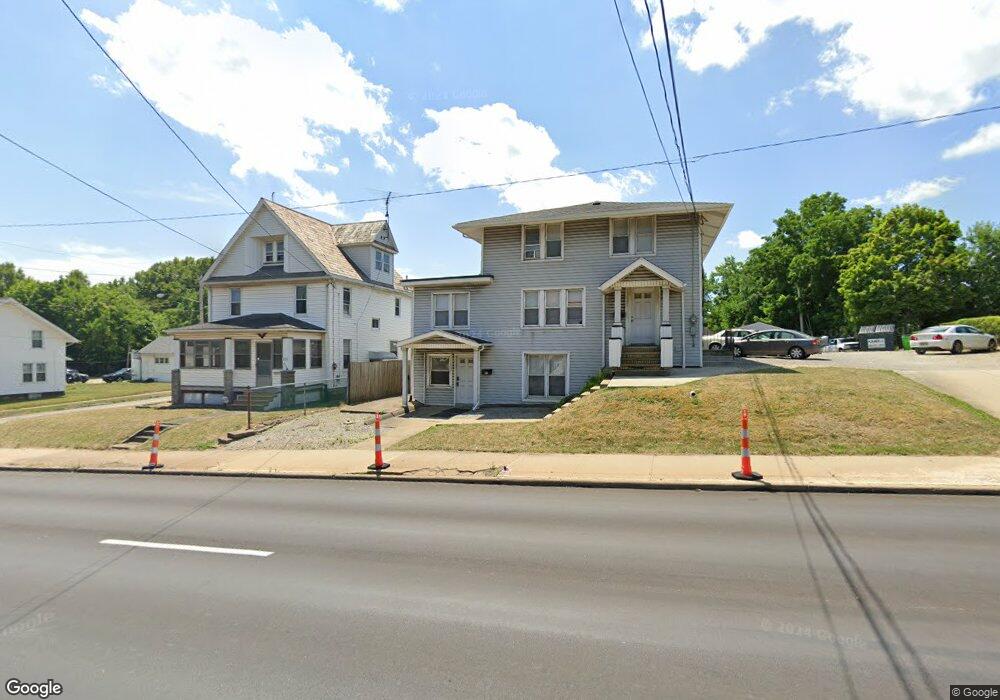
547 E State St Alliance, OH 44601
4
Beds
5
Baths
2,738
Sq Ft
6,229
Sq Ft Lot
About This Home
This home is located at 547 E State St, Alliance, OH 44601. 547 E State St is a home located in Stark County with nearby schools including Alliance Elementary School at Rockhill, Alliance Intermediate School at Northside, and Alliance Middle School.
Ownership History
Date
Name
Owned For
Owner Type
Purchase Details
Closed on
Aug 14, 2006
Sold by
Va
Bought by
Ddl First Properties Llc
Purchase Details
Closed on
Jun 6, 2006
Sold by
Baum Ralph H
Bought by
Va
Purchase Details
Closed on
May 2, 2006
Sold by
Baum Ralph H
Bought by
M & T Mortgage Corp
Purchase Details
Closed on
Sep 20, 1996
Sold by
Hume Kathryn L
Bought by
Baum Ralph H
Home Financials for this Owner
Home Financials are based on the most recent Mortgage that was taken out on this home.
Original Mortgage
$91,800
Interest Rate
7.93%
Mortgage Type
Commercial
Create a Home Valuation Report for This Property
The Home Valuation Report is an in-depth analysis detailing your home's value as well as a comparison with similar homes in the area
Home Values in the Area
Average Home Value in this Area
Purchase History
| Date | Buyer | Sale Price | Title Company |
|---|---|---|---|
| Ddl First Properties Llc | -- | None Available | |
| Va | $66,000 | None Available | |
| M & T Mortgage Corp | $66,000 | None Available | |
| Baum Ralph H | $90,000 | -- |
Source: Public Records
Mortgage History
| Date | Status | Borrower | Loan Amount |
|---|---|---|---|
| Previous Owner | Baum Ralph H | $91,800 |
Source: Public Records
Tax History
| Year | Tax Paid | Tax Assessment Tax Assessment Total Assessment is a certain percentage of the fair market value that is determined by local assessors to be the total taxable value of land and additions on the property. | Land | Improvement |
|---|---|---|---|---|
| 2025 | -- | $34,020 | $8,820 | $25,200 |
| 2024 | -- | $34,020 | $8,820 | $25,200 |
| 2023 | $1,503 | $28,350 | $7,350 | $21,000 |
| 2022 | $1,517 | $28,350 | $7,350 | $21,000 |
| 2021 | $1,510 | $28,350 | $7,350 | $21,000 |
| 2020 | $1,481 | $25,770 | $6,690 | $19,080 |
| 2019 | $1,444 | $25,770 | $6,690 | $19,080 |
Source: Public Records
Map
Nearby Homes
- 1823 S Seneca Ave
- 2041 Watson Ave
- 2351 S Freedom Ave
- 1608 S Liberty Ave
- 152 E Mill St
- 2408 S Linden Ave
- 834 Devine St
- 233 Shadyside Ct
- 224 Shadyside Ct
- 2405 Cherry Ave
- 2372 S Union Ave
- 2406 S Union Ave
- 853 Fairway Dr
- 555 E Milton St
- 167 11th St
- 134 11th St
- 226 Milner St
- 935 S Morgan Ave
- 234 Rosenberry St
- 2560 S Mahoning Ave
- 555 E State St
- 525 E State St
- 515 E State St
- 560 E State St
- 2033 S Seneca Ave
- 605 E State St
- 605 E State St
- 605 523 State St E
- 2042 S Freedom Ave
- 606 E State St
- 1923 S Seneca Ave
- 615 E State St
- 2055 S Seneca Ave
- 2030 S Seneca Ave
- 623 E State St
- 2052 S Freedom Ave
- 475 E State St
- 2040 S Seneca Ave
- 1920 S Freedom Ave
- 2033 S Freedom Ave
Your Personal Tour Guide
Ask me questions while you tour the home.