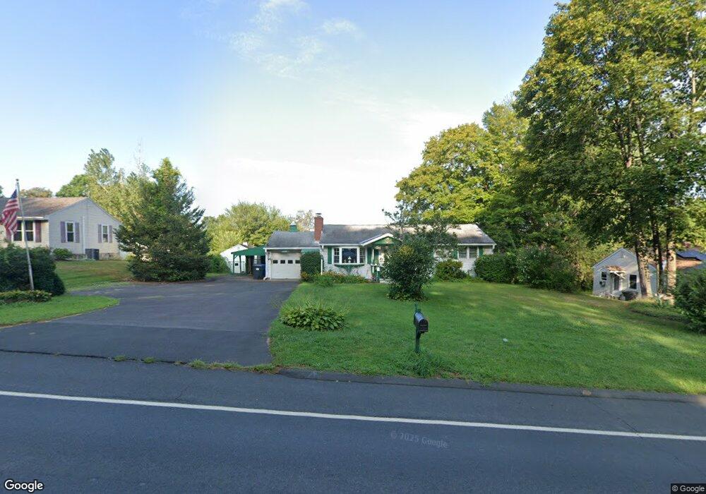
547 East St N Suffield, CT 06078
Estimated Value: $321,000 - $343,000
3
Beds
1
Bath
1,092
Sq Ft
$306/Sq Ft
Est. Value
About This Home
This home is located at 547 East St N, Suffield, CT 06078 and is currently estimated at $334,009, approximately $305 per square foot. 547 East St N is a home located in Hartford County with nearby schools including A. Ward Spaulding School, Mcalister Intermediate School, and Suffield Middle School.
Ownership History
Date
Name
Owned For
Owner Type
Purchase Details
Closed on
Aug 31, 1993
Sold by
King Freda and Rowley John
Bought by
Gagg Albert and Gagg Barbara
Current Estimated Value
Home Financials for this Owner
Home Financials are based on the most recent Mortgage that was taken out on this home.
Original Mortgage
$50,000
Interest Rate
7.06%
Mortgage Type
Unknown
Create a Home Valuation Report for This Property
The Home Valuation Report is an in-depth analysis detailing your home's value as well as a comparison with similar homes in the area
Home Values in the Area
Average Home Value in this Area
Purchase History
| Date | Buyer | Sale Price | Title Company |
|---|---|---|---|
| Gagg Albert | $90,000 | -- |
Source: Public Records
Mortgage History
| Date | Status | Borrower | Loan Amount |
|---|---|---|---|
| Open | Gagg Albert | $306,000 | |
| Closed | Gagg Albert | $50,000 | |
| Previous Owner | Gagg Albert | $30,000 |
Source: Public Records
Tax History Compared to Growth
Tax History
| Year | Tax Paid | Tax Assessment Tax Assessment Total Assessment is a certain percentage of the fair market value that is determined by local assessors to be the total taxable value of land and additions on the property. | Land | Improvement |
|---|---|---|---|---|
| 2025 | $4,021 | $171,780 | $54,180 | $117,600 |
| 2024 | $3,887 | $171,780 | $54,180 | $117,600 |
| 2023 | $3,817 | $133,420 | $54,180 | $79,240 |
| 2022 | $3,817 | $133,420 | $54,180 | $79,240 |
| 2021 | $3,821 | $133,420 | $54,180 | $79,240 |
| 2020 | $3,821 | $133,420 | $54,180 | $79,240 |
| 2019 | $3,832 | $133,420 | $54,180 | $79,240 |
| 2018 | $3,850 | $131,320 | $52,920 | $78,400 |
| 2017 | $3,794 | $131,320 | $52,920 | $78,400 |
| 2016 | $3,703 | $131,320 | $52,920 | $78,400 |
| 2015 | $3,648 | $131,320 | $52,920 | $78,400 |
| 2014 | $3,561 | $131,320 | $52,920 | $78,400 |
Source: Public Records
Map
Nearby Homes
- 21 Pebblestone Cir
- 29 Primrose Ln
- 120 E Bluegill Ln Unit 120
- 176 Dusky Ln Unit 176
- 1 Cheltenham Ct Unit 1
- 45 Douglas St
- 12 Thompson Ct
- 57 Kildeer Ln
- 54 Prospect St
- 69 Prospect St
- 47 Maple Ave
- 37 Mathewson Ave
- 8 Frew Terrace
- 18 Central St
- 243B Pearl St
- 30 Franklin St
- 53 New King St
- 3 Martin St
- 33 Frew Terrace
- 6 Hathaway Ave