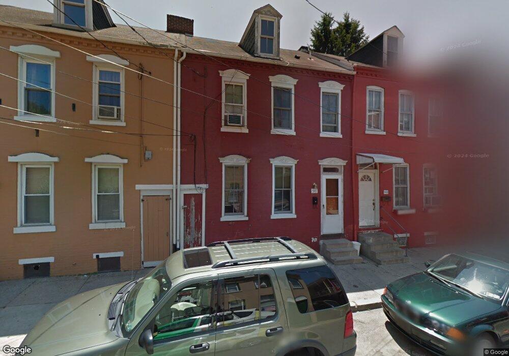
547 Green St Lancaster, PA 17602
Churchtowne NeighborhoodEstimated Value: $162,000 - $173,000
3
Beds
1
Bath
1,143
Sq Ft
$147/Sq Ft
Est. Value
About This Home
This home is located at 547 Green St, Lancaster, PA 17602 and is currently estimated at $168,550, approximately $147 per square foot. 547 Green St is a home located in Lancaster County with nearby schools including King Elementary School, Jackson Middle School, and McCaskey High School.
Ownership History
Date
Name
Owned For
Owner Type
Purchase Details
Closed on
Jun 15, 2011
Sold by
Ayala Rosa
Bought by
Santiago Ernesto
Current Estimated Value
Purchase Details
Closed on
Mar 26, 2003
Sold by
Federal Home Loan Mortgage Corporation
Bought by
Chase Manhattan Mortgage Corp
Purchase Details
Closed on
Mar 24, 2003
Sold by
Chase Manhattan Mortgage Corp
Bought by
Ayala Rosa
Purchase Details
Closed on
Dec 4, 2002
Sold by
Estate Of Earl Woods Jr
Bought by
Federal Home Loan Mortgage Corporation
Purchase Details
Closed on
Apr 20, 2001
Sold by
Woods Ruth E and Estate Of Earl Woods Jr
Bought by
Woods Ruth E
Create a Home Valuation Report for This Property
The Home Valuation Report is an in-depth analysis detailing your home's value as well as a comparison with similar homes in the area
Home Values in the Area
Average Home Value in this Area
Purchase History
| Date | Buyer | Sale Price | Title Company |
|---|---|---|---|
| Santiago Ernesto | $98,982 | None Available | |
| Chase Manhattan Mortgage Corp | -- | -- | |
| Ayala Rosa | $28,000 | -- | |
| Federal Home Loan Mortgage Corporation | $2,316 | -- | |
| Woods Ruth E | -- | -- |
Source: Public Records
Tax History Compared to Growth
Tax History
| Year | Tax Paid | Tax Assessment Tax Assessment Total Assessment is a certain percentage of the fair market value that is determined by local assessors to be the total taxable value of land and additions on the property. | Land | Improvement |
|---|---|---|---|---|
| 2025 | $1,769 | $44,700 | $7,800 | $36,900 |
| 2024 | $1,769 | $44,700 | $7,800 | $36,900 |
| 2023 | $1,739 | $44,700 | $7,800 | $36,900 |
| 2022 | $1,667 | $44,700 | $7,800 | $36,900 |
| 2021 | $1,631 | $44,700 | $7,800 | $36,900 |
| 2020 | $1,631 | $44,700 | $7,800 | $36,900 |
| 2019 | $1,606 | $44,700 | $7,800 | $36,900 |
| 2018 | $516 | $44,700 | $7,800 | $36,900 |
| 2017 | $1,617 | $35,200 | $8,100 | $27,100 |
| 2016 | $1,602 | $35,200 | $8,100 | $27,100 |
| 2015 | $625 | $35,200 | $8,100 | $27,100 |
| 2014 | $971 | $35,200 | $8,100 | $27,100 |
Source: Public Records
Map
Nearby Homes
- 536 Woodward St
- 555 Woodward St
- 462 S Christian St
- 507 Locust St
- 567 S Christian St
- 459 S Queen St
- 520 S Duke St
- 513 Howard Ave
- 506 Beaver St
- 316 Beaver St
- 341 S Prince St
- 518 Green St
- 348 S Prince St
- 346 S Prince St
- 14 E Farnum St
- 543 S Prince St
- 641 S Queen St
- 530 S Lime St
- 561 S Lime St
- 429 Hillside Ave
- 549 Green St
- 545 Green St
- 551 Green St
- 543 Green St
- 553 Green St
- 541 Green St
- 535 E Strawberry St
- 539 Green St
- 537 E Strawberry St
- 521 E Strawberry St
- 537 Green St
- 537 Green St
- 537 1/2 Green St
- 539 E Strawberry St
- 541 E Strawberry St
- 519 E Strawberry St
- 535 Green St
- 535 Green St
- 546 Woodward St
- 543 E Strawberry St