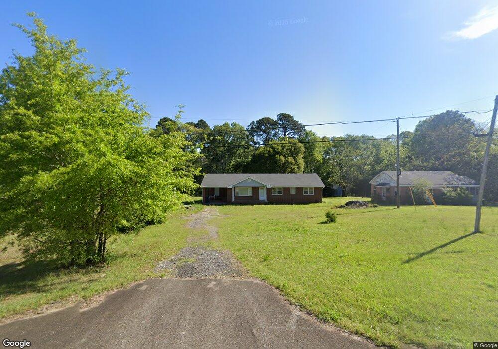
547 Highway 18 W Barnesville, GA 30204
Estimated Value: $205,000 - $283,000
3
Beds
2
Baths
1,508
Sq Ft
$154/Sq Ft
Est. Value
About This Home
This home is located at 547 Highway 18 W, Barnesville, GA 30204 and is currently estimated at $232,698, approximately $154 per square foot. 547 Highway 18 W is a home located in Lamar County with nearby schools including Lamar County Primary School, Lamar County Elementary School, and Lamar County Middle School.
Ownership History
Date
Name
Owned For
Owner Type
Purchase Details
Closed on
Aug 8, 2013
Sold by
Cannon Ginger E
Bought by
Cannon Ginger E
Current Estimated Value
Purchase Details
Closed on
Dec 1, 1986
Sold by
Thomas J B Mrs
Bought by
Kemp John G
Purchase Details
Closed on
Nov 1, 1975
Sold by
Compton Charlie T
Bought by
Kemp John G
Create a Home Valuation Report for This Property
The Home Valuation Report is an in-depth analysis detailing your home's value as well as a comparison with similar homes in the area
Home Values in the Area
Average Home Value in this Area
Purchase History
| Date | Buyer | Sale Price | Title Company |
|---|---|---|---|
| Cannon Ginger E | -- | -- | |
| Kemp John G | -- | -- | |
| Kemp John G | -- | -- |
Source: Public Records
Tax History Compared to Growth
Tax History
| Year | Tax Paid | Tax Assessment Tax Assessment Total Assessment is a certain percentage of the fair market value that is determined by local assessors to be the total taxable value of land and additions on the property. | Land | Improvement |
|---|---|---|---|---|
| 2025 | $1,356 | $61,954 | $6,227 | $55,727 |
| 2024 | $1,356 | $52,990 | $6,227 | $46,763 |
| 2023 | $1,403 | $50,825 | $6,227 | $44,598 |
| 2022 | $2,027 | $73,415 | $3,734 | $69,681 |
| 2021 | $1,306 | $43,424 | $3,734 | $39,690 |
| 2020 | $1,375 | $43,424 | $3,734 | $39,690 |
| 2019 | $1,378 | $43,424 | $3,734 | $39,690 |
| 2018 | $1,323 | $43,424 | $3,734 | $39,690 |
| 2017 | $1,316 | $43,424 | $3,734 | $39,690 |
| 2016 | $1,316 | $43,424 | $3,734 | $39,690 |
| 2015 | $1,315 | $43,424 | $3,734 | $39,690 |
| 2014 | $1,280 | $43,603 | $3,734 | $39,869 |
| 2013 | -- | $45,396 | $5,527 | $39,868 |
Source: Public Records
Map
Nearby Homes
- 0 Washington Cir
- 13 Brown St
- 500 Rose Ave
- 0 Old Milner Rd Unit 10630085
- 746 Highway 18 W
- 254 Needleleaf Dr
- 420 Zebulon St
- 295 Grove St
- 125 Byrd St
- 531 Thomaston St
- 339 Atlanta St
- 0 Veterns Pkwy Unit 10515268
- 150 Georgia Ave
- 245 Atlanta St
- 205 Georgia Ave
- 306 Spencer St
- 0 Highway 341 S Unit 181569
- 0 Highway 341 S Unit 10610486
- 00 Yatesville Rd Unit 1
- 818 Cannafax Rd
- 547 Highway 18 W
- 539 Highway 18 W
- 532 Highway 18 W
- 562 Highway 18 W
- 553 Highway 18 W
- 0 Hwy 18 W Unit 7483771
- 0 Hwy 18 W Unit 7597981
- 0 Hwy 18 W Unit 10022757
- 540 Highway 18 W
- 523 Highway 18 W
- 559 Highway 18 W
- 536 Highway 18 W
- 98 Ashley Oaks Dr
- 96 Ashley Oaks Dr
- 104 Ashley Oaks Dr
- 106 Ashley Oaks Dr
- 112 Ashley Oaks Dr
- 108 Ashley Oaks Dr
- 102 Ashley Oaks Dr
- 544 Highway 18 W