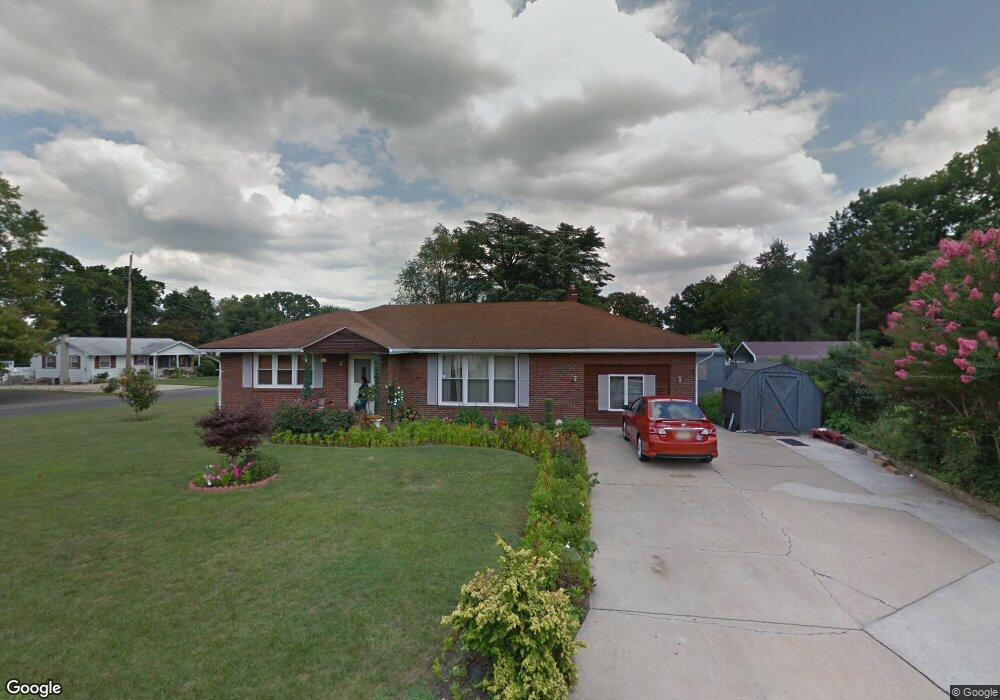
547 Mayfair St Vineland, NJ 08360
Estimated Value: $262,000 - $328,000
--
Bed
--
Bath
1,565
Sq Ft
$186/Sq Ft
Est. Value
About This Home
This home is located at 547 Mayfair St, Vineland, NJ 08360 and is currently estimated at $290,345, approximately $185 per square foot. 547 Mayfair St is a home located in Cumberland County with nearby schools including D'Ippolito Elementary School, Veterans Memorial Intermediate School, and Vineland Senior High School.
Ownership History
Date
Name
Owned For
Owner Type
Purchase Details
Closed on
Jul 6, 2007
Sold by
Csuy Michael L and Bronson Linda
Bought by
Cruz Angela and Cruz Martinez
Current Estimated Value
Purchase Details
Closed on
Jul 9, 1999
Sold by
Petit George
Bought by
Csuy Michael L and Bronson Linda A
Home Financials for this Owner
Home Financials are based on the most recent Mortgage that was taken out on this home.
Original Mortgage
$76,700
Interest Rate
7.39%
Create a Home Valuation Report for This Property
The Home Valuation Report is an in-depth analysis detailing your home's value as well as a comparison with similar homes in the area
Home Values in the Area
Average Home Value in this Area
Purchase History
| Date | Buyer | Sale Price | Title Company |
|---|---|---|---|
| Cruz Angela | $191,000 | -- | |
| Csuy Michael L | $95,900 | -- |
Source: Public Records
Mortgage History
| Date | Status | Borrower | Loan Amount |
|---|---|---|---|
| Previous Owner | Csuy Michael L | $76,700 |
Source: Public Records
Tax History Compared to Growth
Tax History
| Year | Tax Paid | Tax Assessment Tax Assessment Total Assessment is a certain percentage of the fair market value that is determined by local assessors to be the total taxable value of land and additions on the property. | Land | Improvement |
|---|---|---|---|---|
| 2025 | $4,668 | $146,600 | $29,000 | $117,600 |
| 2024 | $4,668 | $146,600 | $29,000 | $117,600 |
| 2023 | $4,637 | $146,600 | $29,000 | $117,600 |
| 2022 | $4,499 | $146,600 | $29,000 | $117,600 |
| 2021 | $4,417 | $146,600 | $29,000 | $117,600 |
| 2020 | $4,291 | $146,600 | $29,000 | $117,600 |
| 2019 | $4,232 | $146,600 | $29,000 | $117,600 |
| 2018 | $4,121 | $146,600 | $29,000 | $117,600 |
| 2017 | $3,914 | $146,600 | $29,000 | $117,600 |
| 2016 | $3,776 | $146,600 | $29,000 | $117,600 |
| 2015 | $3,637 | $146,600 | $29,000 | $117,600 |
| 2014 | $3,439 | $146,600 | $29,000 | $117,600 |
Source: Public Records
Map
Nearby Homes
- 516 N Valley Ave
- 1161 Fairmount Ave
- 1167 Fairmount Ave
- 515 Park Ln
- 785 E Oak Rd
- 1071 E Park Ave
- 584 Overbrook Rd
- 933 Tanglewood Ln
- 23 Northwood Dr
- 1173 New Pear St
- 4 Elmwood Ave
- 18 Elmwood Ave
- 1230 Ramblewood Dr
- 3 N Valley Ave
- 411 N East Ave
- 48 N Myrtle St
- 1249 Sassafras Dr
- 1074 E Landis Ave
- 1138 E Landis Ave
- 0 E Oak Rd Unit NJCB2011142
- 1115 Fairmount Ave
- 543 Mayfair St
- 546 Mayfair St
- 1119 Fairmount Ave
- 541 Mayfair St
- 544 Mayfair St
- 1114 Fairmount Ave
- 1116 Fairmount Ave
- 542 Mayfair St
- 1120 Fairmount Ave
- 1120 Maple Ave
- 552 Mayfair St
- 537 Mayfair St
- 540 Mayfair St
- 1124 Maple Ave
- 1108 Fairmount Ave
- 538 Mayfair St
- 1139 Fairmount Ave
- 1105 Fairmount Ave
- 555 Mayfair St