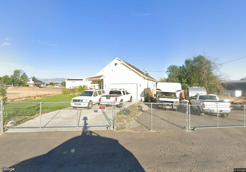
547 N 50 W Tooele, UT 84074
Estimated Value: $488,000 - $665,000
--
Bed
--
Bath
2,865
Sq Ft
$193/Sq Ft
Est. Value
About This Home
This home is located at 547 N 50 W, Tooele, UT 84074 and is currently estimated at $551,706, approximately $192 per square foot. 547 N 50 W is a home with nearby schools including Northlake Elementary School, Tooele Junior High School, and Tooele High School.
Ownership History
Date
Name
Owned For
Owner Type
Purchase Details
Closed on
Feb 12, 2024
Sold by
Stevens Richard and Stevens Lila
Bought by
Stevens Family Trust and Stevens
Current Estimated Value
Purchase Details
Closed on
Jan 6, 2021
Sold by
Stone Ruth K and The Ruth E Stone Revocable Liv
Bought by
Stevens Richard and Lake Lila
Purchase Details
Closed on
Apr 30, 2008
Sold by
Whitlock Helen
Bought by
Stone Ruth
Purchase Details
Closed on
Apr 24, 2008
Sold by
Stone Ruth
Bought by
Stone Ruth E and The Ruth E Stone Revocable Living Trust
Create a Home Valuation Report for This Property
The Home Valuation Report is an in-depth analysis detailing your home's value as well as a comparison with similar homes in the area
Home Values in the Area
Average Home Value in this Area
Purchase History
| Date | Buyer | Sale Price | Title Company |
|---|---|---|---|
| Stevens Family Trust | -- | None Listed On Document | |
| Stevens Richard | -- | Security Title Ins Agcy Of | |
| Stone Ruth | -- | First American Title Insuran | |
| Stone Ruth E | -- | First American Title Insuran |
Source: Public Records
Tax History Compared to Growth
Tax History
| Year | Tax Paid | Tax Assessment Tax Assessment Total Assessment is a certain percentage of the fair market value that is determined by local assessors to be the total taxable value of land and additions on the property. | Land | Improvement |
|---|---|---|---|---|
| 2025 | $3,091 | $257,843 | $68,090 | $189,753 |
| 2024 | $3,303 | $252,130 | $68,090 | $184,040 |
| 2023 | $3,303 | $247,811 | $65,454 | $182,357 |
| 2022 | $3,019 | $259,727 | $64,020 | $195,707 |
| 2021 | $1,078 | $77,600 | $77,600 | $0 |
| 2020 | $779 | $53,500 | $53,500 | $0 |
| 2019 | $792 | $53,500 | $53,500 | $0 |
| 2018 | $163 | $10,450 | $10,450 | $0 |
| 2017 | $138 | $10,450 | $10,450 | $0 |
| 2016 | $144 | $10,450 | $10,450 | $0 |
| 2015 | $144 | $10,450 | $0 | $0 |
| 2014 | -- | $10,450 | $0 | $0 |
Source: Public Records
Map
Nearby Homes
- 107 W 600 N Unit 204
- 530 N 50 W
- 524 N 200 W
- 79 E 600 N
- 465 N 100 E
- 370 N 100 W
- 244 W 670 N
- 118 E 730 N Unit 104
- 122 E 730 N Unit 105
- 413 Parkway Ave
- 277 W 670 N
- 151 E 730 N
- 307 N 200 W
- 590 N Brook Ave
- 353 W 630 N Unit 19
- 416 N 340 W
- 363 W 630 North St Unit 20
- 698 Brook Ave E
- 352 W 600 N Unit 44
- 834 N 200 W
- 546 N 100 W
- 578 N 100 W
- 500 N 50 W Unit 1
- 500 N 50 W
- 66 W 500 N
- 586 N 50 W
- 518 N 100 W
- 506 N 100 W
- 525 N Main St
- 78 W 600 N
- 525 N Main St
- 107 W 600 N Unit 203
- 107 W 600 N Unit 202
- 107 W 600 N Unit 201
- 107 W 600 N Unit 104
- 107 W 600 N Unit 102
- 107 W 600 N Unit 101A
- 107 W 600 N
- 107 W 600 N Unit 103
- 55 W 500 N