
Seller's Agent in 2026
Penny Smith
Realty World First Coast Rlty
(252) 728-7790
6 in this area
71 Total Sales
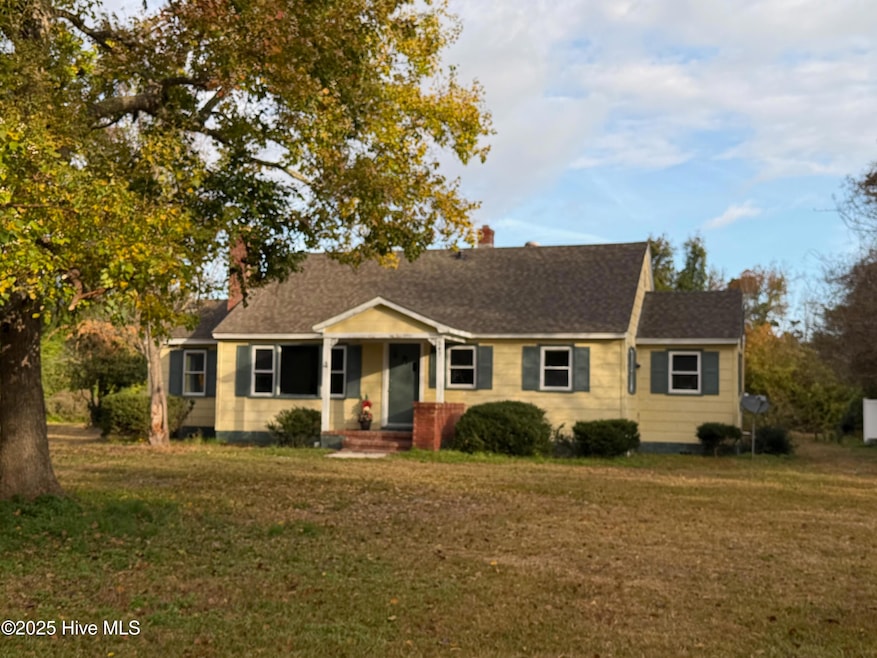
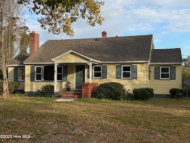
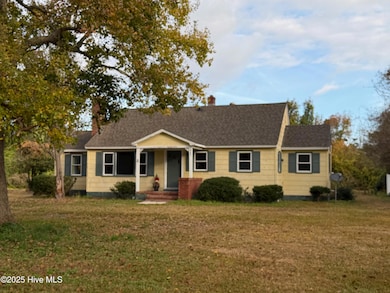
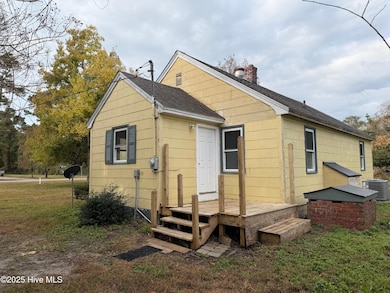
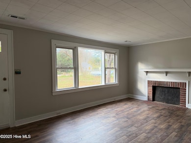
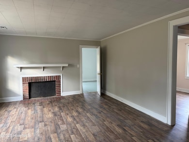
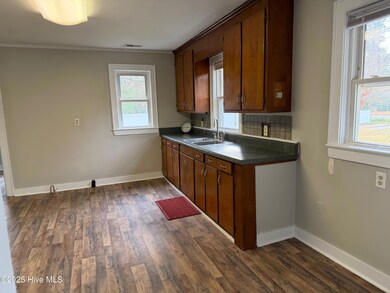
Cottage with 3 BR's and 1 bath. Located just 5 minutes from Harkers Island, or 15 minutes from Down Town Beaufort. New flooring throughout the home, and in the process of being painted. Central heat and air, and fairy new roof. Nice lot. Septic tank was just pumped. Easy to show.
Last Agent to Sell the Property
Realty World First Coast Rlty License #124793 Listed on: 11/14/2025
Last Buyer's Agent
Penny Smith
Realty World First Coast Realty Gateway
| Date | Type | Sale Price | Title Company |
|---|---|---|---|
| Warranty Deed | $150,000 | None Listed On Document | |
| Warranty Deed | $95,000 | None Available | |
| Deed | $77,500 | -- | |
| Deed | -- | -- |
| Date | Status | Loan Amount | Loan Type |
|---|---|---|---|
| Open | $80,000 | New Conventional | |
| Previous Owner | $76,000 | Fannie Mae Freddie Mac |
| Date | Event | Price | List to Sale | Price per Sq Ft |
|---|---|---|---|---|
| 01/28/2026 01/28/26 | Sold | $150,000 | -16.2% | $139 / Sq Ft |
| 12/06/2025 12/06/25 | For Sale | $179,000 | 0.0% | $166 / Sq Ft |
| 12/06/2025 12/06/25 | Pending | -- | -- | -- |
| 11/14/2025 11/14/25 | For Sale | $179,000 | -- | $166 / Sq Ft |
| Year | Tax Paid | Tax Assessment Tax Assessment Total Assessment is a certain percentage of the fair market value that is determined by local assessors to be the total taxable value of land and additions on the property. | Land | Improvement |
|---|---|---|---|---|
| 2025 | $492 | $114,087 | $44,338 | $69,749 |
| 2024 | $478 | $73,060 | $42,681 | $30,379 |
| 2023 | $552 | $73,060 | $42,681 | $30,379 |
| 2022 | $537 | $73,060 | $42,681 | $30,379 |
| 2021 | $530 | $73,060 | $42,681 | $30,379 |
| 2020 | $538 | $73,060 | $42,681 | $30,379 |
| 2019 | $578 | $84,722 | $47,278 | $37,444 |
| 2017 | $574 | $84,722 | $47,278 | $37,444 |
| 2016 | $572 | $84,722 | $47,278 | $37,444 |
| 2015 | $551 | $84,722 | $47,278 | $37,444 |
| 2014 | $260 | $58,222 | $40,560 | $17,662 |
Seller's Agent in 2026
Penny Smith
Realty World First Coast Rlty
(252) 728-7790
6 in this area
71 Total Sales
Source: Hive MLS
MLS Number: 100541393
APN: 7336.04.94.3315000
Disclaimer: Certain information contained herein is derived from information provided by parties other than Homes.com. All information provided is deemed reliable, but is not guaranteed to be accurate and should be independently verified.
![]() The data relating to real estate on this web site comes in part from the Internet Data Exchange program of Hive MLS LLC. All information is deemed reliable but not guaranteed and should be independently verified. All properties are subject to prior sale, change, or withdrawal. Neither listing broker(s) nor Homesnap, Inc. shall be responsible for any typographical errors, misinformation, or misprints, and shall be held totally harmless from any damages arising from reliance upon these data. ©2026 Hive MLS LLC
The data relating to real estate on this web site comes in part from the Internet Data Exchange program of Hive MLS LLC. All information is deemed reliable but not guaranteed and should be independently verified. All properties are subject to prior sale, change, or withdrawal. Neither listing broker(s) nor Homesnap, Inc. shall be responsible for any typographical errors, misinformation, or misprints, and shall be held totally harmless from any damages arising from reliance upon these data. ©2026 Hive MLS LLC
Ask me questions while you tour the home.