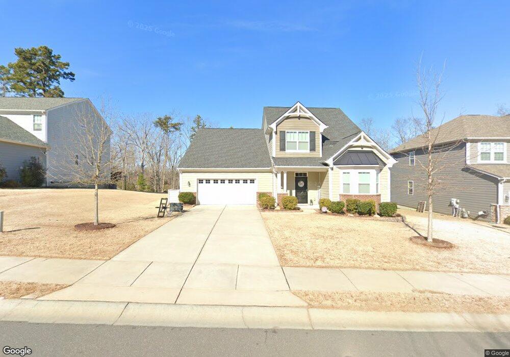
547 Sandbar Point Clover, SC 29710
Estimated Value: $623,000 - $656,000
Studio
1
Bath
3,454
Sq Ft
$184/Sq Ft
Est. Value
About This Home
This home is located at 547 Sandbar Point, Clover, SC 29710 and is currently estimated at $635,329, approximately $183 per square foot. 547 Sandbar Point is a home with nearby schools including Oakridge Elementary School, Oakridge Middle School, and Clover High School.
Ownership History
Date
Name
Owned For
Owner Type
Purchase Details
Closed on
Jun 4, 2022
Sold by
Pavone Joseph S and Pavone Renee Rachel
Bought by
Joe And Rachel Pavone Living Trust
Current Estimated Value
Purchase Details
Closed on
Nov 13, 2018
Sold by
Mattamy Carolina Corp
Bought by
Pavone Joseph Richard and Pavone Rachel Renee
Home Financials for this Owner
Home Financials are based on the most recent Mortgage that was taken out on this home.
Original Mortgage
$379,497
Interest Rate
4.8%
Mortgage Type
New Conventional
Create a Home Valuation Report for This Property
The Home Valuation Report is an in-depth analysis detailing your home's value as well as a comparison with similar homes in the area
Home Values in the Area
Average Home Value in this Area
Purchase History
We collect this data history from publicly available records. To have your information removed, we recommend requesting removal directly through your county’s website.
| Date | Buyer | Sale Price | Title Company |
|---|---|---|---|
| Joe And Rachel Pavone Living Trust | -- | None Listed On Document | |
| Pavone Joseph Richard | $399,470 | None Available |
Source: Public Records
Mortgage History
We collect this data history from publicly available records. To have your information removed, we recommend requesting removal directly through your county’s website.
| Date | Status | Borrower | Loan Amount |
|---|---|---|---|
| Previous Owner | Pavone Joseph Richard | $379,497 |
Source: Public Records
Tax History
| Year | Tax Paid | Tax Assessment Tax Assessment Total Assessment is a certain percentage of the fair market value that is determined by local assessors to be the total taxable value of land and additions on the property. | Land | Improvement |
|---|---|---|---|---|
| 2025 | $2,465 | $18,003 | $2,303 | $15,700 |
| 2024 | $2,212 | $15,655 | $2,600 | $13,055 |
| 2023 | $2,268 | $15,655 | $2,600 | $13,055 |
| 2022 | $1,868 | $15,648 | $2,600 | $13,048 |
| 2021 | -- | $15,648 | $2,600 | $13,048 |
| 2020 | $1,771 | $15,648 | $0 | $0 |
| 2019 | $8,058 | $22,680 | $0 | $0 |
| 2018 | $1,263 | $3,600 | $0 | $0 |
| 2017 | -- | $0 | $0 | $0 |
Source: Public Records
Map
Nearby Homes
- 560 Sandbar Point
- 570 Sandbar Point
- 5347 Baker Ln
- 5327 Baker Ln
- 4946 Norman Park Place
- 445 Sandbar Point
- 5155 Watersail Way
- 662 Sandbar Point
- 5036 Watersail Way
- 2111 Lapalma Trace
- 4353 Duck Haven Ln
- 2491 Napa Terrace
- 2322 Tessa Trace
- 2408 Napa Terrace
- 1212 Englewood Dr
- 733 Fawns Glen Place
- 6704 Montgomery Rd
- 386 Squirrel Ln
- 9719 Nine Eagles Ln
- 1091 Chicory Trace
- 560 Sandbar Point Unit 124 Paige
- 570 Sandbar Point Unit 125 Kendrick
- 548 Sandbar Point Unit 123 Paige
- 561 Sandbar Point
- 5361 Baker Ln Unit LK 105 Laramore
- 557 Sandbar Point
- 557 Sandbar Point Unit 94 Kendrick
- 567 Sandbar Point
- 576 Sandbar Point Unit 126 Paige
- 553 Sandbar Point Unit 95 Quinton
- 5353 Baker Ln
- 540 Sandbar Point
- 573 Sandbar Pointe Unit 91 Kendrick
- 579 Sandbar Point Unit 90 Paige
- 5343 Baker Ln
- 534 Sandbar Point
- 534 Sandbar Point Unit 121 Kendrick
- 541 Sandbar Point
- 5389 Baker Ln
- 5337 Baker Ln
Your Personal Tour Guide
Ask me questions while you tour the home.