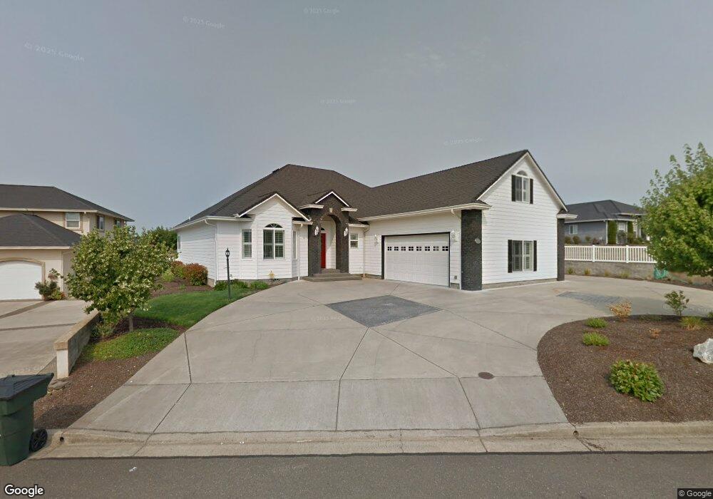
547 St Andrews Ct Sutherlin, OR 97479
Estimated Value: $527,000 - $606,084
3
Beds
2
Baths
2,611
Sq Ft
$218/Sq Ft
Est. Value
About This Home
This home is located at 547 St Andrews Ct, Sutherlin, OR 97479 and is currently estimated at $569,521, approximately $218 per square foot. 547 St Andrews Ct is a home located in Douglas County with nearby schools including East Sutherlin Primary School, West Sutherlin Intermediate School, and Sutherlin Middle School.
Ownership History
Date
Name
Owned For
Owner Type
Purchase Details
Closed on
Mar 3, 2017
Sold by
Brummel Charles D and Brummel Peggy J
Bought by
Brummel Charles D and Brummel Peggy
Current Estimated Value
Home Financials for this Owner
Home Financials are based on the most recent Mortgage that was taken out on this home.
Original Mortgage
$547,350
Outstanding Balance
$453,310
Interest Rate
4.21%
Mortgage Type
Reverse Mortgage Home Equity Conversion Mortgage
Estimated Equity
$116,211
Purchase Details
Closed on
Feb 7, 2017
Sold by
Brown Donovan J and Suzanne Brown L
Bought by
Brummel Charles D and Brummel Peggy J
Home Financials for this Owner
Home Financials are based on the most recent Mortgage that was taken out on this home.
Original Mortgage
$547,350
Outstanding Balance
$453,310
Interest Rate
4.21%
Mortgage Type
Reverse Mortgage Home Equity Conversion Mortgage
Estimated Equity
$116,211
Create a Home Valuation Report for This Property
The Home Valuation Report is an in-depth analysis detailing your home's value as well as a comparison with similar homes in the area
Home Values in the Area
Average Home Value in this Area
Purchase History
| Date | Buyer | Sale Price | Title Company |
|---|---|---|---|
| Brummel Charles D | -- | None Available | |
| Brummel Charles D | $364,900 | Amerititle |
Source: Public Records
Mortgage History
| Date | Status | Borrower | Loan Amount |
|---|---|---|---|
| Open | Brummel Charles D | $547,350 |
Source: Public Records
Tax History Compared to Growth
Tax History
| Year | Tax Paid | Tax Assessment Tax Assessment Total Assessment is a certain percentage of the fair market value that is determined by local assessors to be the total taxable value of land and additions on the property. | Land | Improvement |
|---|---|---|---|---|
| 2024 | $4,950 | $413,770 | -- | -- |
| 2023 | $4,808 | $401,719 | $0 | $0 |
| 2022 | $4,670 | $390,019 | $0 | $0 |
| 2021 | $4,536 | $378,660 | $0 | $0 |
| 2020 | $4,403 | $367,632 | $0 | $0 |
| 2019 | $4,275 | $356,925 | $0 | $0 |
| 2018 | $4,150 | $346,530 | $0 | $0 |
| 2017 | $4,252 | $336,437 | $0 | $0 |
| 2016 | $4,129 | $326,638 | $0 | $0 |
| 2015 | $4,009 | $317,125 | $0 | $0 |
| 2014 | $3,891 | $307,889 | $0 | $0 |
| 2013 | -- | $298,922 | $0 | $0 |
Source: Public Records
Map
Nearby Homes
- 2076 Sawgrass Ct
- 910 Swallow Ave
- 702 Divot Loop
- 832 Sand Pines Ave
- 881 Medina Ave
- 420 Backwater Loop
- 890 Durham Ave
- 178 Dovetail Ln
- 1716 Scardi Blvd Unit 174
- 135 Elkton St
- 1660 Scardi Blvd
- 126 Coles Valley St
- 154 Coles Valley St
- 149 Coles Valley St
- 122 Lilly Ct
- 307 Cambridge Dr
- 1688 W Central Ave
- 181 SW Hutchins St
- 101 Frontier Ct
- 2730 Golfview Ave
- 2074 Culver Loop
- 523 St Andrews Ct
- 536 St Andrews Ct
- 2076 Culver Loop
- 2079 Culver Loop
- 2070 Culver Loop
- 2081 Culver Loop
- 501 St Andrews Ct
- 2078 Culver Loop
- 514 St Andrews Ct
- 2068 Culver Loop
- 2077 Culver Loop
- 2083 Culver Loop
- 2080 Culver Loop
- 2066 Culver Loop
- 2082 Culver Loop
- 2044 Sawgrass Ct
- 2075 Culver Loop
- 2084 Culver Loop
- 1958 Culver Loop