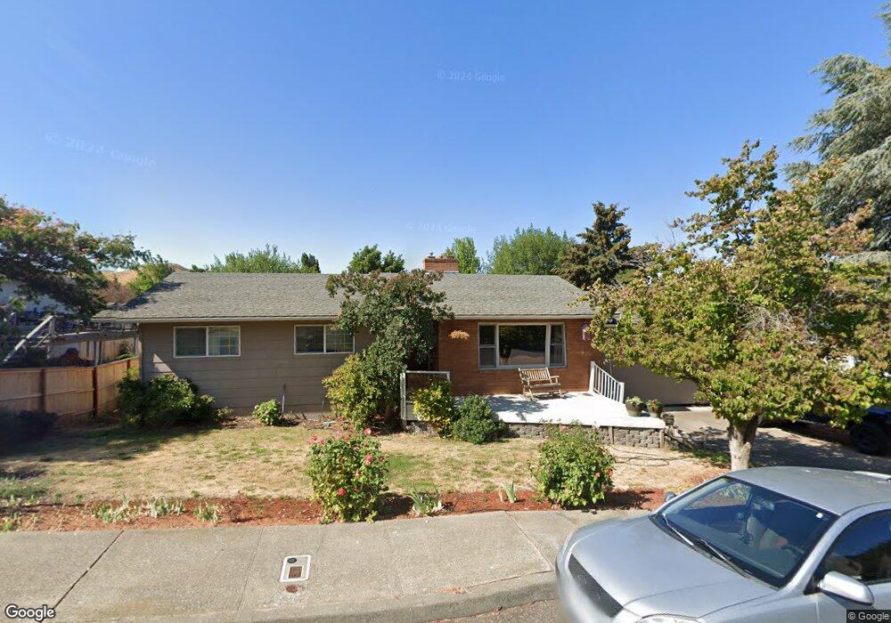
547 Summit Ridge Dr E the Dalles, OR 97058
Estimated Value: $523,000 - $609,000
4
Beds
3
Baths
2,922
Sq Ft
$193/Sq Ft
Est. Value
About This Home
This home is located at 547 Summit Ridge Dr E, the Dalles, OR 97058 and is currently estimated at $564,654, approximately $193 per square foot. 547 Summit Ridge Dr E is a home located in Wasco County with nearby schools including Dry Hollow Elementary School, The Dalles Middle School, and The Dalles High School.
Ownership History
Date
Name
Owned For
Owner Type
Purchase Details
Closed on
Jul 25, 2016
Sold by
Lee Terry M and Warren Donald R
Bought by
Daschel Michael N and Daschel Diana S
Current Estimated Value
Home Financials for this Owner
Home Financials are based on the most recent Mortgage that was taken out on this home.
Original Mortgage
$332,626
Outstanding Balance
$263,753
Interest Rate
3.54%
Mortgage Type
VA
Estimated Equity
$300,901
Purchase Details
Closed on
Aug 28, 2014
Sold by
Carroll Shawn P and Carroll Karen K
Bought by
Lee Terry M and Warren Donald R
Purchase Details
Closed on
Mar 17, 2005
Sold by
Denney Gary L and Denney Wendy L
Bought by
Carroll Shawn P and Carroll Karen K
Home Financials for this Owner
Home Financials are based on the most recent Mortgage that was taken out on this home.
Original Mortgage
$180,000
Interest Rate
5.61%
Mortgage Type
New Conventional
Create a Home Valuation Report for This Property
The Home Valuation Report is an in-depth analysis detailing your home's value as well as a comparison with similar homes in the area
Purchase History
| Date | Buyer | Sale Price | Title Company |
|---|---|---|---|
| Daschel Michael N | $322,000 | Wasco Title Inc | |
| Lee Terry M | $285,000 | None Available | |
| Carroll Shawn P | $255,000 | -- |
Source: Public Records
Mortgage History
| Date | Status | Borrower | Loan Amount |
|---|---|---|---|
| Open | Daschel Michael N | $332,626 | |
| Previous Owner | Carroll Shawn P | $180,000 |
Source: Public Records
Tax History
| Year | Tax Paid | Tax Assessment Tax Assessment Total Assessment is a certain percentage of the fair market value that is determined by local assessors to be the total taxable value of land and additions on the property. | Land | Improvement |
|---|---|---|---|---|
| 2025 | $5,830 | $702,916 | -- | -- |
| 2024 | $5,830 | $682,444 | -- | -- |
| 2023 | $5,963 | $331,284 | $0 | $0 |
| 2022 | $5,830 | $291,469 | $0 | $0 |
| 2021 | $5,652 | $282,980 | $0 | $0 |
| 2020 | $5,512 | $274,738 | $0 | $0 |
| 2019 | $5,821 | $266,736 | $0 | $0 |
| 2018 | $5,659 | $285,769 | $0 | $0 |
| 2017 | $5,480 | $277,446 | $0 | $0 |
| 2016 | $5,361 | $269,365 | $0 | $0 |
| 2015 | $5,269 | $261,519 | $0 | $0 |
| 2014 | $4,638 | $239,168 | $0 | $0 |
Source: Public Records
Map
Nearby Homes
- 3540 Royal Crest Dr E
- 3414 Columbia View Dr
- 3720 Columbia View Dr
- 3302 Old Dufur Rd
- 3113 Fremont St
- 3103 Fremont St
- 1700 Lone Pine Blvd
- 0 Lone Pine Ln
- 1300 Lone Pine Blvd
- 1400 Lone Pine Blvd
- 192 Honeysuckle Ln
- 1500 Lone Pine Blvd
- 260 Lone Pine Ln Unit 2
- 260 Lone Pine Ln Unit 8
- 170 Blue Heron Ct
- 240 Lone Pine Ln Unit 2
- 240 Lone Pine Ln Unit 5
- 162 Blue Heron Ct
- 3564 E 2nd St Unit 33
- 110 Southshore Ave
- 541 Summit Ridge Dr E
- 3541 Royal Crest Dr E
- 3527 Crest Ct E
- 3533 Royal Crest Dr E
- 535 Summit Ridge Dr E
- 3521 Crest Ct E
- 546 Summit Ridge Dr E
- 552 Summit Ridge Dr E
- 540 Summit Ridge Dr E
- 3528 Crest Ct E
- 560 Summit Ridge Dr E
- 527 Summit Ridge Dr E
- 3517 Crest Ct E
- 534 Summit Ridge Dr E
- 3522 Crest Ct E
- 3532 Royal Crest Dr E
- 602 Summit Ridge Dr E
- 3526 Royal Crest Dr E
- 3455 Royal Crest Dr E
- 3501 Royal Crest Dr E
Your Personal Tour Guide
Ask me questions while you tour the home.