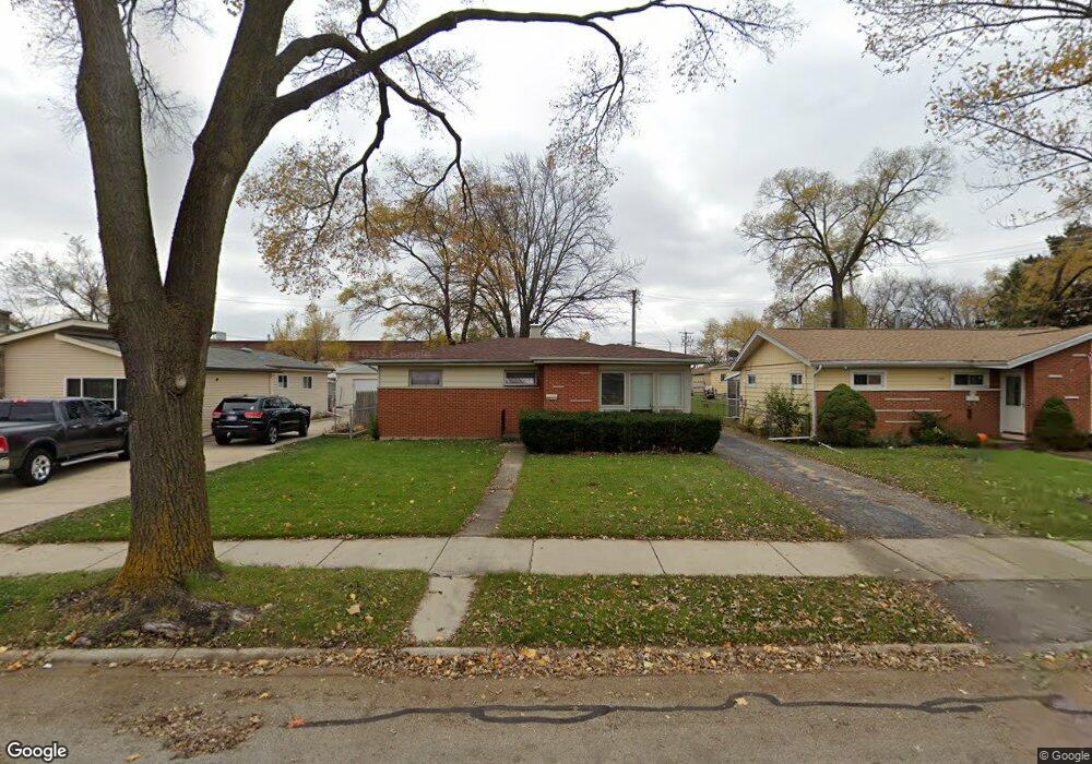
547 W Linda Ln Addison, IL 60101
Estimated Value: $274,894 - $333,000
3
Beds
1
Bath
1,018
Sq Ft
$298/Sq Ft
Est. Value
About This Home
This home is located at 547 W Linda Ln, Addison, IL 60101 and is currently estimated at $302,974, approximately $297 per square foot. 547 W Linda Ln is a home located in DuPage County with nearby schools including Stone Elementary School, Indian Trail Jr High School, and Addison Trail High School.
Ownership History
Date
Name
Owned For
Owner Type
Purchase Details
Closed on
Feb 12, 2025
Sold by
Schaal Gary
Bought by
Trust Number One and Schaal
Current Estimated Value
Purchase Details
Closed on
Mar 18, 2004
Sold by
Brown Caryn and Estate Of Patricia A Glanville
Bought by
Schaal Gary
Home Financials for this Owner
Home Financials are based on the most recent Mortgage that was taken out on this home.
Original Mortgage
$156,000
Interest Rate
5.65%
Mortgage Type
Purchase Money Mortgage
Create a Home Valuation Report for This Property
The Home Valuation Report is an in-depth analysis detailing your home's value as well as a comparison with similar homes in the area
Home Values in the Area
Average Home Value in this Area
Purchase History
| Date | Buyer | Sale Price | Title Company |
|---|---|---|---|
| Trust Number One | -- | None Listed On Document | |
| Schaal Gary | $184,000 | Heritage Title Company |
Source: Public Records
Mortgage History
| Date | Status | Borrower | Loan Amount |
|---|---|---|---|
| Previous Owner | Schaal Gary | $156,000 |
Source: Public Records
Tax History Compared to Growth
Tax History
| Year | Tax Paid | Tax Assessment Tax Assessment Total Assessment is a certain percentage of the fair market value that is determined by local assessors to be the total taxable value of land and additions on the property. | Land | Improvement |
|---|---|---|---|---|
| 2024 | $4,947 | $78,191 | $36,224 | $41,967 |
| 2023 | $4,702 | $71,880 | $33,300 | $38,580 |
| 2022 | $4,426 | $66,100 | $30,670 | $35,430 |
| 2021 | $4,234 | $63,320 | $29,380 | $33,940 |
| 2020 | $4,110 | $60,650 | $28,140 | $32,510 |
| 2019 | $4,074 | $58,320 | $27,060 | $31,260 |
| 2018 | $4,019 | $55,510 | $25,760 | $29,750 |
| 2017 | $3,905 | $53,050 | $24,620 | $28,430 |
| 2016 | $3,783 | $48,980 | $22,730 | $26,250 |
| 2015 | $3,669 | $45,250 | $21,000 | $24,250 |
| 2014 | $3,567 | $43,910 | $21,660 | $22,250 |
| 2013 | $3,499 | $44,800 | $22,100 | $22,700 |
Source: Public Records
Map
Nearby Homes
- 744 N Neva Ave
- 820 N Neva Ave Unit 2
- 957 N Howard Ave
- 502 W Ronald Dr
- 465 N Mill Rd
- 551 N 6th Ave
- 4N327 7th Ave
- 929 W Surrey Rd
- 465 W Dominion Dr Unit 909
- 465 W Dominion Dr Unit 508
- 465 W Dominion Dr Unit 1302
- 465 W Dominion Dr Unit 1304
- 465 W Dominion Dr Unit 1003
- 126 W Elizabeth Dr
- 318 S Dominion Dr
- 385 Masters Dr
- 379 Masters Dr
- 235 N Mill Rd Unit 115B
- 86 W Elizabeth Dr
- 329 Masters Dr