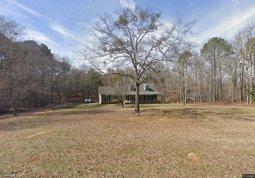
5470 Colbert Danielsville Rd Colbert, GA 30628
Estimated Value: $303,000 - $360,000
3
Beds
2
Baths
2,078
Sq Ft
$162/Sq Ft
Est. Value
About This Home
This home is located at 5470 Colbert Danielsville Rd, Colbert, GA 30628 and is currently estimated at $335,602, approximately $161 per square foot. 5470 Colbert Danielsville Rd is a home located in Madison County with nearby schools including Madison County High School.
Ownership History
Date
Name
Owned For
Owner Type
Purchase Details
Closed on
Mar 28, 2024
Sold by
Mcnabb Michael T
Bought by
Baker Jeannie C and Blair Rachel L
Current Estimated Value
Purchase Details
Closed on
Apr 5, 2004
Sold by
Hooten Judy A
Bought by
Mcnabb Michael T and Mcnabb Tracy M
Purchase Details
Closed on
Jun 29, 1999
Sold by
Colquitt Randy W
Bought by
Hooten Judy A
Purchase Details
Closed on
Jan 1, 1993
Bought by
Colquitt Randy W
Create a Home Valuation Report for This Property
The Home Valuation Report is an in-depth analysis detailing your home's value as well as a comparison with similar homes in the area
Home Values in the Area
Average Home Value in this Area
Purchase History
| Date | Buyer | Sale Price | Title Company |
|---|---|---|---|
| Baker Jeannie C | $222,698 | -- | |
| Mcnabb Michael T | $169,500 | -- | |
| Hooten Judy A | $157,000 | -- | |
| Colquitt Randy W | $5,500 | -- |
Source: Public Records
Tax History Compared to Growth
Tax History
| Year | Tax Paid | Tax Assessment Tax Assessment Total Assessment is a certain percentage of the fair market value that is determined by local assessors to be the total taxable value of land and additions on the property. | Land | Improvement |
|---|---|---|---|---|
| 2024 | $2,385 | $93,626 | $16,000 | $77,626 |
| 2023 | $2,719 | $89,079 | $16,000 | $73,079 |
| 2022 | $2,176 | $80,880 | $16,000 | $64,880 |
| 2021 | $1,981 | $66,909 | $16,000 | $50,909 |
| 2020 | $1,995 | $66,909 | $16,000 | $50,909 |
| 2019 | $1,990 | $65,991 | $16,000 | $49,991 |
| 2018 | $1,958 | $64,780 | $16,000 | $48,780 |
| 2017 | $1,940 | $67,358 | $16,000 | $51,358 |
| 2016 | $1,710 | $61,574 | $16,000 | $45,574 |
| 2015 | $1,711 | $61,574 | $16,000 | $45,574 |
| 2014 | $1,718 | $61,451 | $16,000 | $45,451 |
| 2013 | -- | $61,451 | $16,000 | $45,451 |
Source: Public Records
Map
Nearby Homes
- 118 Kingston Rd
- 00 Kingston Rd
- 0 Kingston Rd Unit 10531125
- 77 Sugar Maple Way Unit 44
- 45 Sugar Maple Way Unit 43
- 208 Redbud Trail Unit 48
- 270 Lola St
- 14 Sourwood Trail Unit 53
- 95 Lola St
- 0 Old Kincaid Rd Unit CL336310
- 0 Old Kincaid Rd Unit 10582354
- 0 Bluff Rd Unit 10591799
- 120 Harold's Way
- 0 2nd Ave
- 45 Southwinds Dr
- 180 S 4th St
- 0 Kincaid Cemetery Rd Unit 10626668
- 0 Kincaid Cemetery Rd Unit 7662961
- 0 Kincaid Cemetery Rd Unit CL341804
- 49 Kristin Ct
- 0 Colbert Danielsville Rd Unit 8430030
- 0 Colbert Danielsville Rd Unit 8430029
- 0 Colbert Danielsville Rd Unit 7146498
- 0 Colbert Danielsville Rd Unit 7326519
- 0 Colbert Danielsville Rd Unit CM934697
- 0 Colbert Danielsville Rd Unit 3184619
- 0 Colbert Danielsville Rd Unit 7297782
- 0 Colbert Danielsville Rd Unit 7558832
- 0 Colbert Danielsville Rd Unit 8195055
- 0 Colbert Danielsville Rd Unit 8277197
- 0 Colbert Danielsville Rd Unit 964070
- 0 Colbert Danielsville Rd Unit 964071
- 25 Applebaum Way
- 75 Applebaum Way
- 5435 Colbert Danielsville Rd
- 111 Applebaum Way
- 10 Applebaum Way
- 0 Applebaum Way
- 5592 Colbert Danielsville Rd
- 5565 Colbert Danielsville Rd