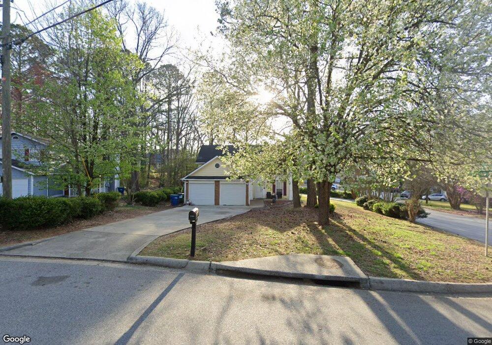
5470 Forest Downs Cir Atlanta, GA 30349
Estimated Value: $245,000 - $292,000
4
Beds
3
Baths
1,776
Sq Ft
$148/Sq Ft
Est. Value
About This Home
This home is located at 5470 Forest Downs Cir, Atlanta, GA 30349 and is currently estimated at $263,492, approximately $148 per square foot. 5470 Forest Downs Cir is a home located in Fulton County with nearby schools including Liberty Point Elementary School, Camp Creek Middle School, and Langston Hughes High School.
Ownership History
Date
Name
Owned For
Owner Type
Purchase Details
Closed on
Feb 22, 2023
Sold by
Holt George R
Bought by
Holt George R and Holt Donna C
Current Estimated Value
Purchase Details
Closed on
Sep 12, 2006
Sold by
Streeter Thomas T and Streeter Sally G
Bought by
Holt George R
Home Financials for this Owner
Home Financials are based on the most recent Mortgage that was taken out on this home.
Original Mortgage
$100,000
Interest Rate
6.52%
Mortgage Type
New Conventional
Create a Home Valuation Report for This Property
The Home Valuation Report is an in-depth analysis detailing your home's value as well as a comparison with similar homes in the area
Home Values in the Area
Average Home Value in this Area
Purchase History
| Date | Buyer | Sale Price | Title Company |
|---|---|---|---|
| Holt George R | -- | -- | |
| Holt George R | $125,000 | -- |
Source: Public Records
Mortgage History
| Date | Status | Borrower | Loan Amount |
|---|---|---|---|
| Previous Owner | Holt George R | $100,000 |
Source: Public Records
Tax History Compared to Growth
Tax History
| Year | Tax Paid | Tax Assessment Tax Assessment Total Assessment is a certain percentage of the fair market value that is determined by local assessors to be the total taxable value of land and additions on the property. | Land | Improvement |
|---|---|---|---|---|
| 2025 | $4,009 | $100,000 | $25,120 | $74,880 |
| 2023 | $4,009 | $90,080 | $25,200 | $64,880 |
| 2022 | $646 | $73,720 | $17,280 | $56,440 |
| 2021 | $640 | $71,600 | $16,800 | $54,800 |
| 2020 | $625 | $57,920 | $10,520 | $47,400 |
| 2019 | $632 | $43,480 | $9,800 | $33,680 |
| 2018 | $719 | $35,360 | $4,720 | $30,640 |
| 2017 | $336 | $19,840 | $4,200 | $15,640 |
| 2016 | $335 | $19,840 | $4,200 | $15,640 |
| 2015 | $336 | $19,840 | $4,200 | $15,640 |
| 2014 | $337 | $19,840 | $4,200 | $15,640 |
Source: Public Records
Map
Nearby Homes
- 310 Wolf Downs Way
- 3318 Stonewall Ln
- 3320 Stonewall Ln
- 4838 Station Lane-Lot 15
- Nelson Plan at The Enclave at Stonewall Station
- Cecil Plan at The Enclave at Stonewall Station
- Nelson Plan at Stonewall Station
- Beaufort Plan at Stonewall Station
- Cecil Plan at Stonewall Station
- Cooper Plan at Stonewall Station
- Kayla Plan at Stonewall Station
- 4817 Station Ln Unit 32
- 4813 Station Ln
- 5250 Forest Downs Ln
- 4811 Station Ln
- 4822 Station Ln
- 4818 Station Ln
- 4814 Station Ln
- 4815 Station Dr Unit 33
- 4835 Station Dr Unit 27
- 5460 Forest Downs Cir
- 5360 Forest Downs Ln
- 5490 Forest Downs Cir
- 5450 Forest Downs Cir
- 3550 Station Dr
- 5185 Forest Crossing Way
- 5395 Forest Downs Cir
- 5500 Forest Downs Cir
- 5405 Forest Downs Cir
- 5440 Forest Downs Cir
- 5370 Forest Downs Ln
- 5330 Forest Downs Ln
- 5400 Stonewall Tell Rd
- 5415 Forest Downs Cir
- 5375 Forest Downs Cir
- 5510 Forest Downs Cir
- 5355 Forest Downs Ln
- 5430 Forest Downs Cir
- 5320 Forest Downs Ln
- 5345 Forest Downs Ln